Dredging projects in preparation and implementation
Dredging planning
We divide our activities into the following categories:
- Nationwide
- Urban
- Boezem, large rural area and lakes
In these categories, the work is programmed in a dredging cycle. This results in so-called dredging blocks. The cycles of these blocks depend on the type of block.
- Nationwide once every 7 years
- Urban once every 14 years
- Boezem, large rural area and lakes once every 30 years
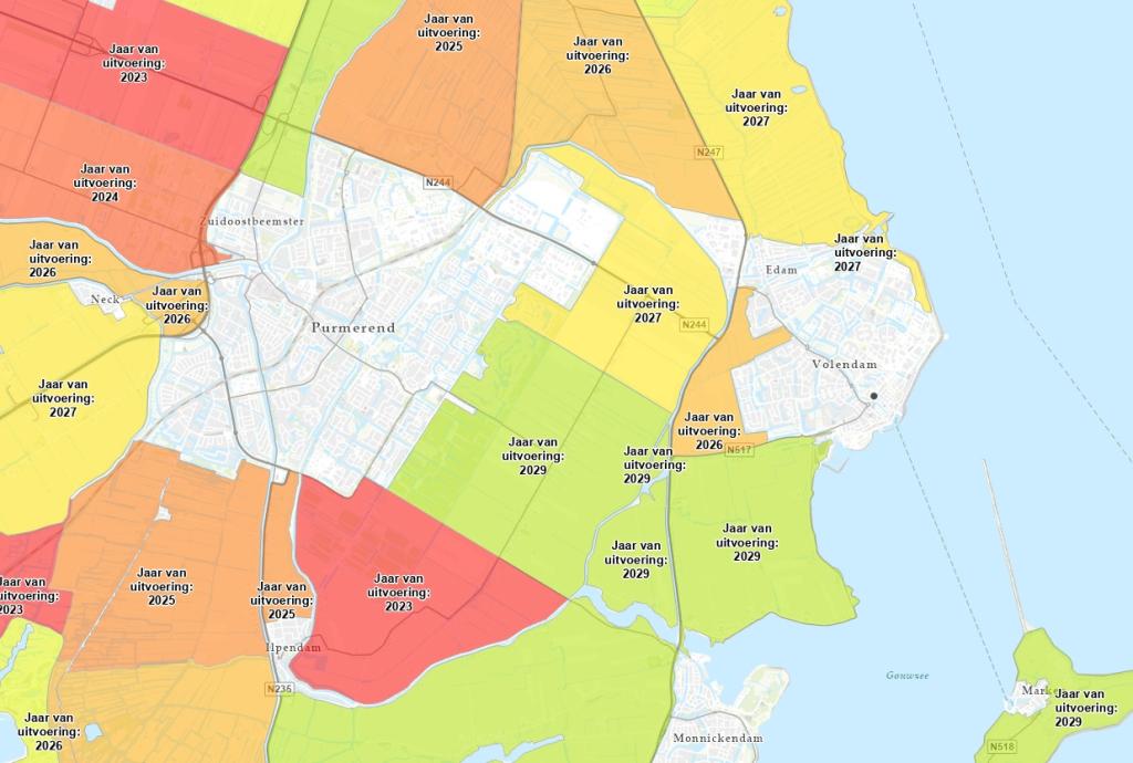
The link below will take you to the dredging schedule map. The large bodies of water are not shown on this map due to the long intervals between dredging operations.
In these blocks, we use measurements to check the depth and quality. The depth data is used to determine which waterways will be dredged. Do you have questions about a particular waterway on this map? Please note the waterway code and contact us.
For the current schedule of dredging projects in your region, please visit Work in the neighbourhood.