The Nieuwendam near Assendelft
On the border between the municipalities of Uitgeest and Assendelft, a short dike rises up in the polder landscape: the Nieuwendam. The municipal border runs along what used to be the Kromme IJ and straight through the dam that was built in 1357 to close off this sea arm.
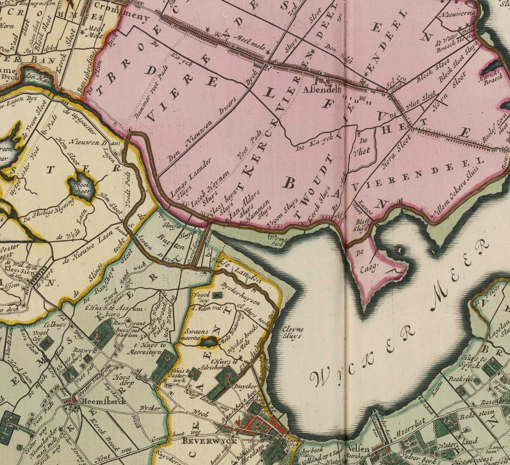
The Kromme or winding IJ was an offshoot of the IJ, which meandered through North Holland as far as Beverwijk. The IJ was an arm of the Zuiderzee. The Kromme IJ flowed into the Lange or Alkmaardermeer. The villages of Krommenie and Krommeniedijk derive their names from it. It was an important fishing ground and also part of the shipping route between Alkmaar and Haarlem. However, as an open connection between the seawater of the IJ and the lakes in the Noorderkwartier, it also posed a danger during storms.
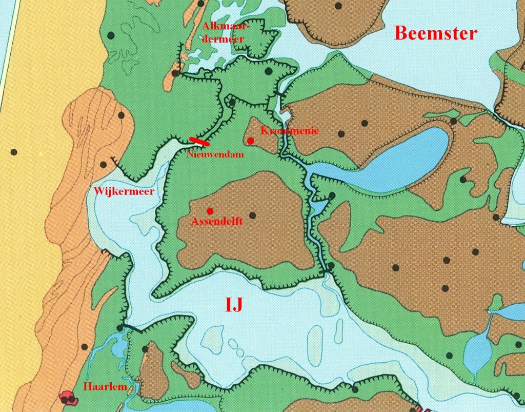
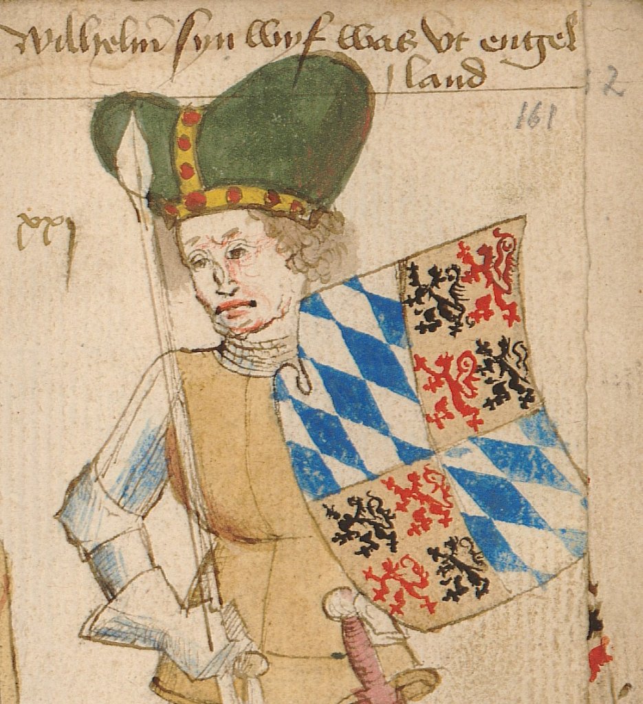
Count William V of Holland (1330-1389) therefore gave authorisation in 1357 authorisation close off the Kromme IJ with a dam between the dikes around Uitgeest and Assendelft. However, a section of approximately five metre had to remain metre for shipping and fishing. A lock could be built there. The dam in the Kromme IJ became known as the new dam, or Nieuwendam – not to be confused with the village of Nieuwendam and another, later Nieuwendam near Monnickendam.
The board, the college of dam lords or dam masters, consisted of the bailiff of Akersloot as dike reeve and representatives of Akersloot, Uitgeest, Wormer, and Graft—later also De Rijp—as district water board members. These villages had an interest in the dam, which primarily offered them protection. That is why they were responsible for its maintenance. The board of dam lords remained in existence until 1971, when it was absorbed into a larger water board.
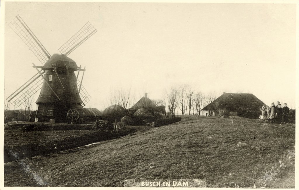
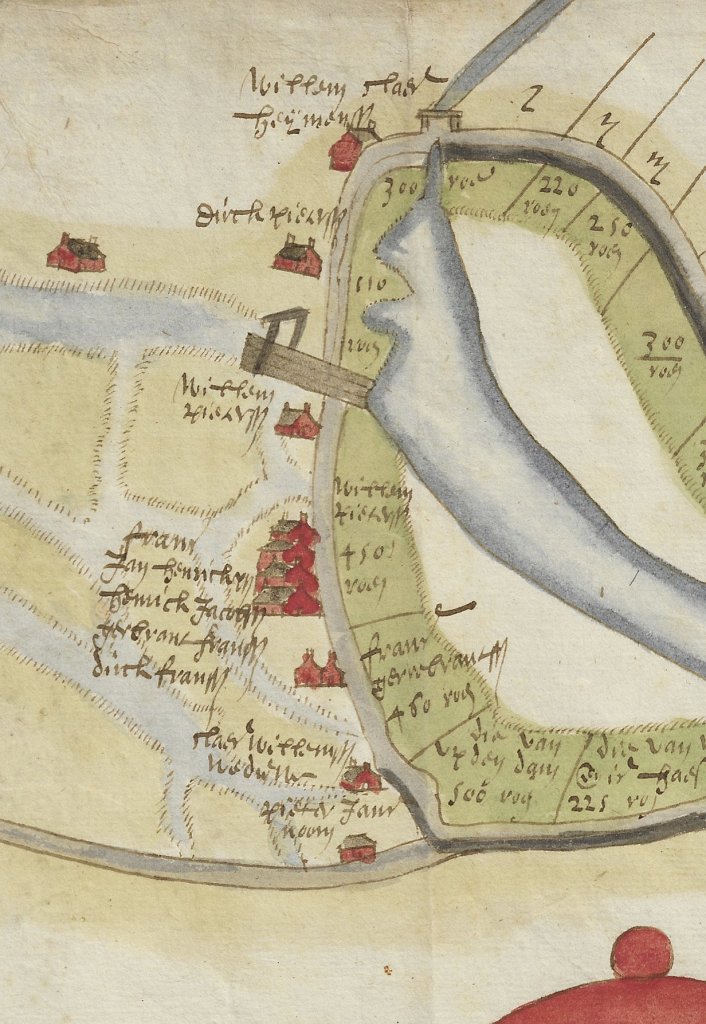
A settlement sprang up along the Nieuwendam, where farmers and fishermen lived. Around 1550, there were 10 to 12 houses, possibly with a small inn and a chapel. Today, only one farm remains. The hamlet was probably known as Busch en Dam or Bus en Dam, as the area around the dam is still called today. The name Busch is derived from the Zaan word for forest, which was used to refer to the reed landscape overgrown with trees.
In 1544, Emperor Charles V (1500-1558), as Count of Holland, ordered the closure of the last open sea channels in the Noorderkwartier to prevent flooding and land loss. In 1546, a lock was constructed, but this eliminated the current and caused the Kromme IJ to silt up rapidly. A narrow channel remained, known as the Kil. In 1569, the lock was replaced by a transfer channel, which could only accommodate small ships.

In the 17th century, sluices were installed in Nieuwendam once more. The Heerhugowaard and the Wormermeer were drained, which meant that the water storage capacity or reservoir in North Holland became much smaller around 1630. To compensate for this, the reservoir manager, the Hoogheemraadschap van de Uitwaterende Sluizen (Water Board of the Drainage Locks), obliged the polders to install two sluice gates. One of these also served as a lock for shipping traffic. However, silting remained a problem. After Uitwaterende Sluizen had constructed a culvert lock near Nauerna in 1651 for water drainage, a lock in the Nieuwendam became superfluous.
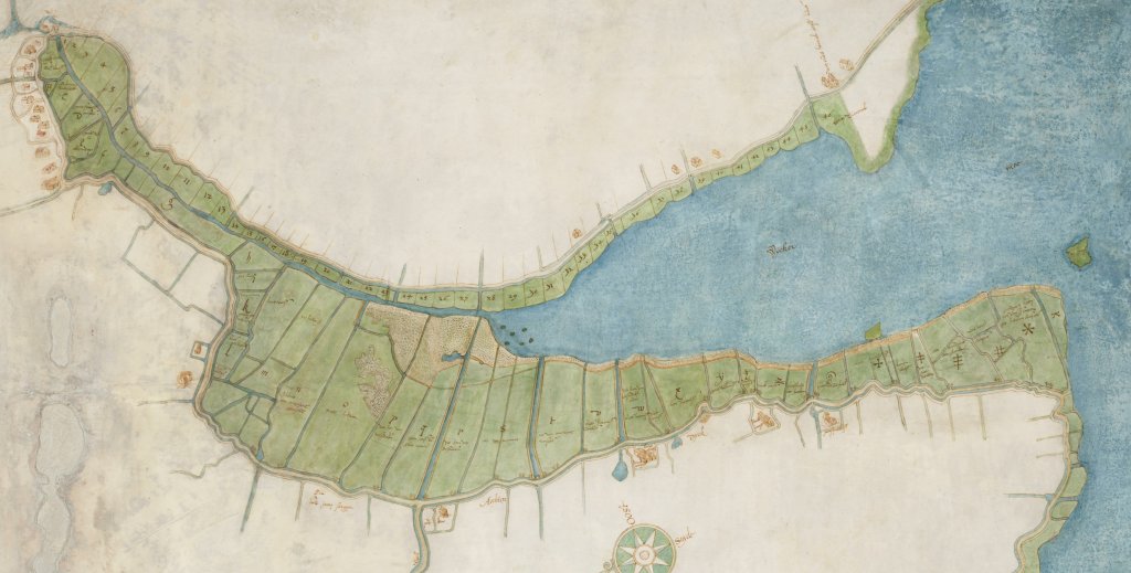
Despite the silting up, flooding could still occur. During storm surges, water from the Zuiderzee could not escape into the IJ and the dikes broke. During the infamous Christmas flood of 1717, which caused extensive damage in North Holland, the waves tore large holes in the IJ dikes, two of which were near the Nieuwendam. To prevent a repeat, it was decided to dike the silted land in front of the Nieuwendam. The new polder was called Binnengedijkte Buitenlanden, Noorder Buitendijken, or Honderd Morgen.
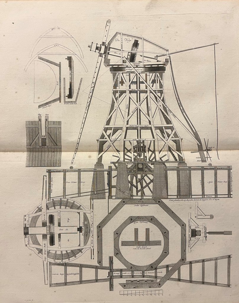
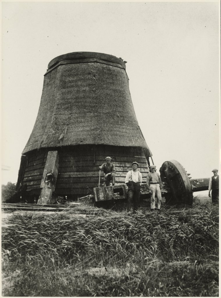
Because the De Noorder Buitendijken polder was higherthanthe surrounding land, farmers depended on the remnants of the Kromme IJ, now called the Ham, for fresh water. In 1731, after twelve years of wrangling, a mill was installed to pump water from the Ham. Krommenie was strongly opposed to this because a lot of fresh water was needed for the sailcloth weaving industry. Although the mill was called the Slof, the people of Krommenie nicknamed it the Water Thief. The mill was an octagonal post mill equipped with a paddle wheel.
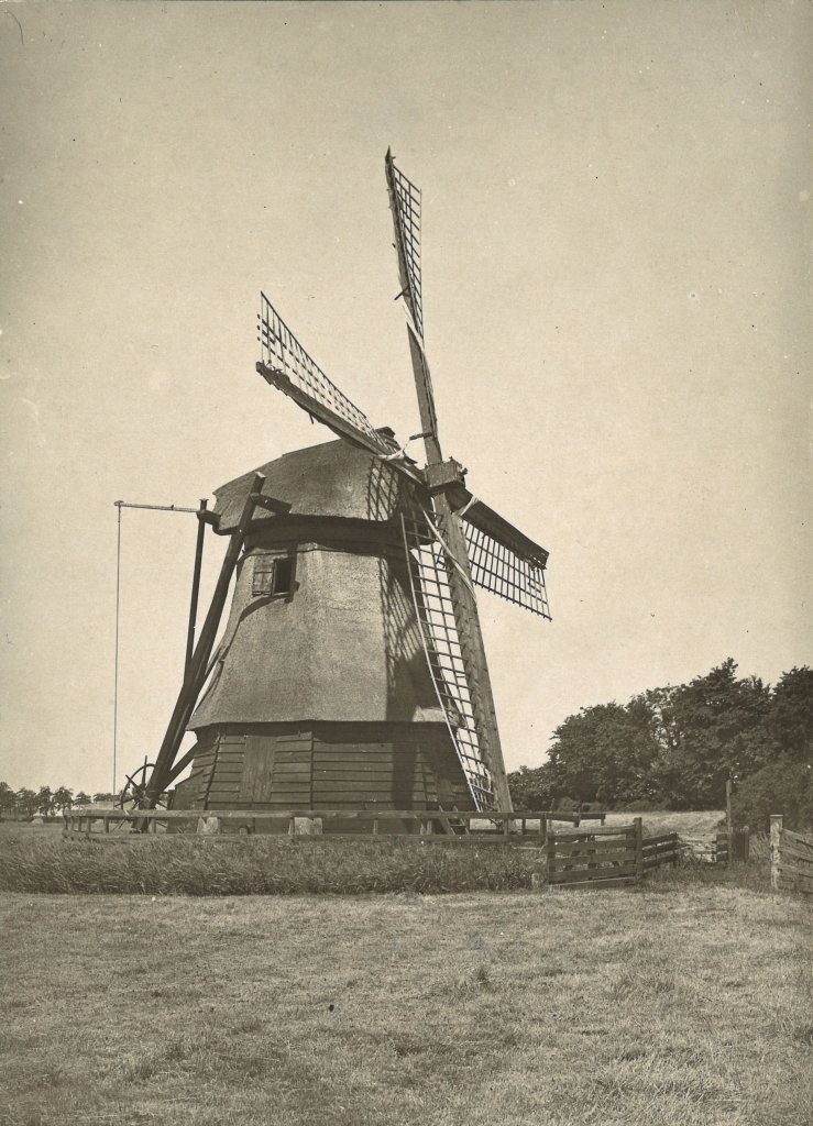
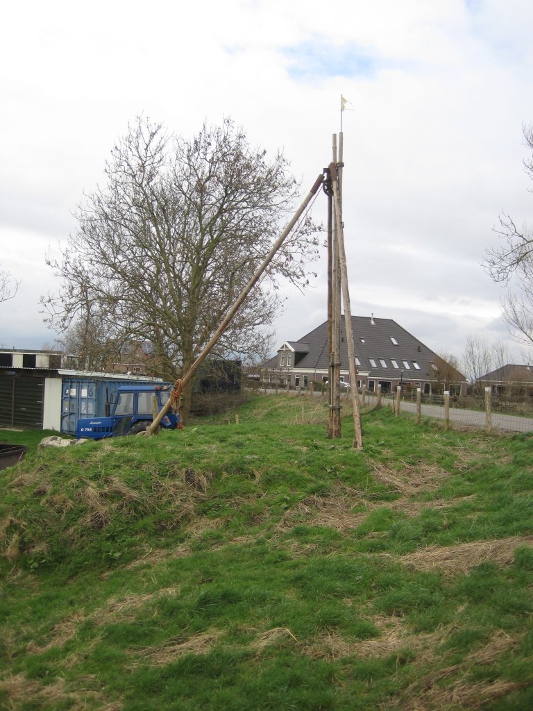
Around 1900, the board of dam owners only had authority over less than one hectare of land on the dam and earned a small amount of money from leasing the grass. The dilapidated mill was replaced in 1926 by a small electric pumping station, which has since disappeared. Today, there is a culvert through the dam. The last dike reeve, the mayor of Akersloot, thought that the dam could be excavated. It did not come to that. The Waterdief will also return to its old place: work on rebuilding the mill has been underway since 2021.
Extra
- The Nieuwendam is part of the Crommenije and Stelling van Amsterdam cycling route (Oer-IJ).
- Another cycling route that crosses the dam is the Jubilee Cycling Route (Laag Holland).
- There are no walking routes across the dam, but the Busch en Damroute (North Holland Walking Network) passes right by it.
- The Waterdief is being rebuilt: the aim is to have the mill back in its original location by 2026. This video gives an impression of the preparatory activities. For more information about the project, see:https://dewaterdief.nl/.