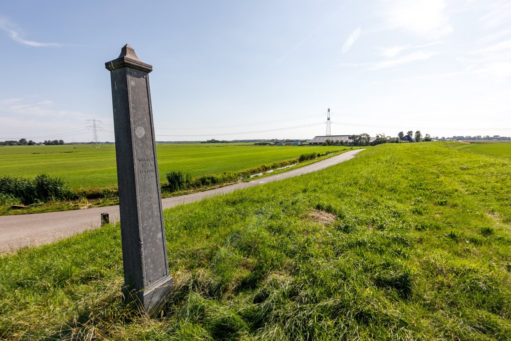
Dike post Assendelver Zeedijk
Along the winding Assendelver Zeedijk, at the T-junction with Genieweg, there is a bluestone dike post. The dike has a long history and has been breached several times. The many bends in the dike are a reminder of those breaches.
Assendelver Seawall
The Assendelver Zeedijk was probably constructed in the 13th century to protect Assendelft from flooding from the IJ and an offshoot known as the Wijkermeer. At that time, the IJ was openly connected to the Zuiderzee and could be quite turbulent. Between 1870 and 1876, the IJ and the Wijkermeer were drained as part of the construction of the North Sea Canal. The Wijkermeerpolder took shape in 1875, leaving the old Assendelver Zeedijk in the middle of the land.
At the end of the 19th century, the dike was incorporated into the Defense Line of Amsterdam. This line was constructed between 1880 and 1894 as a defensive line around Amsterdam. The 135 km long line consisted of 46 forts, batteries, dikes, dams, and locks.
Christmas flood of 1717
During Christmas night in 1717, a northwesterly storm hit the coastal region of the Netherlands. The wind pushed water from the ocean into the North Sea. The water pressed so violently that several holes appeared in the Assendelver Zeedijk. The dike had already failed once in 1714, had not been properly repaired, and was in poor condition.
The Zaanstreek and Waterland regions were completely submerged. Much livestock did not survive, and there was extensive material damage. This enormous flood was later named the Christmas Flood of 1717.
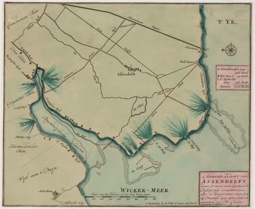
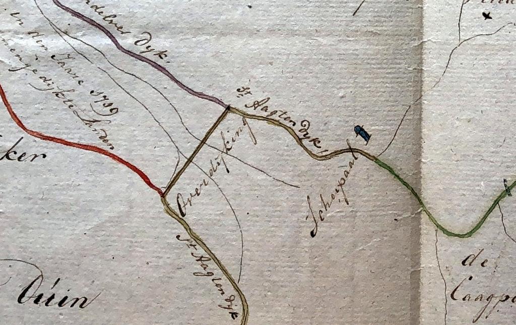
The breaches in the dike were inspected, their width and depth measured, and then the holes were filled in. This required a large workforce. The surrounding villages were approached to provide manpower. Not only did the dike need to be repaired, it also needed to be improved and raised to prevent a recurrence. In addition, the northernmost part of the Wijkermeer was dammed with a transverse dike, the (New) Overdijking, between the Sint Aagtendijk along the west side of the Wijkermeer and the Assendelver Zeedijk along the east side. This created a large loop of both sea dikes with a length of 7½ km to the inner dike and immediately reclaimed 170 ha of new land. This shortening naturally also necessitated a redistribution of the management and maintenance of both sea dikes.
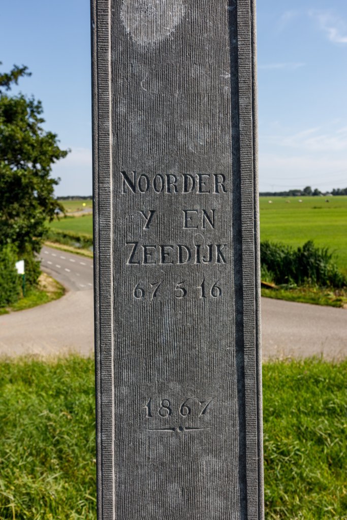
Dike post
The dike post marked the new boundary between the Assendelver Zeedijk and the Sint Aagtendijk. North of the dike post, the dike had been managed by the Sint Aagtendijk Water Board since 1719, and south of it by the Assendelver Zeedijk Water Board. In 1843, the entire dike came under the supervision of an umbrella water board, the Vereeniging van den Noorder IJ- en Zeedijk. In 1921, this water board merged into the new Hoogheemraadschap Noordhollands Noorderkwartier, which in turn merged into the current Hoogheemraadschap Hollands Noorderkwartier.
The current dike post is a replica from 1982-1983. The original post is on display in the Zaans Museum.
The necessary text is carved into all sides of the pole:
North side: S[int]: AAG TENDYK DYKGRAAF MR. J. NUHOUT VAN DER VEEN HEEMRADEN MR. J. NUHOUT VAN DER VEEN F. BAK, C. VAN DEN STEENOVEN, J. KOOPMAN, J. LAARMAN, L. VEER SECRETARY 1802
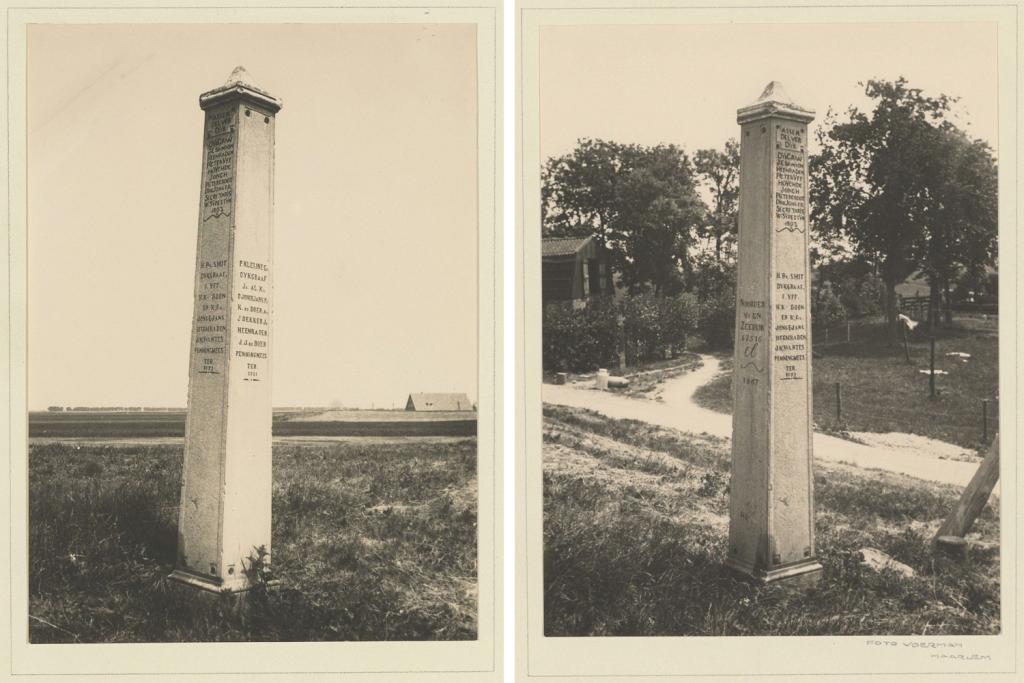
East side: P. KLEYNE Gz. DYKGRAAF, J.B. AL Kz., D. JONGEJANS Pz., K. DE BOER Az., J. DEKKER Jz., HEEMRADEN J.J. DE BOER PENNINGMEESTER 1911
South side: ASSEN DELVER DYK
DYKGRAAF J.C. VAN SON, HEEMRADEN PIETER YFF HUYGH DE JONGH, PIETER GROOT, DIRK JONKER SECRETARY W. SYPESTYN 1802
H. B. SMIT, DYKGRAAF F. YFF, H. Kz. BOON, EN . Gz. JONGEJANS, HEEMRADEN J. KWANTES TREASURER 18[..]
West side: NOORDER Y = EN 67516 EL (length in ells) 1867