Breakthrough at Scharwoude
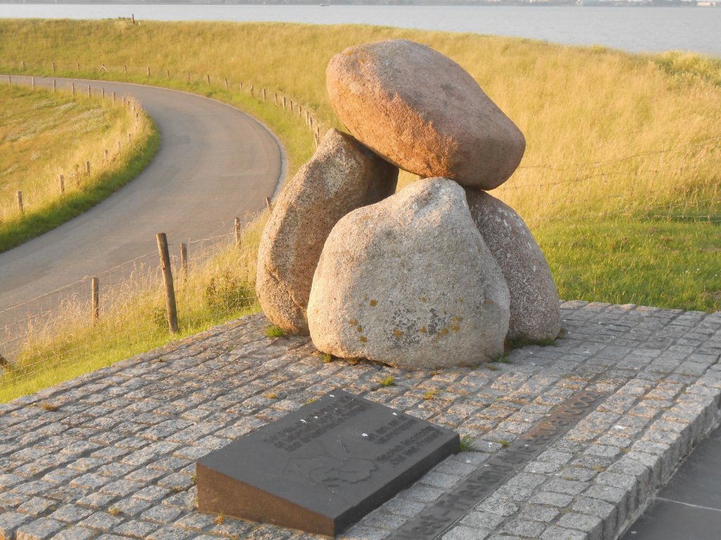
In 1675, the water wolf struck mercilessly here. This monument, erected exactly three centuries later, commemorates the disaster that struck West Friesland at that time.
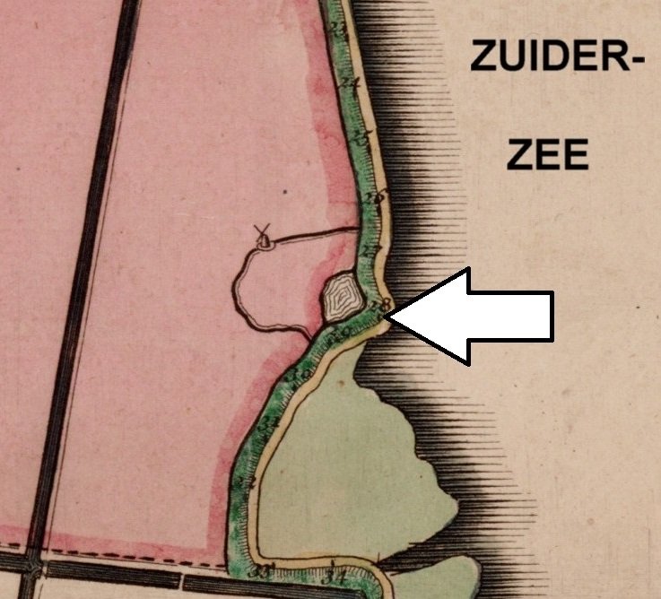
This location (arrow on the map) is situated at the corner of the dike and the Rietkoog, a strip of land outside the dike (green). It was precisely there that the water from the Zuiderzee was pushed up slightly higher during storms.
During a severe northwesterly storm on November 5, 1675, the Omringdijk broke down here at half past two in the morning.
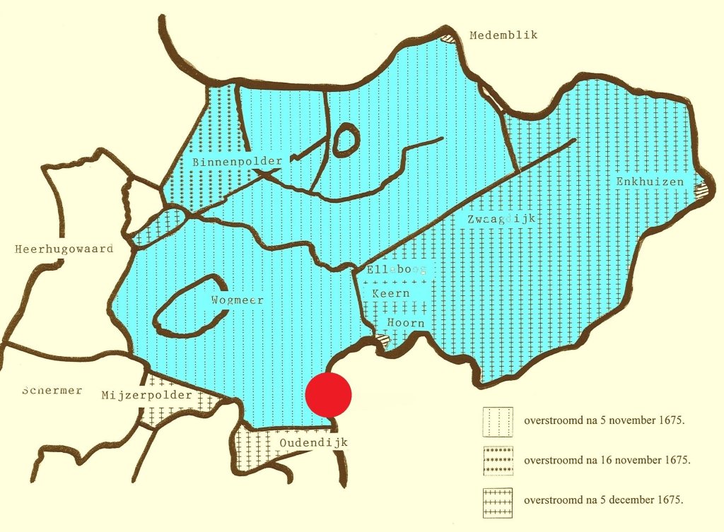
Eventually, the entire region between Heerhugowaard, Hoorn, Enkhuizen, and Medemblik disappeared beneath the salty waters of the Zuiderzee. The red dot indicates the location of the breach.
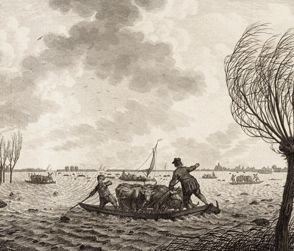
Fortunately, there were no casualties among the population. However, a lot of livestock drowned.
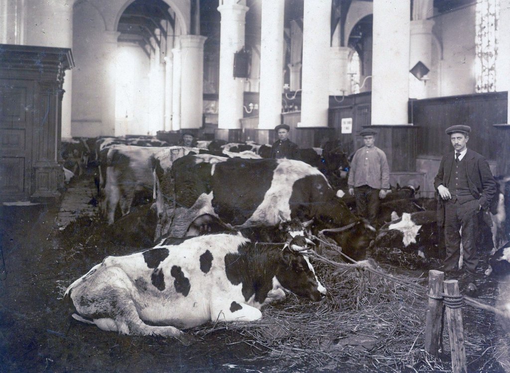
The churches were quickly converted into stables. They usually remained dry because they were located at the highest point of the village.
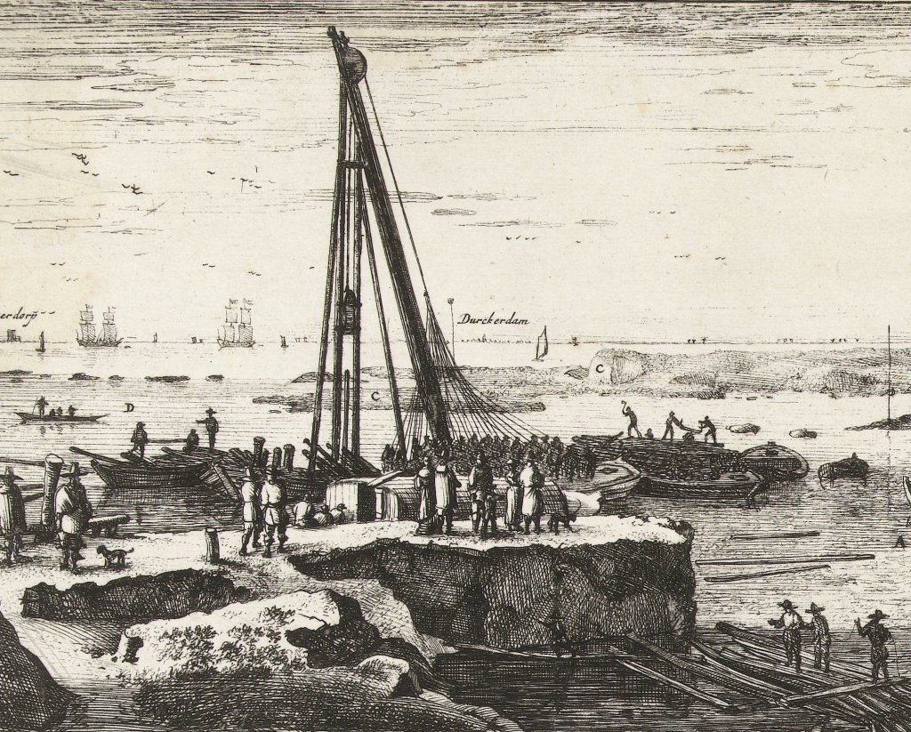
Hundreds of workers were called in to close the breach. They drove a double row of piles into the seabed around the deep hole in the dike. The space between the piles was filled with hay, straw, and seaweed. The dangerous work claimed three lives.
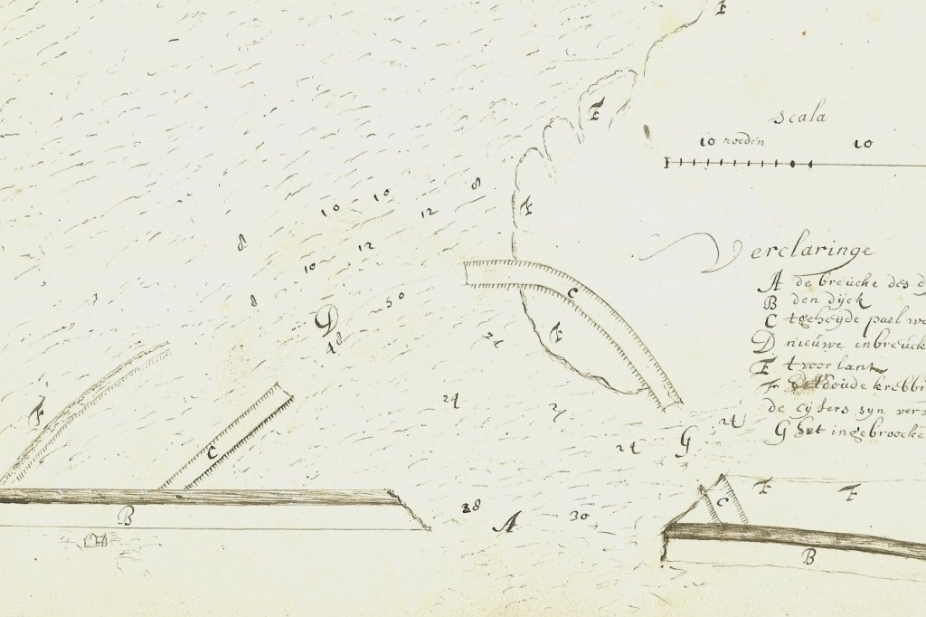
On November 29, 1675, the breach was closed. But five days later, a new storm arose. Everything was washed away again. This map shows that.
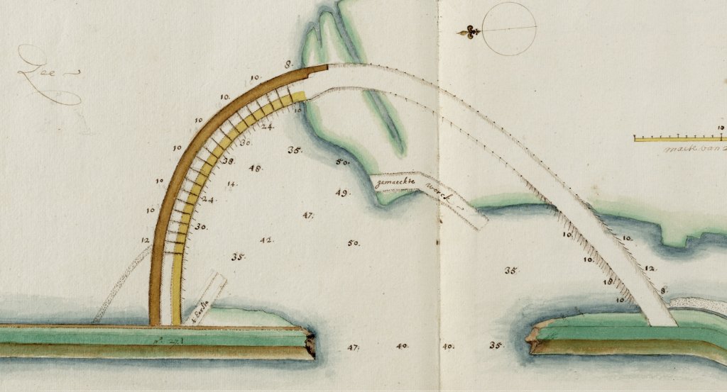
There was no other option but to drive a triple row of piles further into the seabed. On January 21, 1676, the dike was finally closed, this time for good.
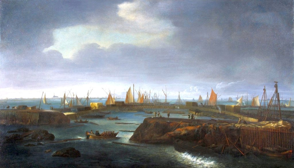
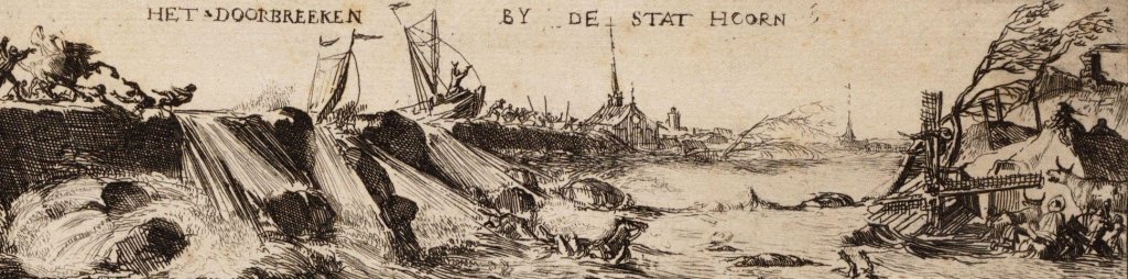
The Hoorn painter Matthias Withoos captured the scene in a painting. We are looking from the land. In the foreground, we see the breach, then the arch of piled stakes, and behind that, the water of the Hoornse Hop with the city of Hoorn on the left. The painting is now on display in the Westfries Museum.
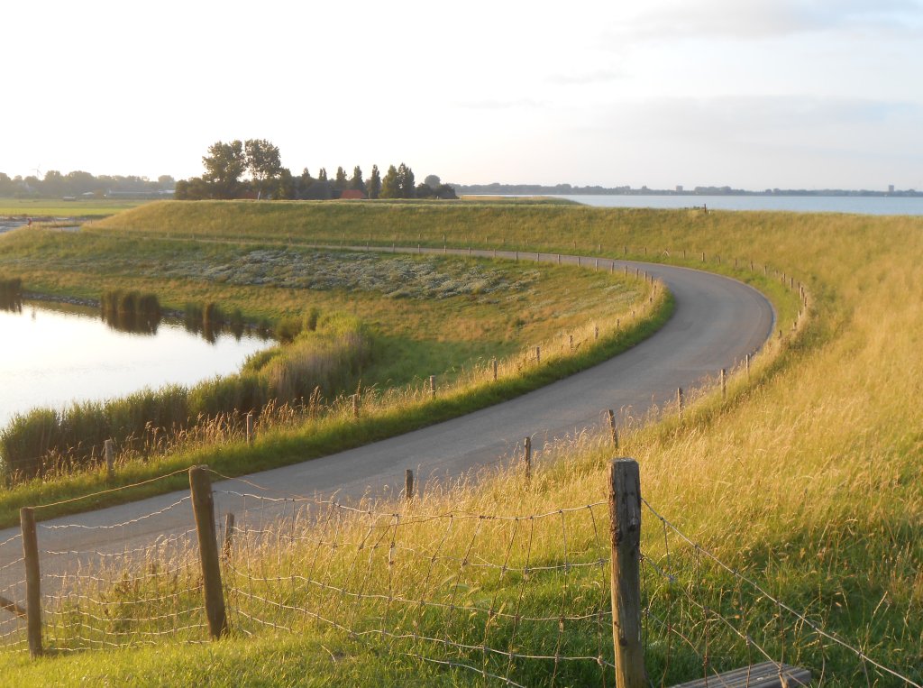
Almost three and a half centuries later, the scars of the 1675 breach are still clearly visible. The dike curves around a small lake or pool for hundreds of meters. This is what remains of the hole that was washed out metre more than sixteen metre .
Monument to the 1675 dike breach
- Next: C. Mantel pumping station and the Schermerboezem
- Previous: Scharwoude dyke warehouse