Burghorn diving lock
Near Burghorn recreation park, in a gentle bend in a medieval section of the Westfriese Omringdijk, a diving lock is hidden away in the greenery. It looks fairly peaceful, but for centuries the Burghorn polder and the Schagerkogge quarreled over the flooding that the lock sometimes caused.
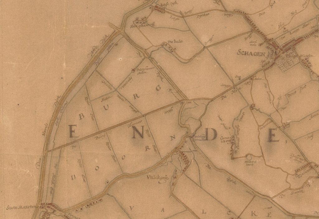
The monumental lock dates back to 1739, but its history goes back to the 15th century. At that time, a diving lock was already built at this location, which was essential for draining the new Burghorn polder. The excess water was drained via the ditches of the Schagerkogge, which consisted of Schagen and the surrounding countryside. It then flowed to Kolhorn, where it was discharged into the Zuiderzee.
During the 13th century, the sea swallowed up much of the land and formed the large sea arm of Zijpe behind the dunes of Callantsoog. To stem the advance of the seawater, the Valkkogerdijk was constructed, which connected to the Oudedijk at a sharp angle . However, during storms, this remained a weak spot in the West Frisian Omringdijk. In 1421, the Oudedijk broke through and a large lake, the Schagerwiel, was created behind it.
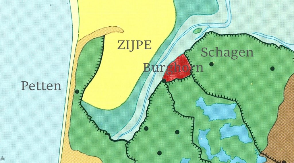
The sea threatened to break through here to Heerhugowaard and the smaller lakes connected to it. That is why the Count of Holland wanted to diked Zijpe as early as 1388. Meanwhile, the corner between the Valkkogerdijk and the Oudedijk silted up into a salt marsh. Local residents grazed cattle there in the summer, collected eggs, and hunted birds. This prompted the Lord of Schagen, Willem van Beieren (1387/9-1473), to embank the salt marsh. He was an uncle of the count and an influential nobleman.
In 1457, he received count's authorisation for this. He found wealthy Dutchmen willing to invest in the embankment, which was completed in 1462. The count determined that the West Frisian hinterland, including the Schagerkogge, had to pay for the maintenance of the dike that dammed the salt marsh. In 1463, Lord Willem arranged for drainage via the lock in the Oudedijk. Unfortunately, it was not possible to discharge into the Zijpe. It was too silted up and, moreover, the polder soil quickly subsided.
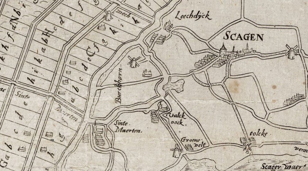
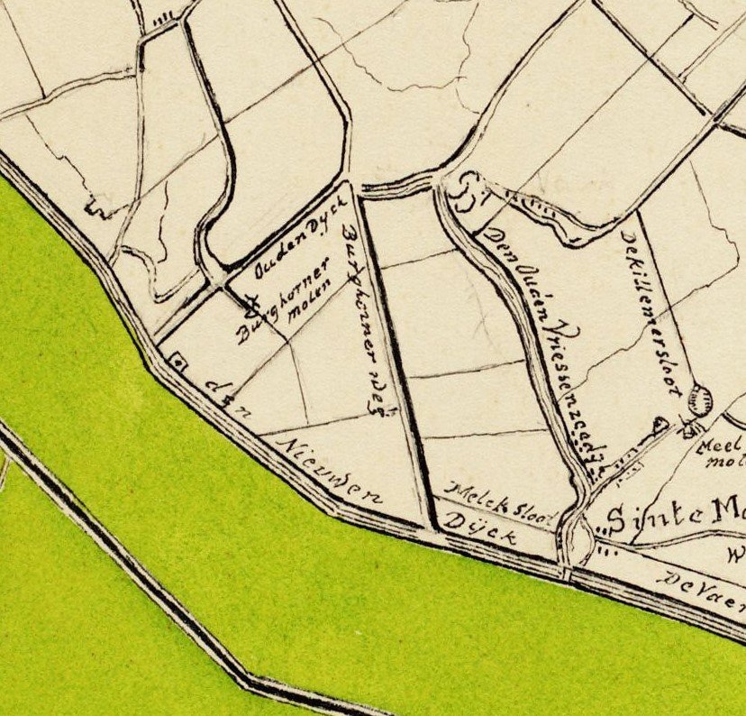
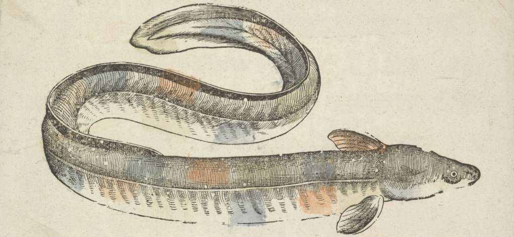
The lock was built near an elevation in the landscape called the Hale. The water was channeled to Kolhorn via the ditches of the Schagerkogge. The main purpose of the lock was and remained drainage, but of course it was also a good place to fish for eels. The polder became a manor that Willem van Schagen gave to one of his sons. The lord of Burghorn earned well from eel fishing.
In the early years, gravity was sufficient to drain the more than 265-hectare polder, but soon the polder land came to lie lower than the land of the Schagerkogge. The landowners of Burghorn therefore invested in an expensive windmill in 1467. The people of Schagen were not happy with all that water, but Schagen was only allowed to keep the sluice closed if Burghorn flooded, to prevent the land from becoming salinated by seawater.
In 1509, the polder was hit by a disastrous storm surge and the lord of Schagen did indeed have the sluice quickly closed. This led to a huge family dispute and a lawsuit with the lord of Burghorn. The lords settled their differences, but the drainage of the water continued to cause problems. The Zijpe was drained in the 16th century, but the land there was also much higher than in Burghorn. The water therefore still had to flow through the Schagerkogge to Kolhorn.
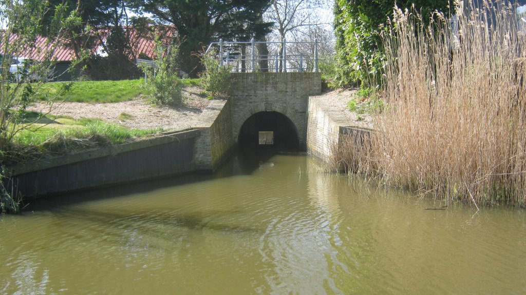
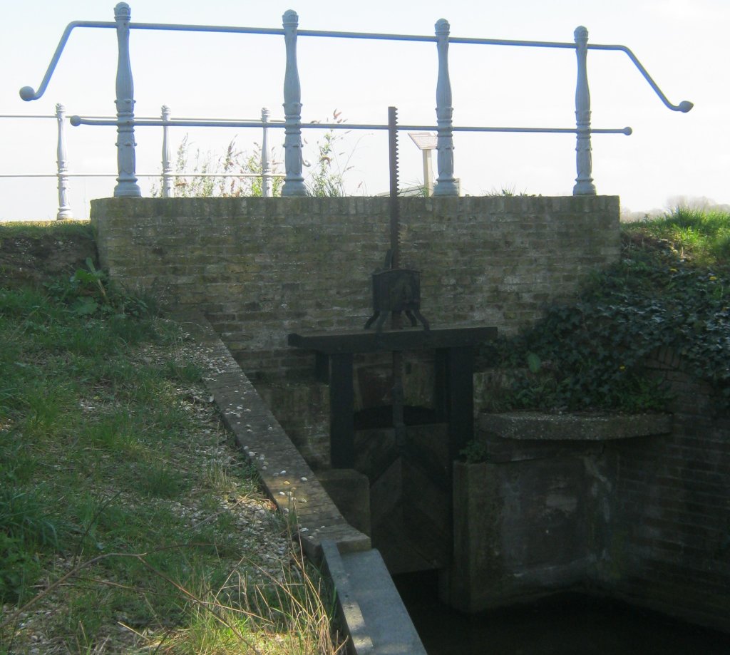
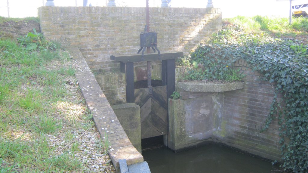
Around 1625, land subsidence in the Schagerkogge led to Burghorn gradually rising higher. After the Schagerkogge itself had built mills, the two water boards entered into an agreement in 1738. The Schagerkogge took over the polder drainage in exchange for an annual payment of 100 guilders. Not long after, the Burghorn mill was sold and the current culvert lock, consisting of a single lock chamber, was constructed in 1739. The culvert has an arched barrel vault and can be closed with a slide, which can be opened and closed with a windlass.
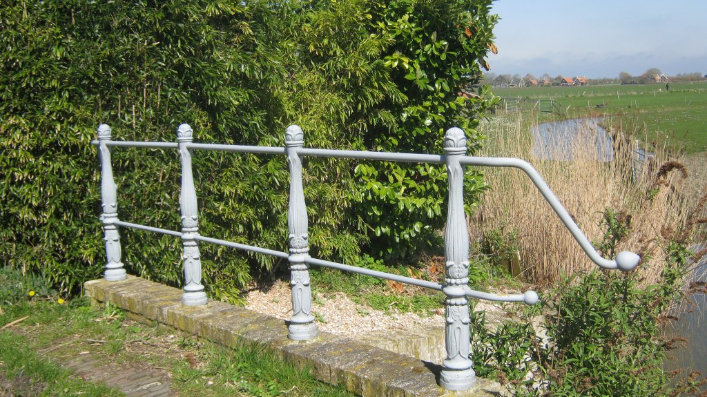
Disputes over the inflow and outflow of water between the two polders continued to fester until 1902, when a satisfactory solution was found. In 2015-2017, the culvert lock was restored by the water board. The rotten wooden railings were then replaced by cast iron balusters. Despite this renovation, the Foundation for Historic Locks and Weirs in the Netherlands awarded this restoration a shared third Sluizenprijs (Lock Prize) in 2017. The culvert lock is considered a fairly unique type.
Extra
- The Burghorn diving lock is located somewhat off the beaten track of the usual cycling and walking routes: if you want to cycle past it, you will generally have to deviate slightly from the route over and around the Westfriese Omringdijk.
- The same applies to the fourth stage of the Streekpad Westfriese Omringdijk. If you want to walk past the culvert lock, you will need to deviate slightly from the route.
- One walking route that does pass by the diving lock is the Oudedijkroute from the North Holland Walking Network.
- Other, shorter walking routes in the neighbourhood the Wielenroute from Noord-Hollands Landschap, the Paarse route from Sint-Maarten, and the Burghornroute from Wandelnetwerk Noord-Holland.