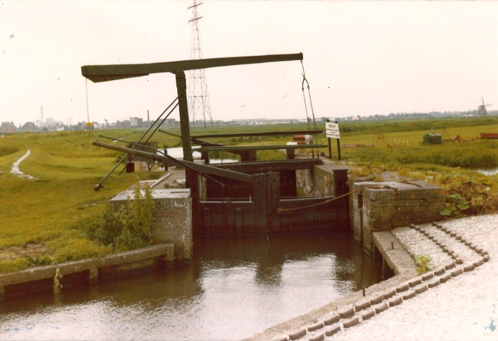
Damped Boerensluis, Krommenieër-Woudpolder
Polder Het Woud was remote for centuries and not many people lived there. It was a navigable polder, which meant that it was only easily accessible by boat. One of the locks was used so often by the farmers of Markenbinnen that it was nicknamed Boerensluis (Farmer's Lock).
Originally, Het Woud was one area with Markenbinnen, part of the municipality of Uitgeest. However, in the first half of the 17th century, new waterways were dug that were necessary to improve the drainage of the Schermerboezem. Markenbinnen was incorporated into the Starnmeer polder, but many farmers lived with land on the other side of the canal, in Het Woud.

Due to the drainage, the undiked old land suffered from severe flooding, which is why Het Woud was also diked and reclaimed in 1650-1651. Five sluices were installed in the dikes, including the Boerensluis opposite Markenbinnen and the Woudaapsluis opposite the Tap- or Tochtsloot. This allowed farmers with land in Het Woud to access their pastures. Anyone who wanted to pass through the sluices of Het Woud had to pay a toll, which was used to pay for the maintenance of the sluices.
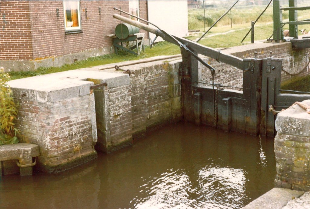
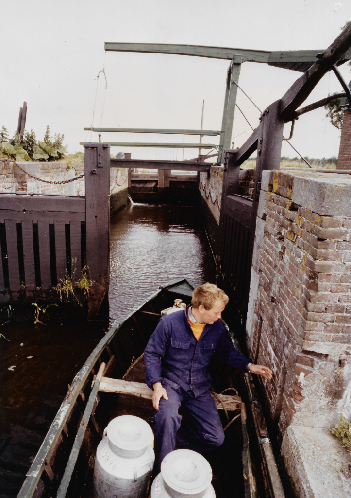
Because so many forest farmers lived in Markenbinnen, the lock directly opposite that village was used particularly frequently. This is probably where the lock got its nickname, Boerensluis (Farmer's Lock). In the 1960s and 1970s, there were still about ten 'boat farmers' who sailed back and forth with their cattle, hay, and milk. For a long time, the locks were made of wood. When they fell into disrepair in the 19th century, they were filled in or replaced by new brick locks.
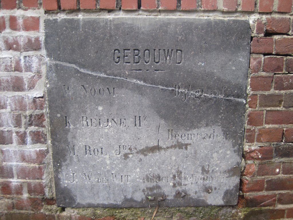
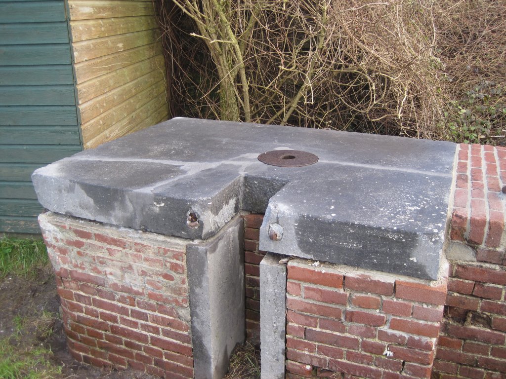
An example of such a sailing farmer from Markenbinnen was Willem Noom (1833-1899). In 1859, he was elected head of the Het Woud polder. Later, he became a member of the water board and, in 1884, dike reeve, a position he held until his death. When the wooden Boerensluis lock was replaced by a stone lock in 1898, a memorial stone was erected with Willem Noom's name at the top. Afterwards, his descendants also served on the polder board.
Since 1898, there had also been a lock keeper's house at the lock. In 1896, the Boerensluis lock was given an additional task: it became a water inlet point for flooding. The forts of Markenbinnen and Krommeniedijk were part of the Defense Line of Amsterdam, which served to protect the capital from foreign invaders in times of war. The land surrounding the forts would then be flooded. The Het Woud polder was part of the inundation zone.
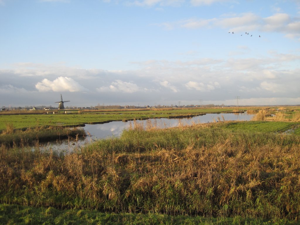
Het Woud was first flooded by the Dutch army in May 1940 when the Germans invaded. The polder was quickly drained again after the war, which lasted only five days. In the spring of 1944, the German occupiers flooded the polder again. This time, Het Woud remained flooded for a year: it was not drained until May 1945. Water plants grew everywhere and for a year the polder was a paradise for water birds.
After the war, the Boerensluis remained important for a long time, but around 1980, the water board wanted to fill in the dilapidated lock. In 1983, the Woudpolder was opened up by a road, meaning it was no longer a navigable polder. Only Willem Noom's great-grandson still used the lock frequently, but his cattle farm was relocated. Restoration would have been very expensive and, moreover, the waves caused by shipping traffic on the Markervaart canal posed a danger to the dilapidated lock.
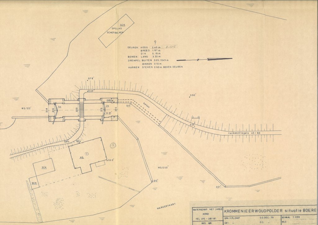
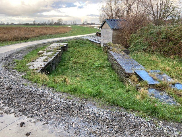
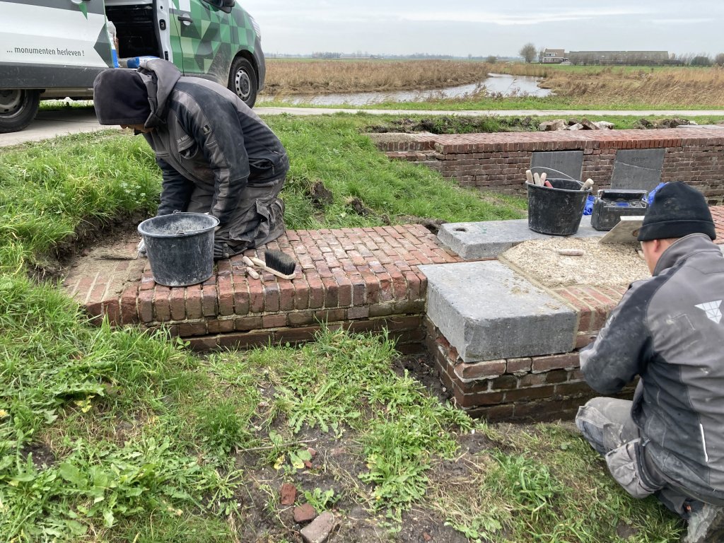
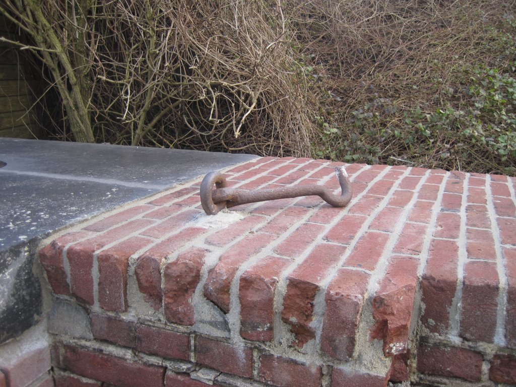
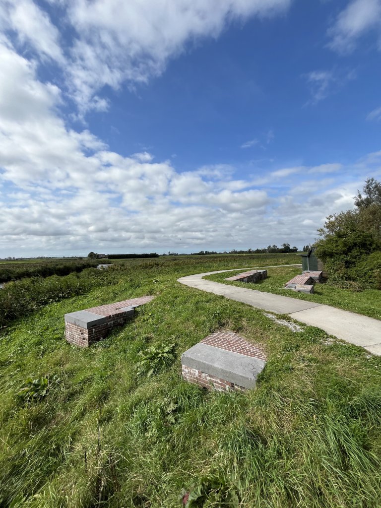
In 1984, the Boerensluis was therefore filled in. The lock walls were preserved as a monument. The memorial stones were to be moved so that cyclists and walkers could see them clearly. A memorial stone was also placed to mark the filling in of the lock. Unfortunately, one of the two older memorial stones was lost. The Woudaap lock is now the only remaining lock in Het Woud.
Extra
The dammed Boerensluis is discussed in the second episode of the documentary series Langs de Hollandse Waterlinies(Along the Dutch Water Lines) , minutes 09:34-11:41.
In the clip below, you can see the Boerensluis in operation. This clip is taken from a longerfilm about the last sailing farmers of Het Woud, the Nooms from Markenbinnen.
The Boerensluis is a photogenic stop on the Krommenieër-Woudpolder route (North Holland Walking Network).
Cycling along the Boerensluis is also a good option. A beautiful route is the Jubileumfietsroute(Laag Holland).
Another beautiful route is the Crommenije-Stelling van Amsterdamcycle route (Oer-IJ).
At the lock keeper's house at Markervaart 2, there is a rest stop where you can find coffee and tea, soup, tire repair kits, and a first aid kit. Friends on Bikes can also spend the night there.
Conservation is made possible in part by the province of North Holland.