Floodgate on the southern Beemster ring dike
Introduction
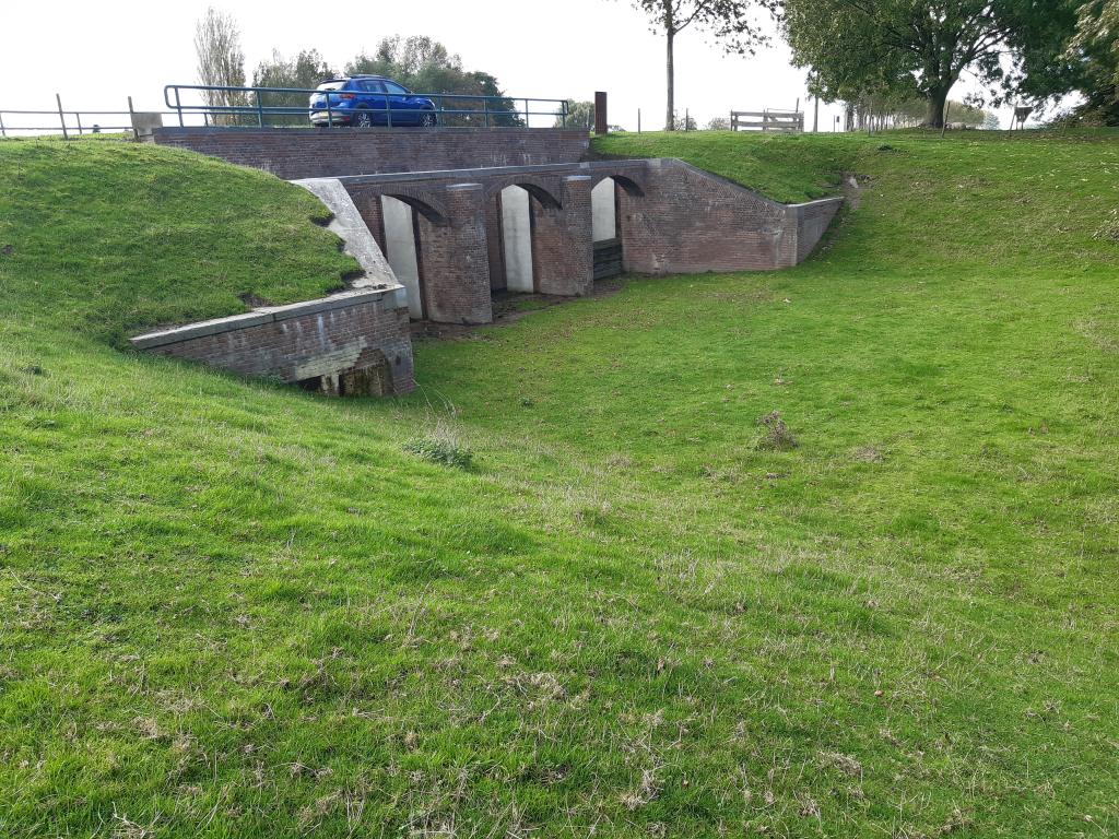
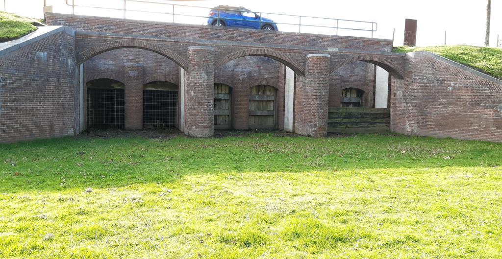
This large floodgate is located in the southern ring dike between Fort aan de Middenweg and Fort aan de Nekkerweg (Fort Resort Beemster). The lock was constructed between 1890 and 1891 as part of the Defense Line of Amsterdam. The lock is protected as a provincial monument. As part of the Defense Line of Amsterdam, it has been listed as a UNESCO World Heritage Site since 1996 and, since 2021, as part of the Dutch Waterlines.
Line of Amsterdam
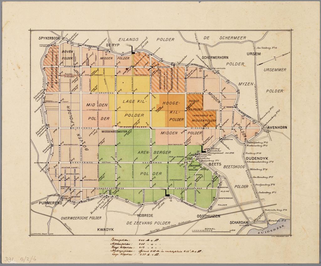
The Defense Line was constructed between 1881 and 1914 (with additions until 1940) as a defensive line around Amsterdam. The 135 km long line consisted of 46 forts and batteries, as well as dikes, dams, and locks. In front of the forts were large inundation zones. 'Inundation' is the deliberate flooding of an area. Thanks to an ingenious system, the land outside this circle could be flooded to a depth of 20 to 30 cm in just a few days, which was too shallow for boats but too deep for men and horses.
Floodgate
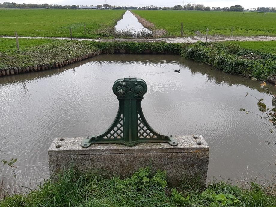
The floodgate in the Beemster ring dike was part of the Defense Line. In the event of war, this gate allowed water from the North Holland Canal to be let in to flood the southern part of the Beemster.
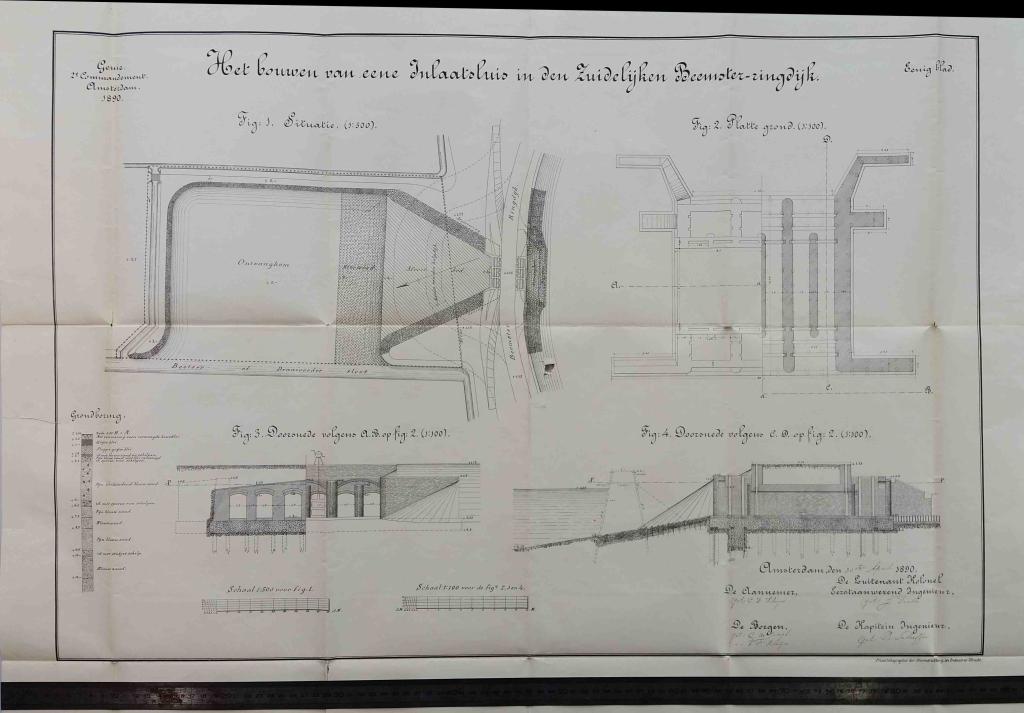
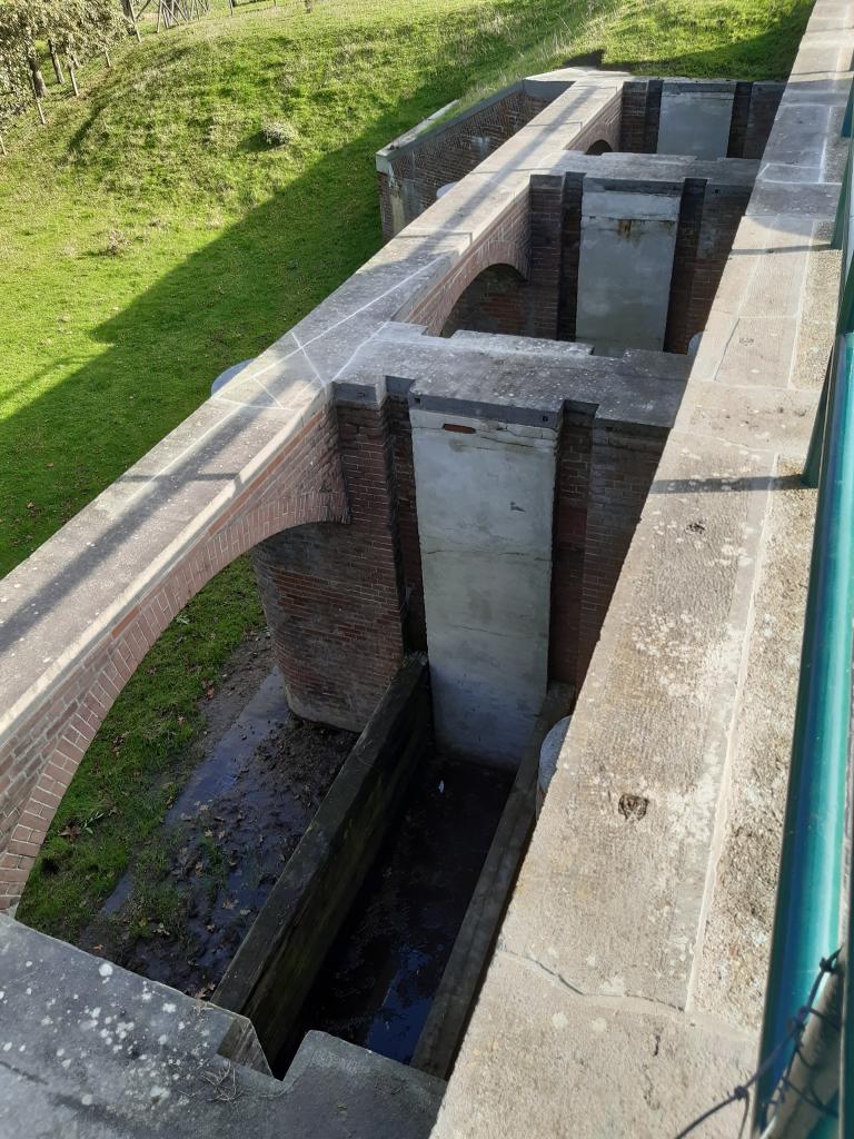
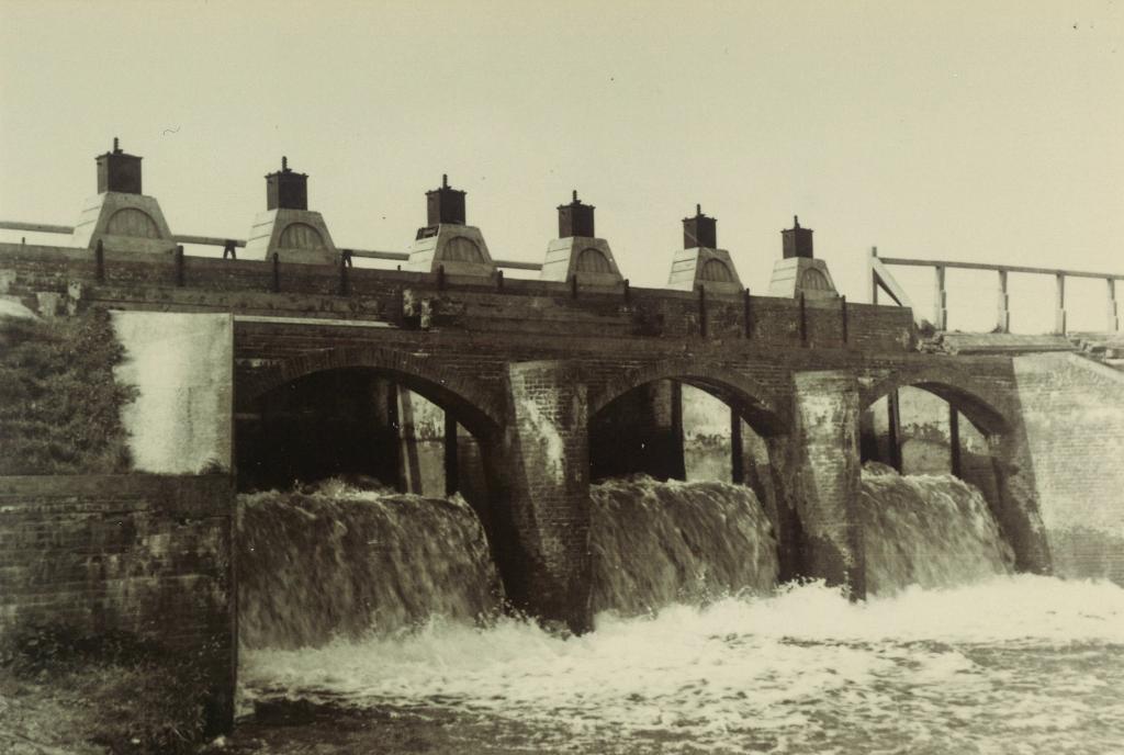
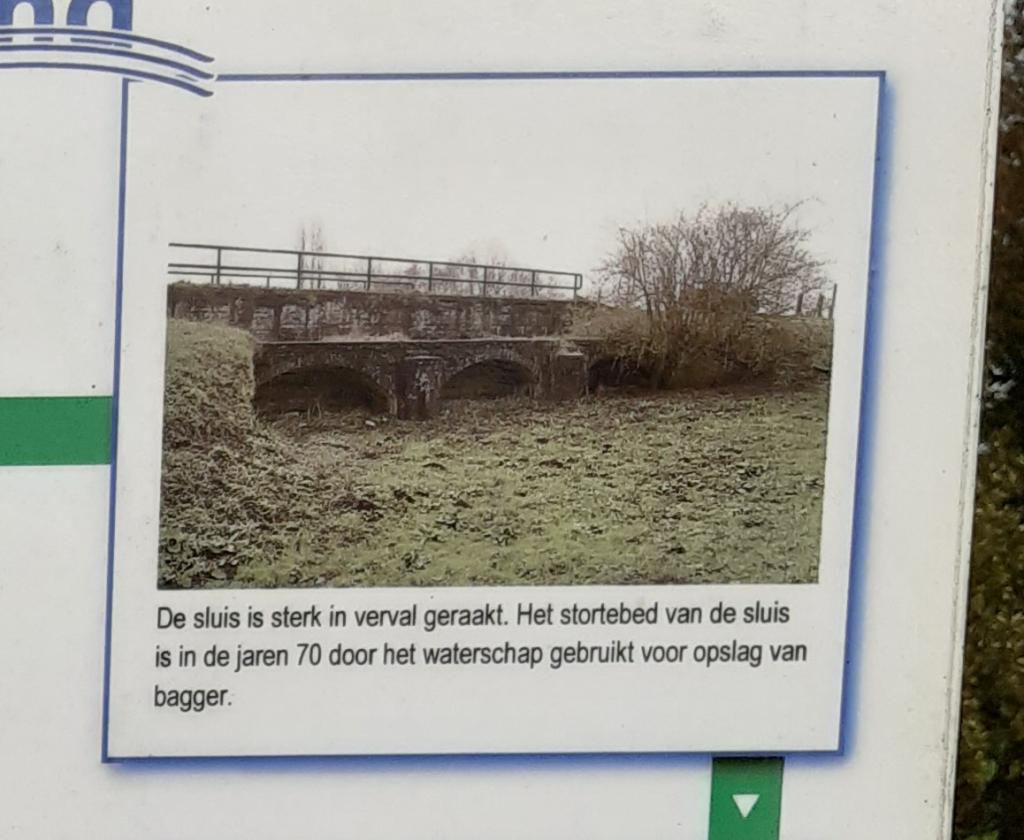
The floodgate consists of a lock section in the dike body and a connecting basin section in the Beemster polder. The lock is constructed of masonry, founded on piles, and has a concrete floor. There are six tubes approximately one and a half metre .
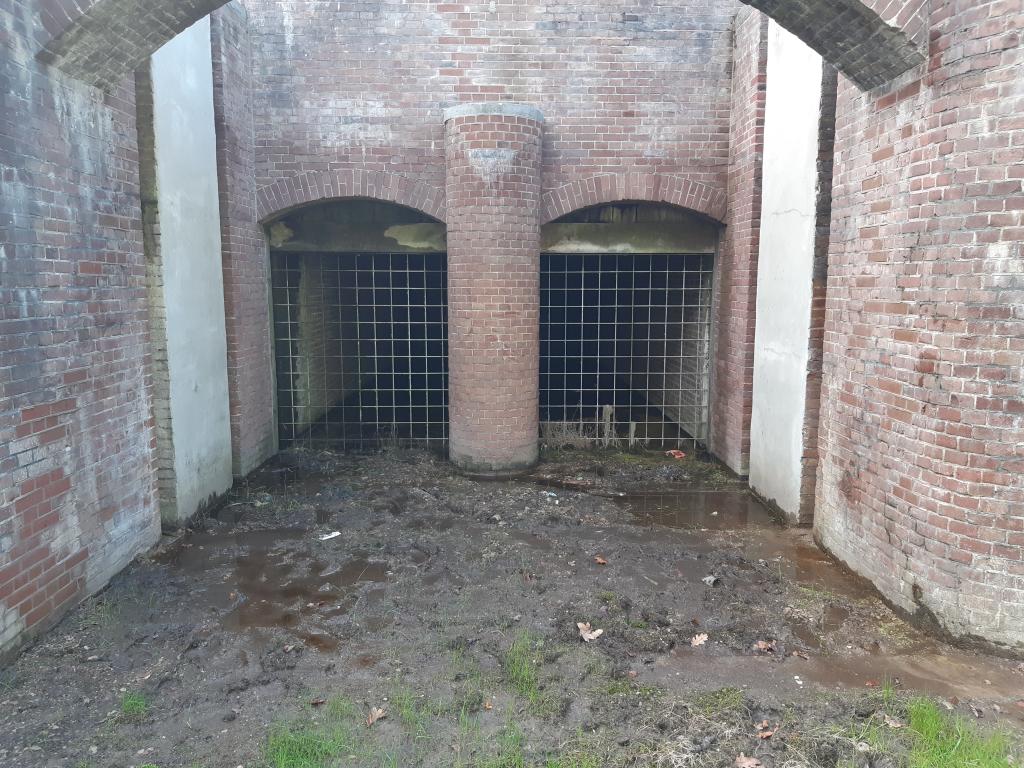
In peacetime, the lock was closed by two bulkheads (with sand in between) that were composed of stacked bulkhead beams. Once the beams and sand had been removed, the lock could be opened by lifting the sluice gates using windlasses. These have since been removed.
It was never the intention to flood the entire Beemster. The villages of Zuidoostbeemster, Middenbeemster, and the entire northern part of the polder had to remain dry. To achieve this, various roads were raised so that they could serve as flood barriers. Bridges could be closed off with stop logs. Culverts were closed with a slide gate. There is still such a culvert in the Volgerweg.
Flooding during World War II
Although there was never any fighting in the area of the Defense Line, the Beemster was flooded twice. In 1940, the Dutch armed forces opened the floodgate to hinder the German invasion. After five days of fighting, the Netherlands capitulated and the polder could be drained again.
The second time the Beemster was flooded was in March 1944. This inundation took place on the orders of the German occupiers and lasted over a year. After liberation on May 5, 1945, the pumping stations were immediately restarted and two weeks later the entire polder was dry. Fruit growers in particular suffered enormous damage because not a single tree had survived the inundation.
Renovation
Around 1962, the lock was taken out of service and the openings on the canal side were sealed with concrete and the lock chambers filled with earth. The lock then fell into disrepair. The Hollands Noorderkwartier Water Board had the lock renovated in 2005. The work consisted of removing soil from the receiving basin directly behind the lock and repairing the masonry, concrete work, and natural stone. The Beemster Historical Society awarded this project the HGB Compliment Prize in 2007. In 2022, the floodgate was refurbished again: parts of the joints and masonry were repaired.
Extra
- Wormer and Jisperveld cycle route, 27.3 km
- Cycling route: Waterline Route, Edam-Beverwijk section, 43.0 km
- Walking route: World Heritage squared, 17.0 km
- More information about the history of the Defense Line of Amsterdam
- More information about recreation and tourism around the Defense Line of Amsterdam