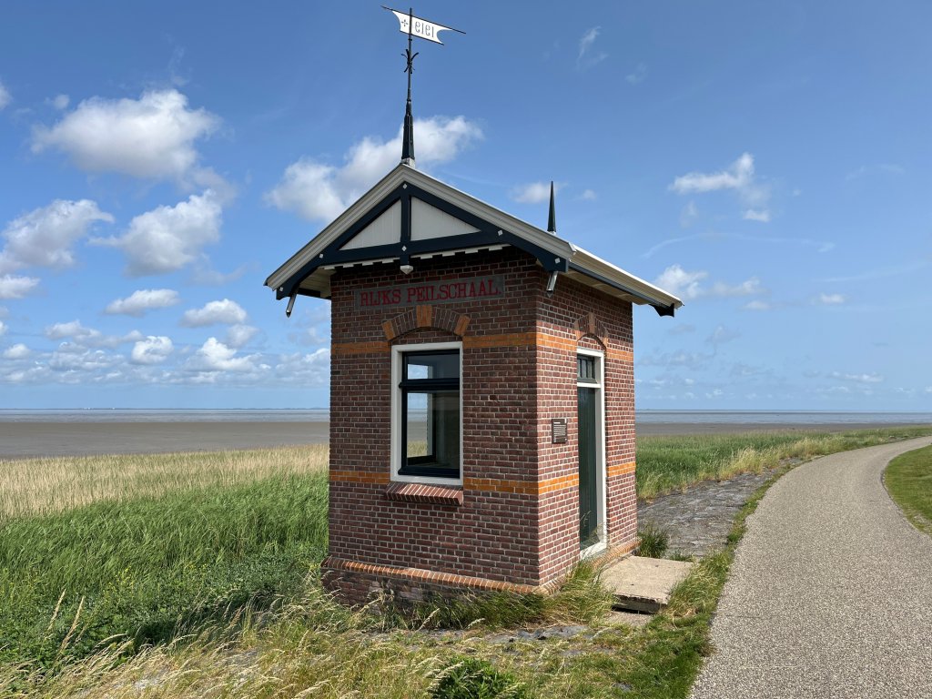
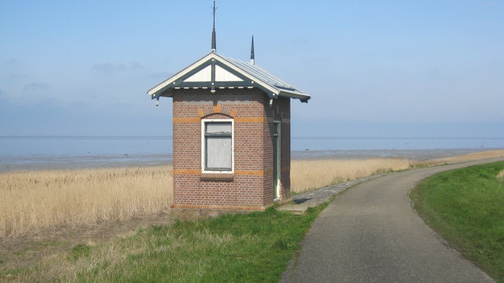
Westerland gauge house
Where the Wadden Sea, the former island of Wieringen, and the Amsteldiepdijk meet, there stands a mysterious, slender building, contrasting sharply with the mudflats, water, and sky. This solitary house is a reminder of the Zuiderzee Works, which turned the island of Wieringen into part of the mainland of North Holland.
After the great storm surge of 1916, when parts of Waterland and the Anna Paulowna polder were flooded, the decision was made in 1918 to close off the Zuiderzee with a dike. Wieringen would be connected to the mainland by means of a dike through the Amsteldiep and then by the Afsluitdijk with Friesland. This would lead to higher water levels in the part of the Zuiderzee that would remain open.
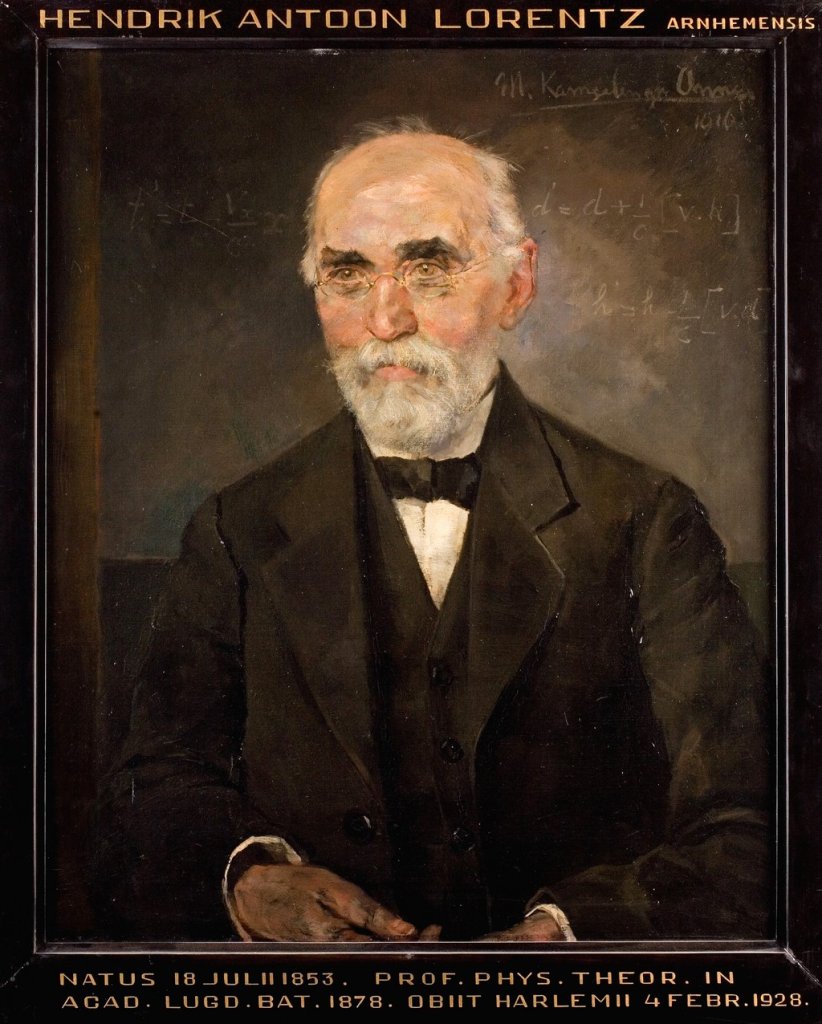
To investigate water levels and wave run-up in the northern Zuiderzee area, the Zuiderzee State Commission was appointed, led by the famous physicist and Nobel Prize winner Hendrik Lorentz (1853-1928), after whom the locks at Kornwerderzand are named. Gauges had to be installed at various locations in the Zuiderzee area to collect data on the height reached by the seawater.
In order to investigate the consequences of closing off the Amsteldiep, two gauges were installed on Wieringen in 1919, housed in specially built huts, one at the port of Den Oever and one in the empty western part of Wieringen. Between 1805 and 1919, this area was used by the navy to serve as a quarantine station for sailors with infectious diseases and as a gunpowder storage facility. The dike road where the western hut stands is still called Quarantaineweg (Quarantine Road).
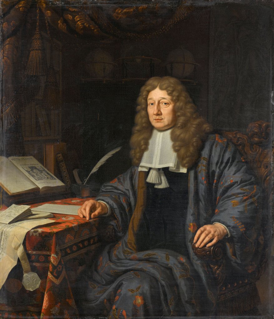
A gauge is an instrument that measures the level of a particular liquid, such as the water level of a river, relative to the Amsterdam Ordnance Datum (NAP). This is derived from the Amsterdam Datum established in 1684. Under the leadership of Mayor Johannes Hudde (1628-1704), in order to keep Amsterdam dry, the average sea level was determined so that the dikes could be maintained at the correct height and the water level could be measured.
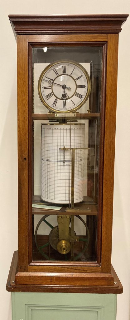
From 1829 onwards, water levels throughout the country had to be measured using gauges that indicated the Amsterdam Water Level. To this end, Rijkswaterstaat and the water boards had gauges installed and water level marks applied throughout the country. From 1858 onwards, a new type of gauge was used, the recording gauge, which was placed in special gauge houses. The Wieringer gauge houses are part of this tradition.
A water level recorder was used in the gauge houses. In a well beneath the building, a float floated on the seawater, connected to a pen that automatically recorded the water level relative to sea level on a roll of paper. The roll was driven by a clockwork mechanism and had to be replaced every 24 hours. The water levels were reported daily to the Department of Waterways and Public Works in The Hague.
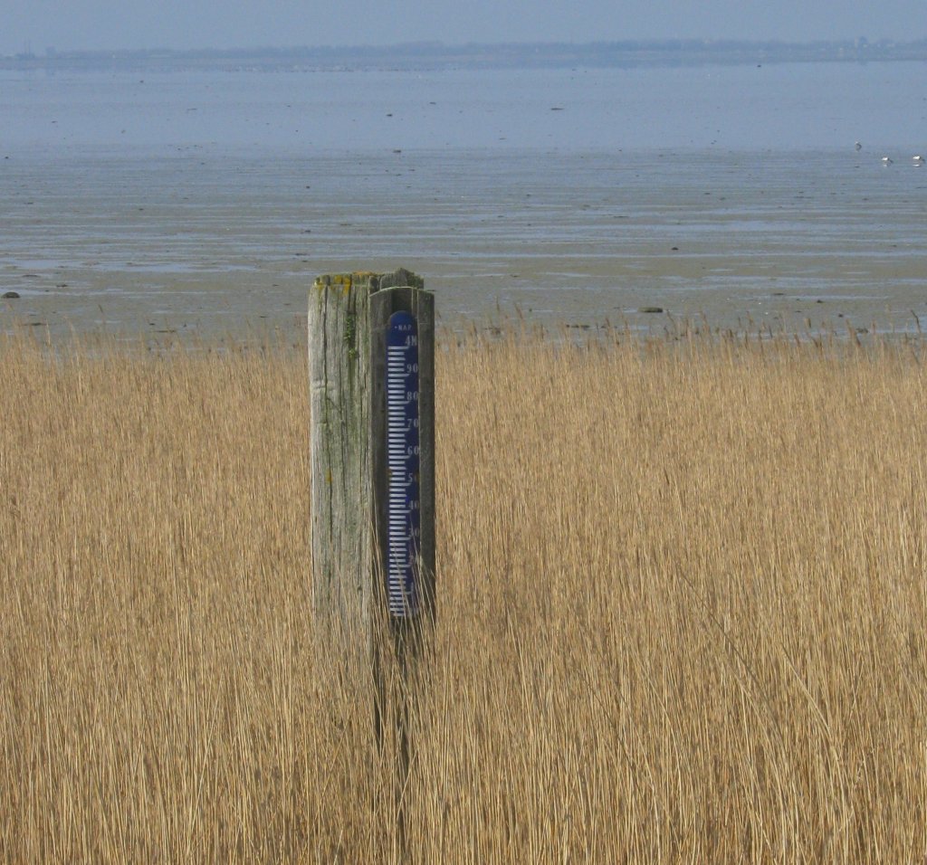
For a quick glance, a gauge was also installed on a wooden pole on the dike, which is still there today. The gauge house fulfilled its original purpose until after the closure of the Zuiderzee. In the years that followed, the mudflats near Westerland silted up and the tidal channels shifted, making it difficult to measure the water level there.
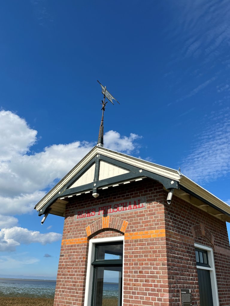
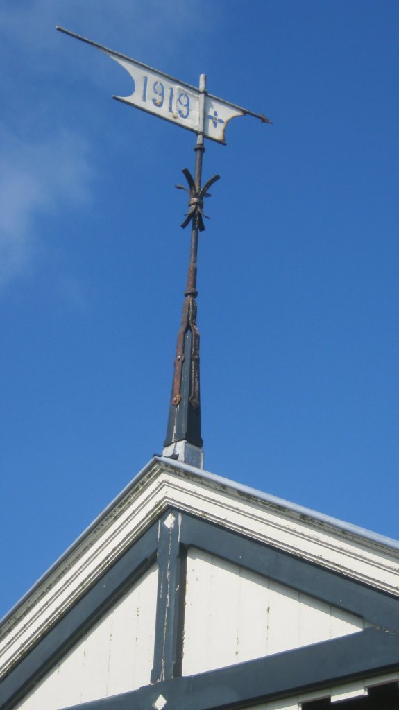
In 1939, the water level recorder was removed from the hut, which was then used as a shelter for dike guards during heavy storms. The beautiful building with its characteristic bands of orange glazed bricks is now a monument. A bluestone frieze with the inscription 'Rijks Peilschaal' (National Gauge) commemorates its purpose, while the decorative wrought-iron weather vane bearing the inscription '1919' indicates the year of construction. As a whole, it is a reminder of the time of the Zuiderzee works.
Extra
- If you want to cycle past the Westerland gauge house, you will need to make a small detour from the main walking or cycling routes. This applies, for example, to this cycling route through the Wieringermeer and across Wieringen.
- The Den Helder-Harlingen section of the Coastal Route will also be nearby.
- Two shorter walking routes starting at De Haukes pass by. The Damroute and the Westerkliefroute.