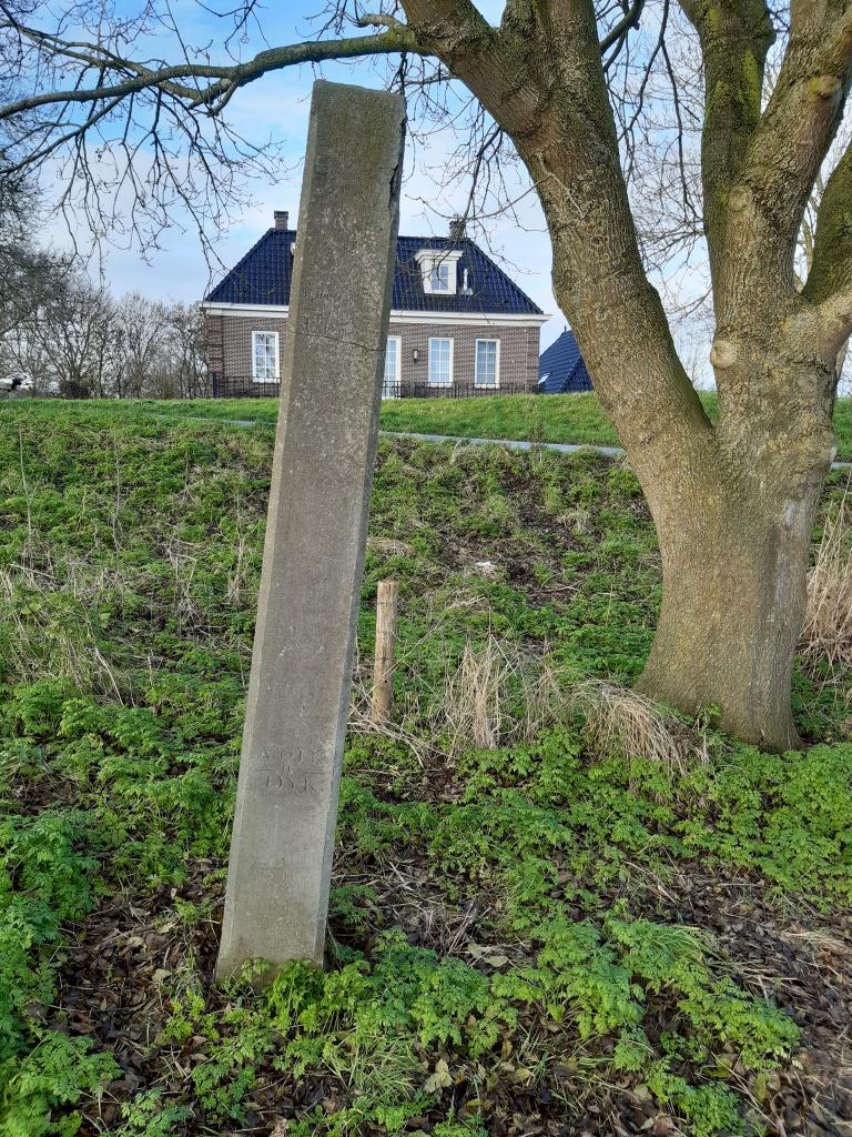
Water level gauge pole Edam
It is hardly noticeable. This gauge pole is one of the smallest national monuments in Edam. Slightly off-center, the bluestone memorial pole stands under a tree between the dike and the old lock keeper's house of the Zeesluis. If you look closely, you can see an important inscription on this 18th-century pole.
Storm surge of 1775
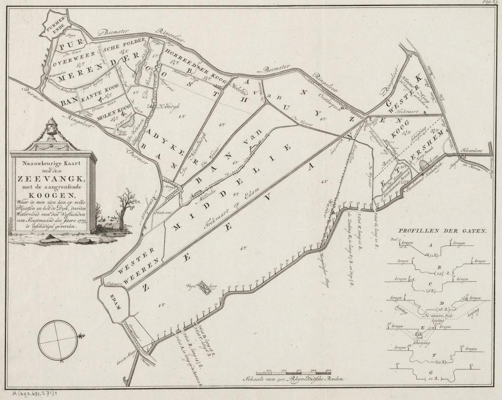
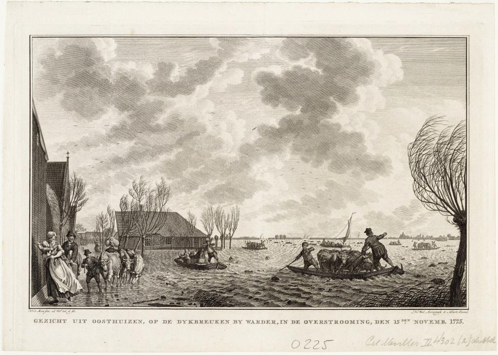
On the night of November 14-15, 1775, there was a very strong northwesterly storm. Strong gusts of wind and large amounts of water from the North Sea were driven into the Zuiderzee, causing the water level to rise very quickly. This storm surge caused six breaches along the Zeevangszeedijk north of Edam. The entire Zeevang polder was flooded. Because it was already late in the year, the cows were already in their stables and could be rescued. They were driven into the Beemster, among other places. The sheep, however, were outside and thousands of them ultimately drowned.
That night, workers went to the dike to help. Around half past two in the morning, Costerus van de Zeevang, the dike reeve who lived in Edam, walked from the town along the Oorgat to the dike to see how things were going. However, he did not get very far. The current Zeesluis (sea lock) did not exist at that time; the water was then diverted by the Sassluis, located a little further inland. The sea flowed over it on all sides and Costerus had to turn back. At three o'clock in the morning, the population was warned by the ringing of the alarm bell and the beating of drums. The inhabitants of the houses north of the Oorgat had to flee from the water pouring over the dike.
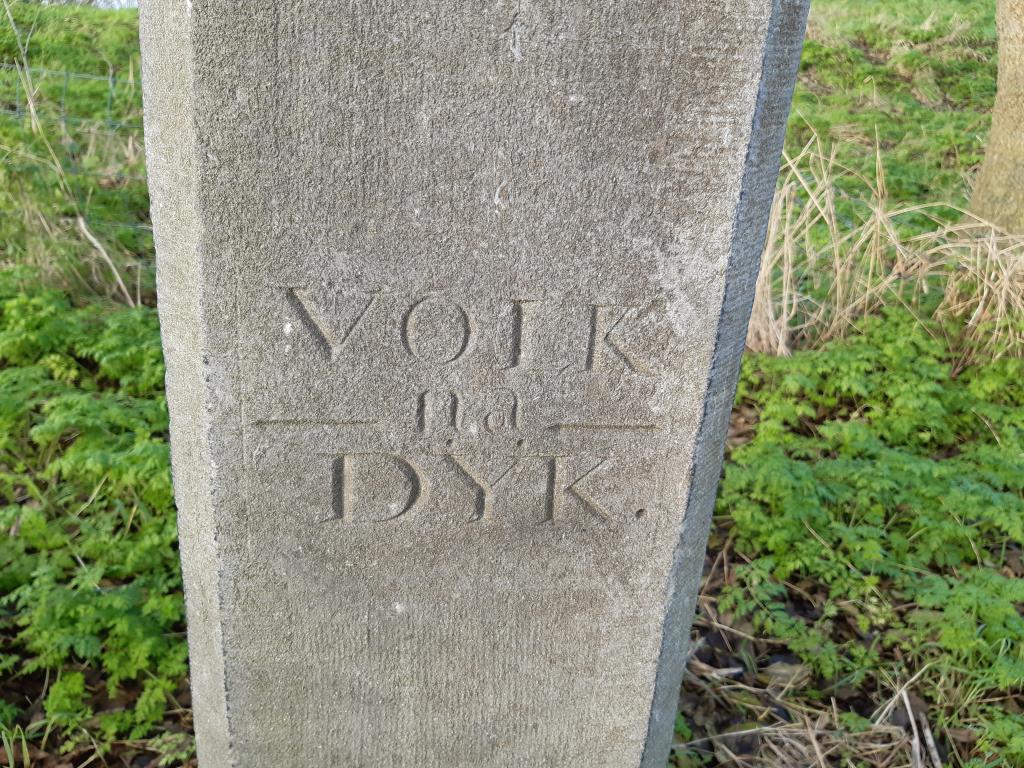
Inscriptions
This storm surge in 1775 revealed that the warning system for high water levels was inadequate. That is why this gauge pole was installed. There are two marks on the nearly metre pole. The upper mark indicates: three o'clock in the morning. That is the level reached at 3:00 a.m. on the stormy night of 1775.
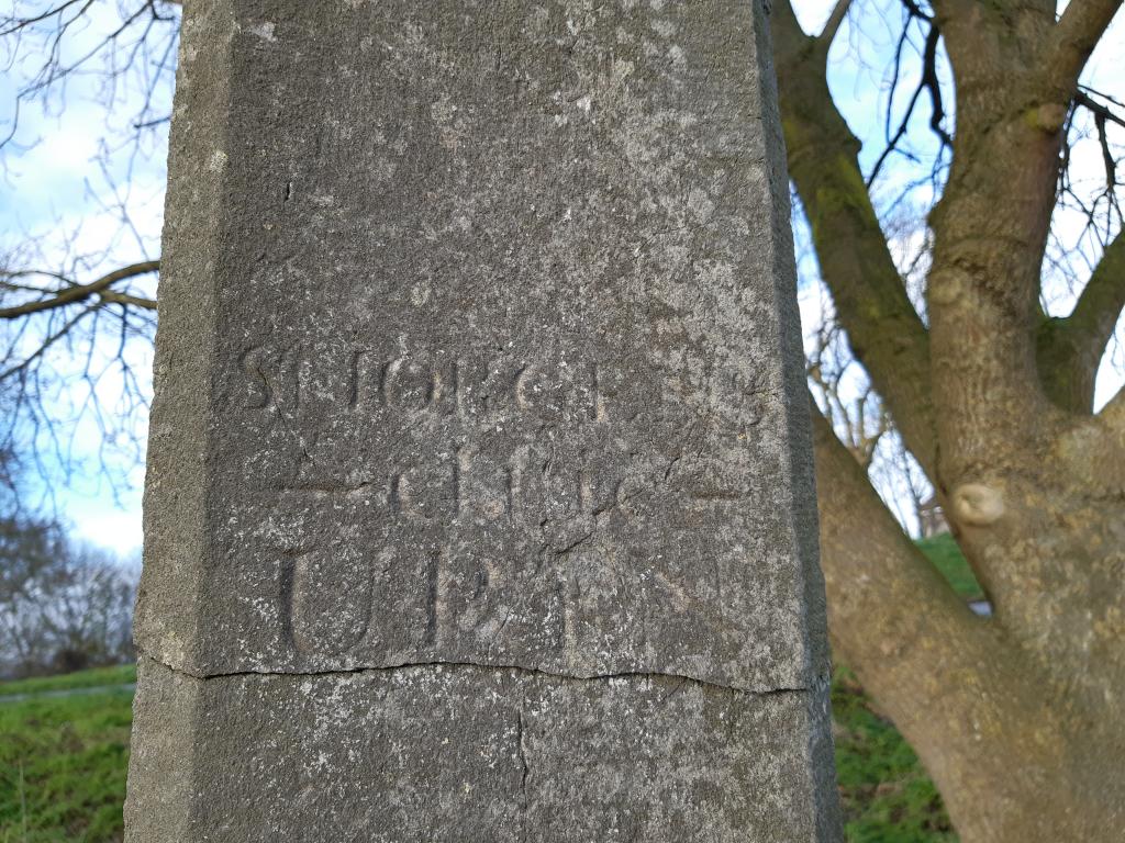
The bottom mark indicates: Volk na dyk (People to the dike). If the water rose to this level, all the men from Zeevang had to come to the dike with shovels. Here they had to lay down sandbags and stretch dike sails over the threatened areas. Hopefully, this would prevent the dike from failing again.
Extra