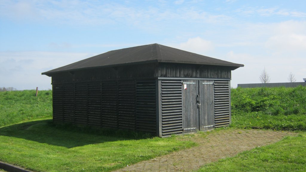
De Haukes shot put shed
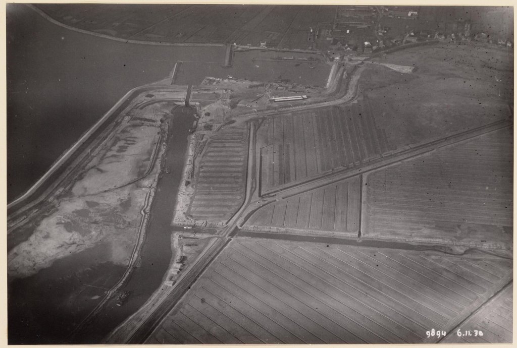
Right next to the De Haukes walking trail starting point stands a monument that is inconspicuous at first glance: the De Haukes shot beam shed, now best known for the marina near the village. When Wieringen was still an island, travellers the mainland already came ashore here, although it took until 1892 before a harbor was built.
The shot beam shed is closely linked to that harbor and was built in 1931. The rectangular building is made of wood and was originally completely tarred black. Nowadays, part of it is painted black. The walls are not made of solid planks, but of slats, so that the wind can blow through the shed. Two wooden sliding doors give access to the beams stacked in the shed.
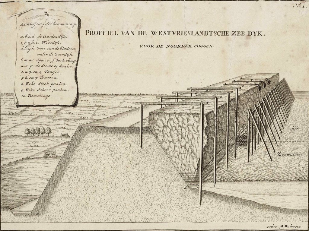
The crossbeams are intended for the breach or cut in the Westerlanderdijk, which protected the low Westerlanderkoog from high water when Wieringen was an island. Around 1800, it was still a seaweed dike, which means that the earthen dike body on the sea side was reinforced with a seaweed belt or seaweed dike, composed of seaweed and wood. That seaweed was actually eelgrass, which grew particularly well around Wieringen in the Zuiderzee.
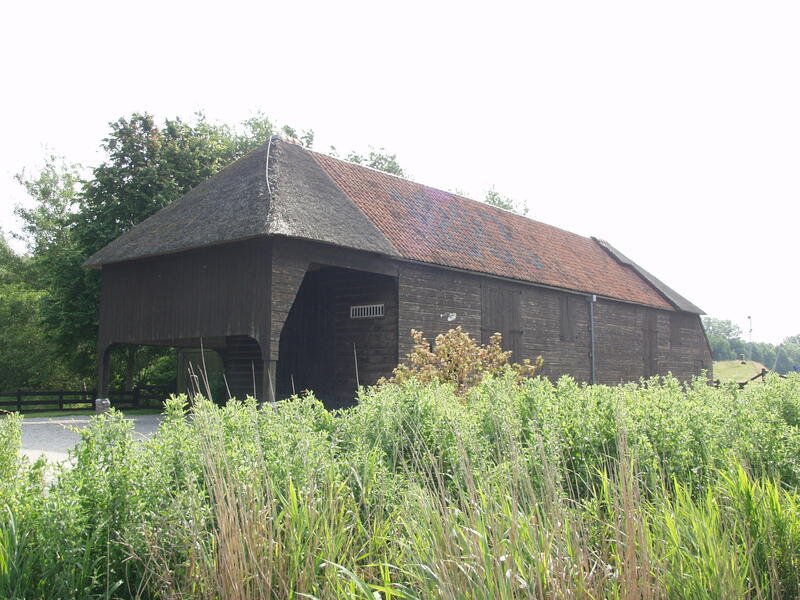
Wieringen was therefore the centre seaweed fishing. In the neighbourhood De Haukes in particular, there were many areas with large seaweed, and a lot of seaweed was brought ashore in the hamlet. It was dried in specially built seaweed barns. At some point, seaweed dikes were no longer built, but until the 20th century, dried seaweed from Wieringen was in high demand as cushion and mattress filling.
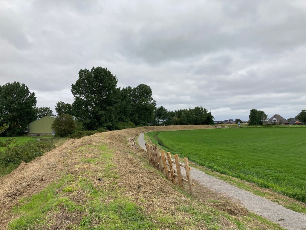
Over time, mound dikes were replaced by earthen dikes with stone revetment almost everywhere, but on Wieringen, the mound dikes on the south side of the island remained in use for a long time. In 2020-2021, the only remaining mound between the old island and the Waard-Nieuwland polder was restored. A cycling and walking route that starts in De Haukes takes you across this cultural-historical monument.
When the Wieringermeer had just been reclaimed, a road was constructed along the new harbor to the newly built Haukessluis, which connects the Slootvaart in the new polder with the Amstelmeer. From there, the road continues into the Wieringermeer. To prevent traffic congestion, a cut was made in the old Wierdijk in 1931. A concrete wall with two slots was erected on both sides.
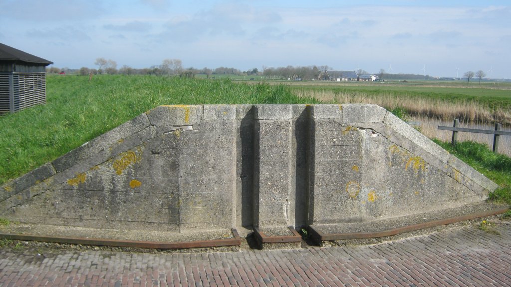
When high water threatens De Haukes, the beams are taken from the nearby shed and lowered into the trenches. Other ports also have similar coupures, such as Den Oever. The fishing port of this village is located outside the dykes, but traffic can easily access the port area through the cut. The cut in Den Oever has been reinforced with large doors and can be closed even faster at high tide.
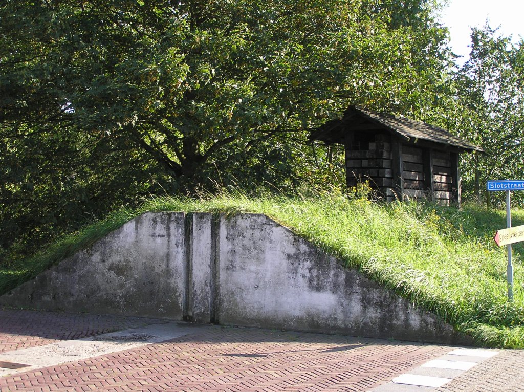
The flood barrier shed at De Haukes is still in use and is tested once a year, in case the water level of the Amstelmeer rises too high. Together with the cut and the dike, the small building forms a functional cultural-historical ensemble. It is a reminder of the time when Wieringen was still surrounded by the sea, and not only pleasure yachts but also fishing boats moored in the harbor of De Haukes.
Extra
- This cycling route through the Wieringermeer and across Wieringen passes by the shot beam shed of De Haukes:
- The Dutch Coastal Path 2 passes the shot put shed in stage 12.
- Stage 6 of the North Holland Trail ends in De Haukes.
- In addition, there are three shorter routes starting from De Haukes. The Dam Route, the Westerklief Route, and the Postboot Route.