Drainage of the Schagerkogge
Until 1844, the village of Kolhorn was located by the sea. At this location, excess water from the former Schagerkogge water board was discharged via a sluice (arrow in the photo). In order to discharge the water, it had to be low tide. The drainage worked well until around 1500, when the land sank below sea level. What further impeded the drainage was the accumulation of silt in front of the dike.
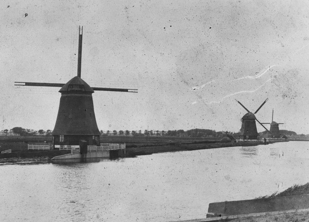
As a result of the drainage problems, the large ditches that drained the water from the polders did not drain properly. This led to flooding in the polder itself. Farmers wanted a solution, but the town of Schagen considered the problems to be minor. In 1738, the big step was finally taken: the Schagerkogge water board decided to build three mills near the sea lock.
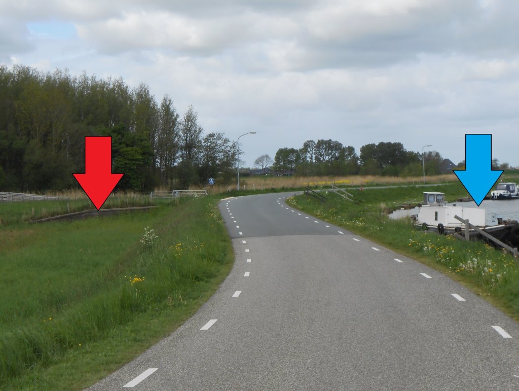
The mills pumped water from the main water system (the reservoir) up into the upper sump (blue arrow in the photo). This connected to the lock. The water level in the sump was higher, so that water could be discharged at regular intervals. One of the mills stood at the location indicated by the red arrow. The others were further to the west.
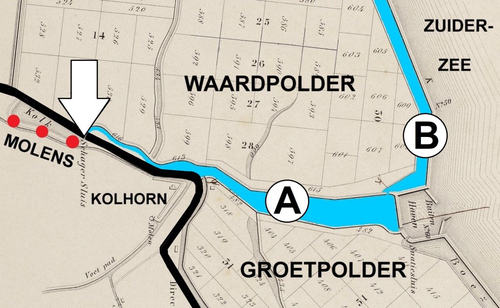
Meanwhile, the Zuiderzee formed silty soils. Between 1844 and 1847, these were reclaimed under the names Waard and Groet. As a result, the Omringdijk (black line on the map) was no longer located by the sea. In order to continue draining, a drainage channel was dug from the lock (arrow) along Kolhorn (A). This connected to a drainage canal (B), which had been dug by the water boards on the new polder.
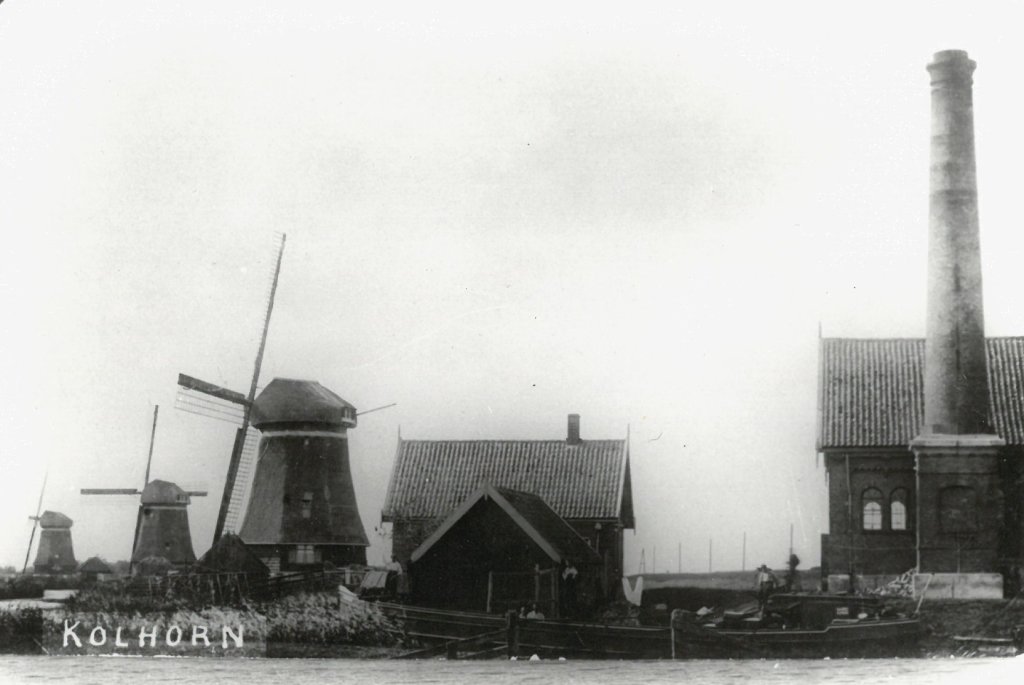
Steam technology had made great strides in the meantime. A network of engineers, machine factories, and coal suppliers had emerged. Steam had become a reliable and affordable option for water boards. In 1871, the De Schagerkogge steam pumping station was completed near the windmills. It was used when there was no wind, but also when the wind was too strong. A windmill can catch fire if it turns too fast.
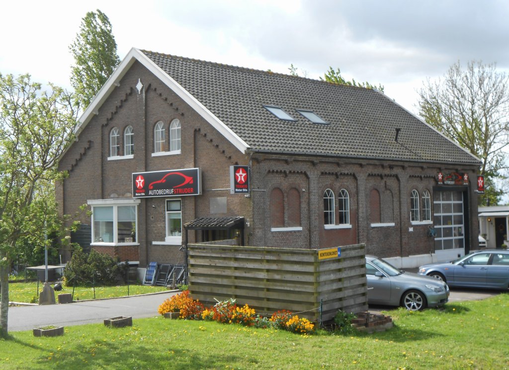
The pumping station was not the work of the Schagerkogge water board, but of a special water board that had managed the mills since 1861. In 1927, this water board had an electric pumping station built in Kolhorn. It was so powerful that the steam pumping station and the mills could be taken out of service. The mills were demolished in 1939, but the steam pumping station building still stands before us (photo), albeit without a chimney.
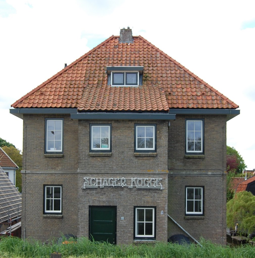
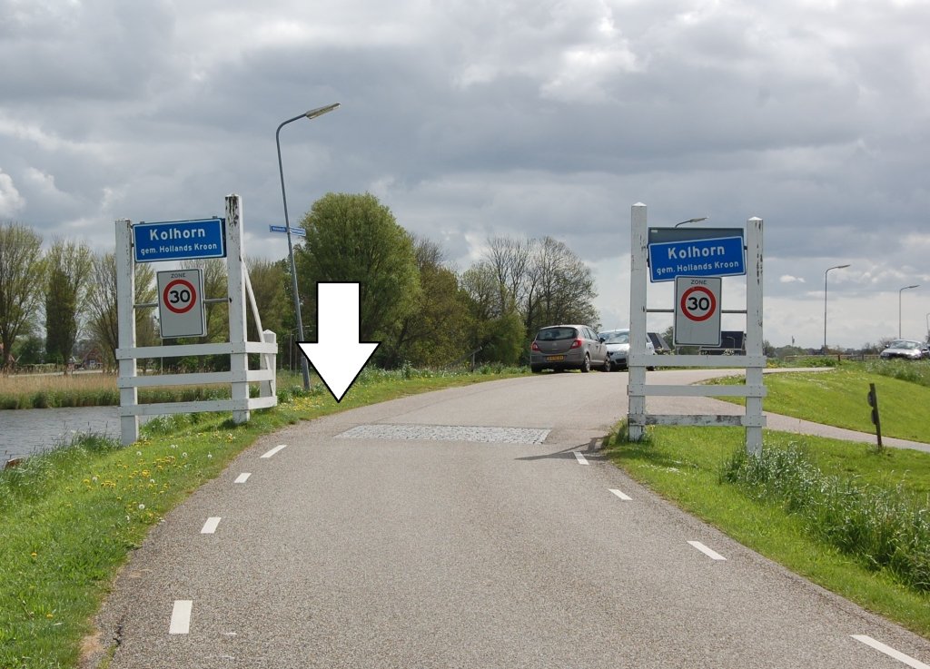
The electric pumping station in Kolhorn (photo) was in service until 2007. Since then, the water system has been pumped by an electric pumping station west of the village. Like its predecessors, it is called Schagerkogge.
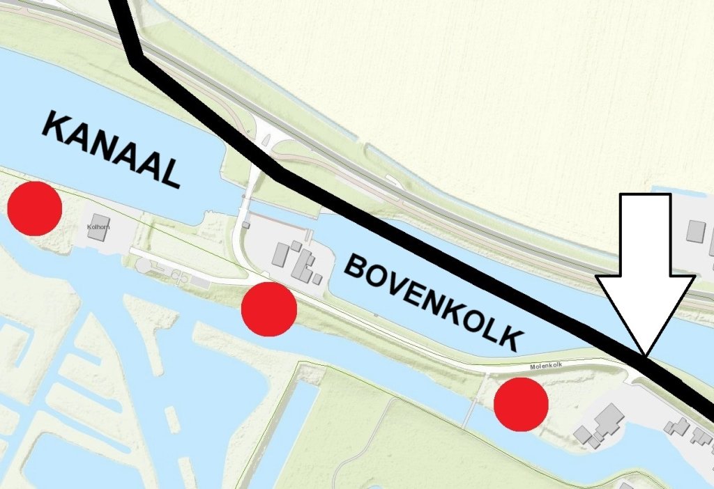
Behind the upper lock, there was originally the Omringdijk (black line on the map), but it was dug through in 1934. They wanted to incorporate the lock into the new Schagen-Kolhorn canal. To do this, it had to be widened and several hundred meters of the dike had to be removed. You are standing at the tip of the arrow; the red dots indicate where the windmills stood.