Wierdijk Enkhuizen
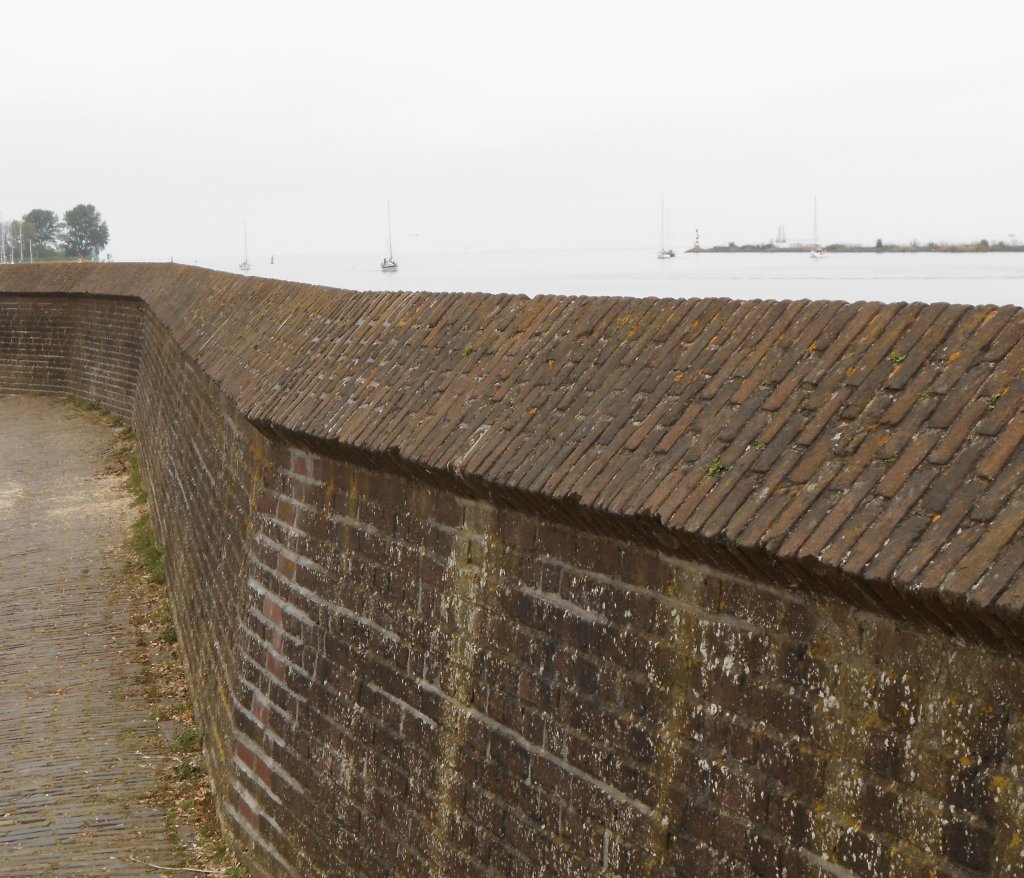
The town of Enkhuizen, originally a fishing village, began to flourish around 1600. The Wierdijk was constructed in 1567 to expand the harbor capacity. In the years that followed, large residential and warehouse buildings came to dominate the streetscape. Such activity was not a given. Today, the town and the IJsselmeer are protected by the Afsluitdijk, but at the time, this characteristic sea wall was the only obstacle to the raging Zuiderzee.
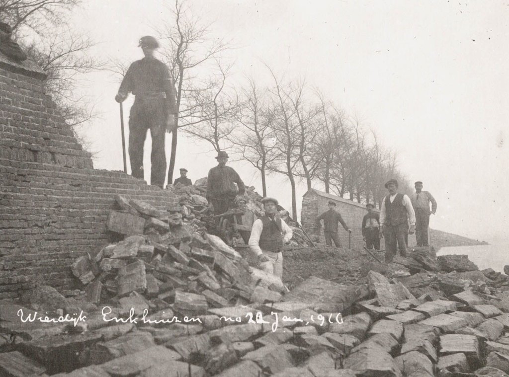
The storm surge of January 13-14, 1916, is sometimes referred to as a forgotten disaster, but it was the deciding factor in the redevelopment of the Zuiderzee area. Between Edam and Amsterdam, the sea dike broke in several places. At Andijk, the Westfriese Omringdijk narrowly held its ground, and in Enkhuizen, the Wierdijk was severely damaged. Holes tens of meters long had been knocked in the wall. Immediate repairs were essential.
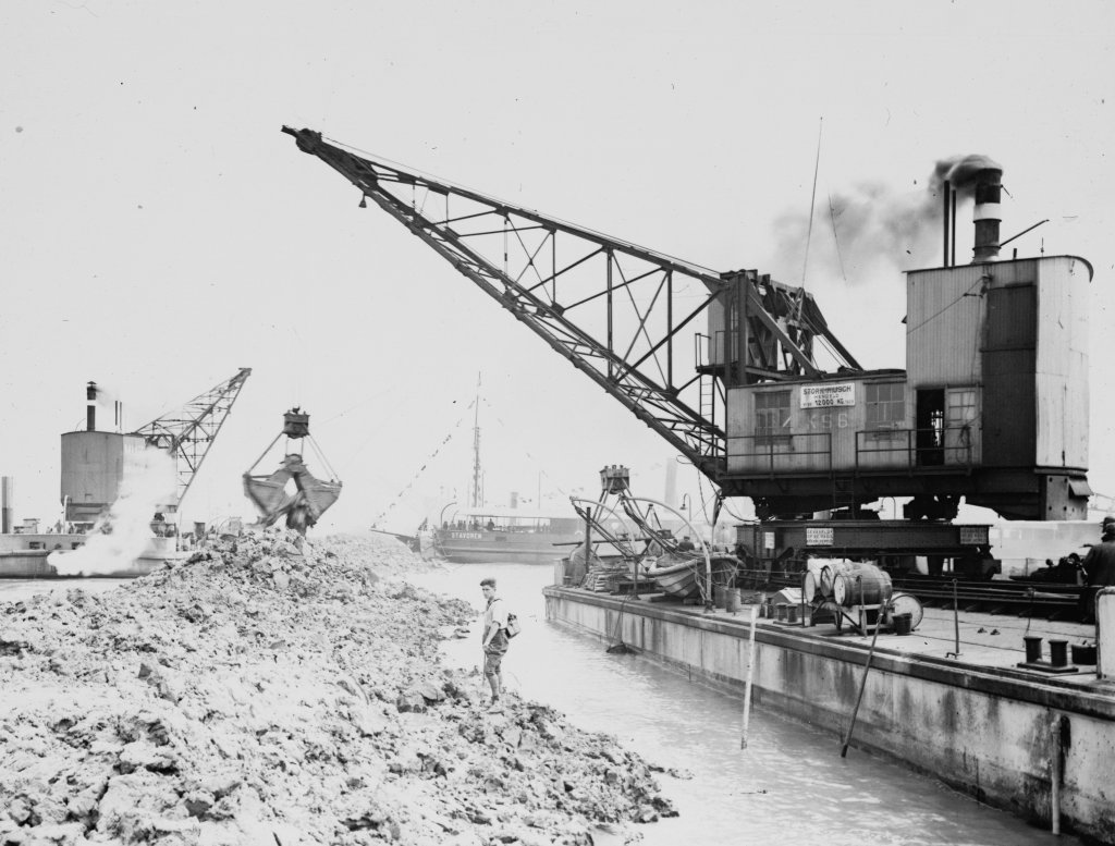
After the disaster, Minister of Water Management Cornelis Lely's Zuiderzee Act was a done deal. The act sealed the fate of the Zuiderzee: it was divided by a dike between Den Oever and Friesland, the Afsluitdijk (completed in 1932). Since then, Enkhuizen has been located on the IJsselmeer. This photo shows the construction of the Afsluitdijk. The cranes are dumping boulder clay into one of the closure holes.
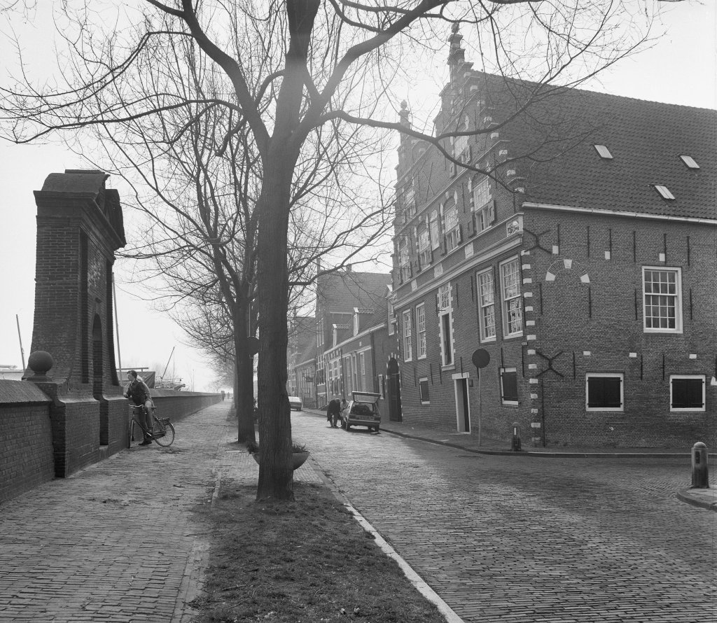
The Dutch East India Company (VOC) had packing and auction houses on the Wierdijk. One of these was the Peperhuis, built in 1625. It was originally a residence and warehouse, built on behalf of Pieter van Beresteyn, a wealthy merchant and shipowner. The VOC bought the building in 1682 and used it to store spices such as pepper and cinnamon. After the company went bankrupt in 1799, most of the VOC buildings in the severely impoverished town of Enkhuizen were demolished. The Peperhuis remained standing and retained its function for other companies until the Zuiderzee Museum moved in in 1947.
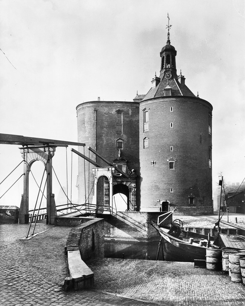
One of Enkhuizen's eye-catchers is the Drommedaris, built in 1540 and a remnant of the city wall. The passageway and drawbridge are located on the route of the Omringdijk, with the water flowing under the bridge to the Oude Haven. The Drommedaris has had various functions: from gate, defense tower, and prison in the past to cultural meeting place today. On the first floor, there are still cells that used to be in a structure on the roof. Every Thursday at noon, the city carillonneur rings the bells of the carillon in the dome tower.
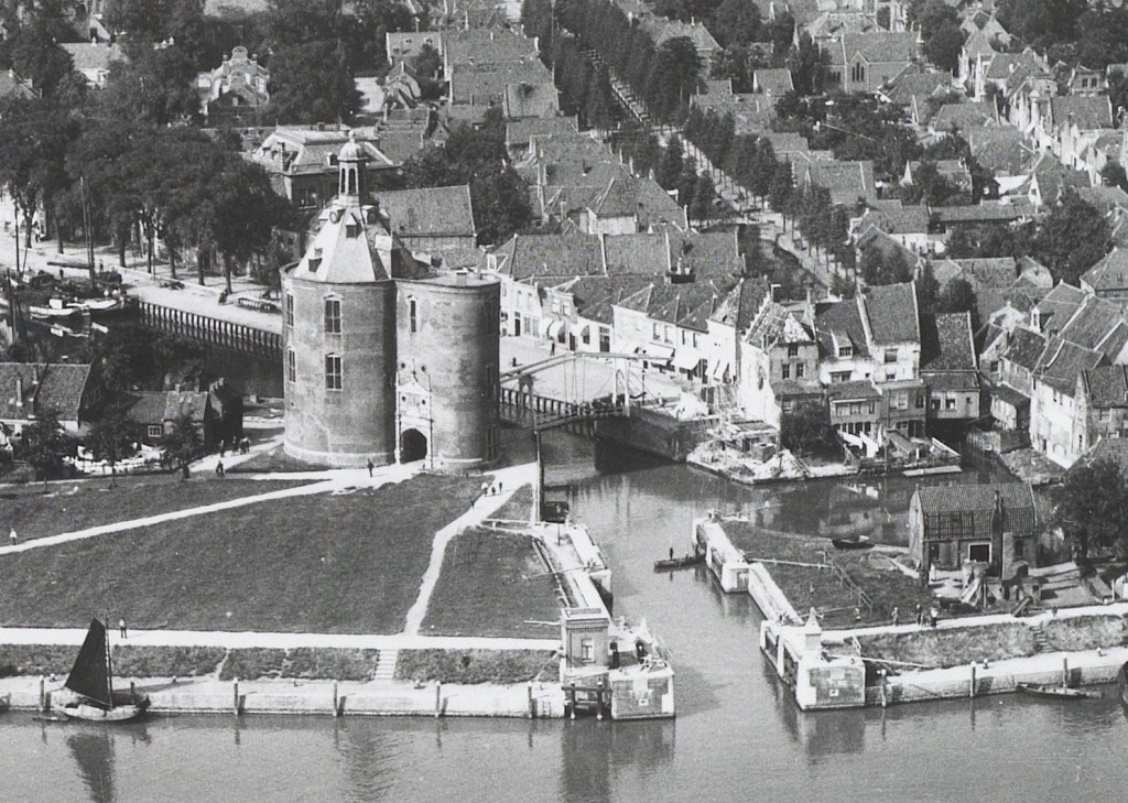
Until the nineteenth century, the Old Harbor behind the Drommedaris was openly connected to the Zuiderzee. On February 4, 1825, the city experienced a frightening day. A storm blew the water straight into the harbor. Quays were flooded, and if the wind had not subsided after noon, the city would certainly have been flooded. Enkhuizen had learned its lesson. In 1827, under the supervision of Rijkswaterstaat, the harbor was closed off with the Sassluis. This is located in front of the Drommedaris and has been owned by the water board since 1996.
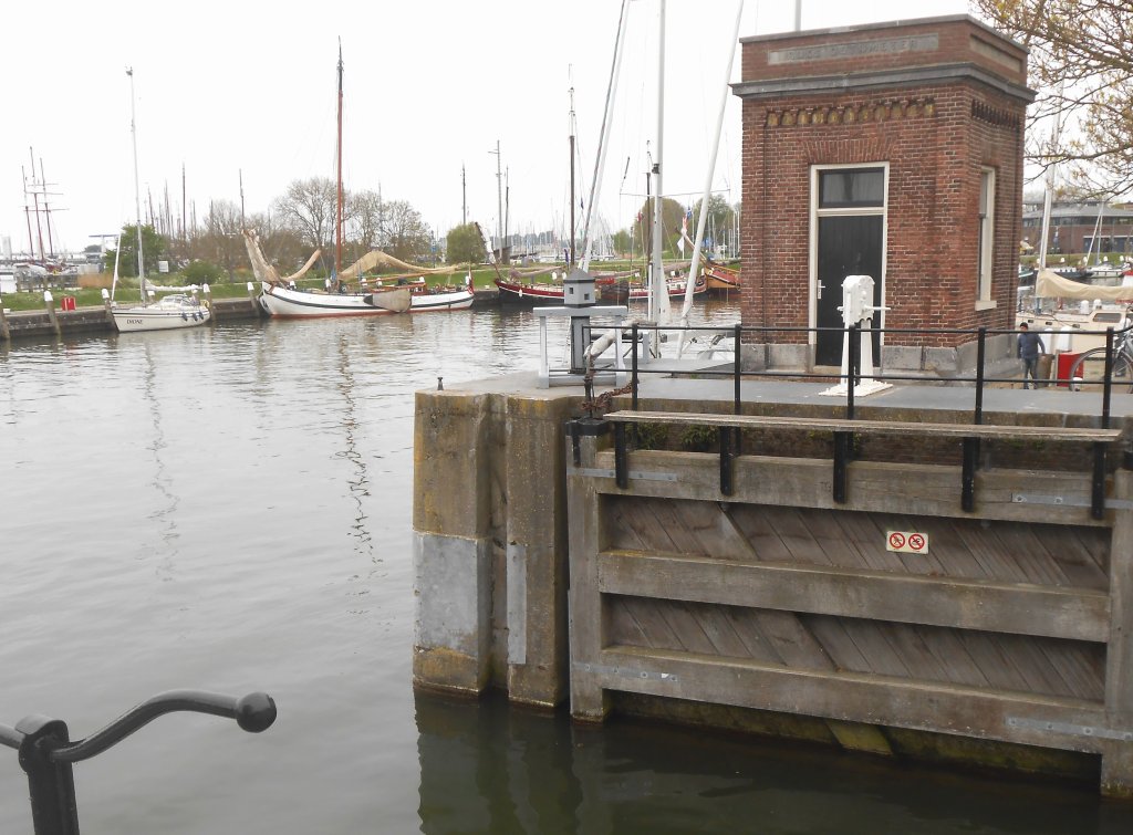
Although Enkhuizen's water safety has greatly improved since the construction of the Afsluitdijk, the battle against the water continues. During the last inspection, doubts arose about the reliability of the Sassluis: can the wooden double doors withstand high water levels during storms? And what if the raging water carries something that gets stuck between the doors? The water board is therefore going to improve the lock.