Burghorn
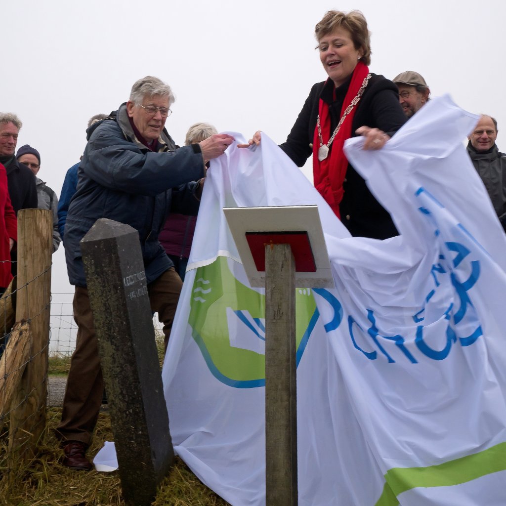
On January 11, 2018, Mayor Marjan van Kampen of the municipality of Schagen (right in the photo) unveiled an information sign at this old dike post, known as the Schagerpaal. The sign was an initiative of local historian Karel Numan (left). The Schagerpaal serves as a reminder of the first major land reclamation in North Holland, more than 550 years ago.
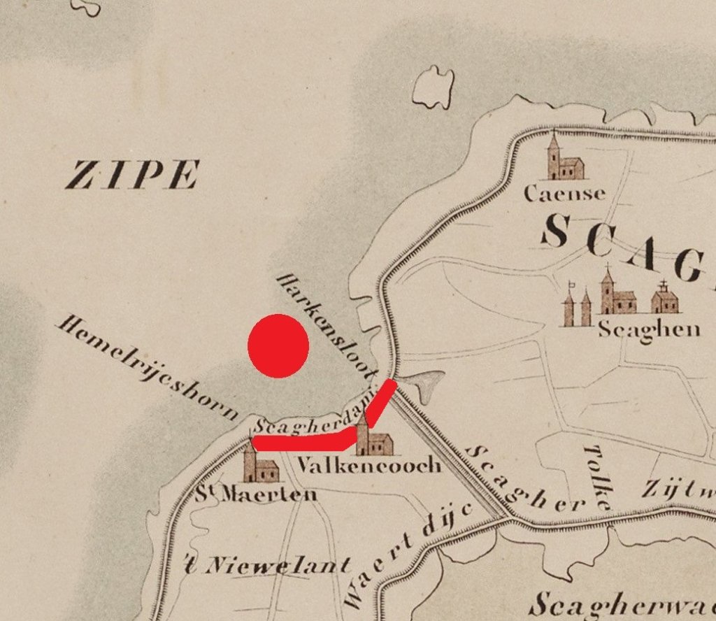
At the beginning of the13th century, the landscape in this area looked completely different (red dot on the map). The settlements of Valkkoog and Sint Maarten were then still located on a large area of mud flats and salt marshes, known as the Zijpe. This was connected to the Zuiderzee by a wide open channel. During storms in 1248, the dikes broke here. Much of the land was washed away. To close the large gap in the Omringdijk, a new dike was built further inland (red line). It was named Schager- or Vriezendam and is now called Valkkogerdijk.
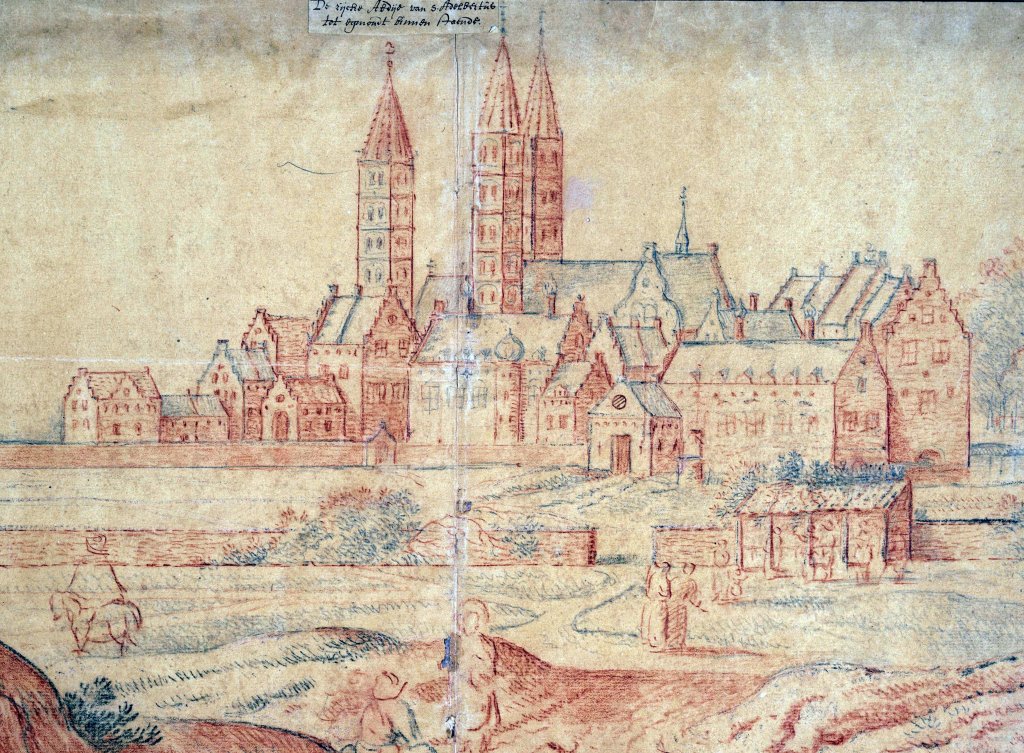
The Schagerdam was built on the initiative of Egmond Abbey. This monastery owned a lot of land in the Schagen area. In 1250, Abbot Lubbertus issued a charter regulating the work. This is also the first time that part of the Omringdijk is mentioned in ancient writings.
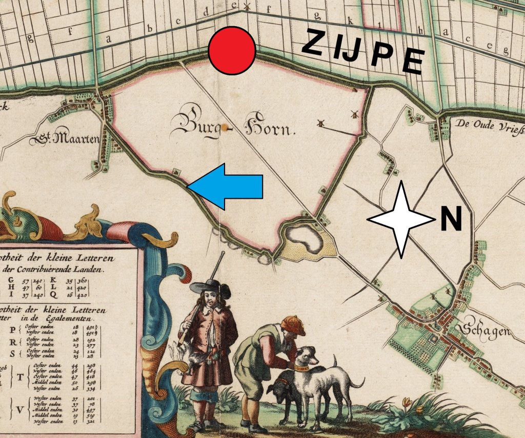
The construction of the Schagerdam (blue arrow on the map) created a large inlet. Over the centuries, the sea deposited a lot of sand and silt there. In 1456, Willem de Bastaard, the first lord of Schagen, obtained permission to reclaim this highly silted area. He did so by constructing a closure dike. This created the 300-hectare Burghorn polder, the first large land reclamation project in our region. More than 500 years later, Willem de Bastaard's closure dike is still called the Nieuwe Dijk (New Dike). We are now standing on top of it (red dot).
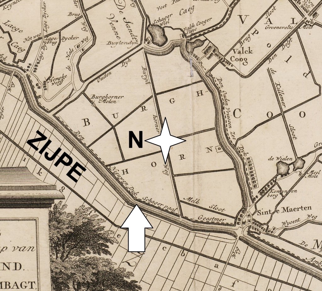
The question remained as to who should maintain the Nieuwe Dijk: only the local water board, the Schager en Niedorper Koggen, or also the water board to the south, the Geestmerambacht. It ended up in court. In 1469, the Court of Holland ruled that the Geestmerambacht had to maintain one third (= 1,333 metre) of the dike and the Schager en Niedorper Koggen two thirds (= 2,666 metre). A pole was placed on the border, the Schagerpaal (arrow on the map). The current pole dates from 1871 and is made of blue-gray Belgian limestone or bluestone.