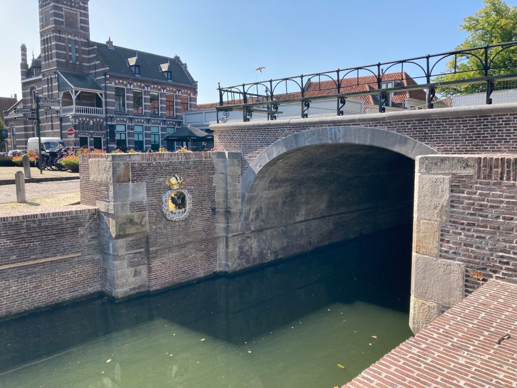
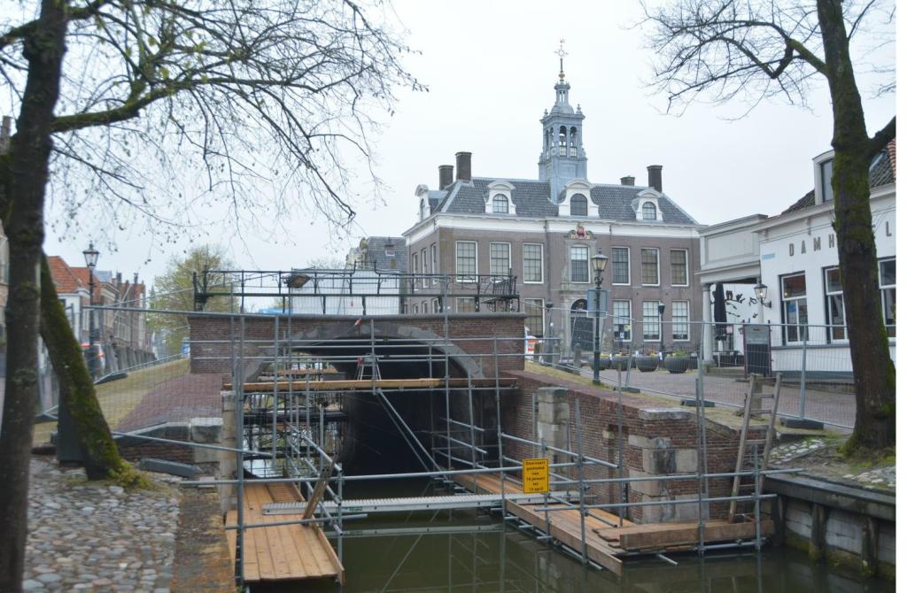
Edam dam lock
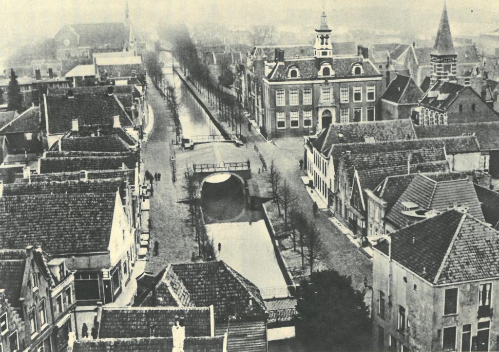
The lock occupies a prominent place in the heart of Edam. At first glance, the tall, wide bridge structure looks like just a bridge, but it has also been a lock for centuries. This monumental lock has a rich history. In 2021/2022, the Damsluis lock underwent a thorough renovation.
Open connection to the Zuiderzee
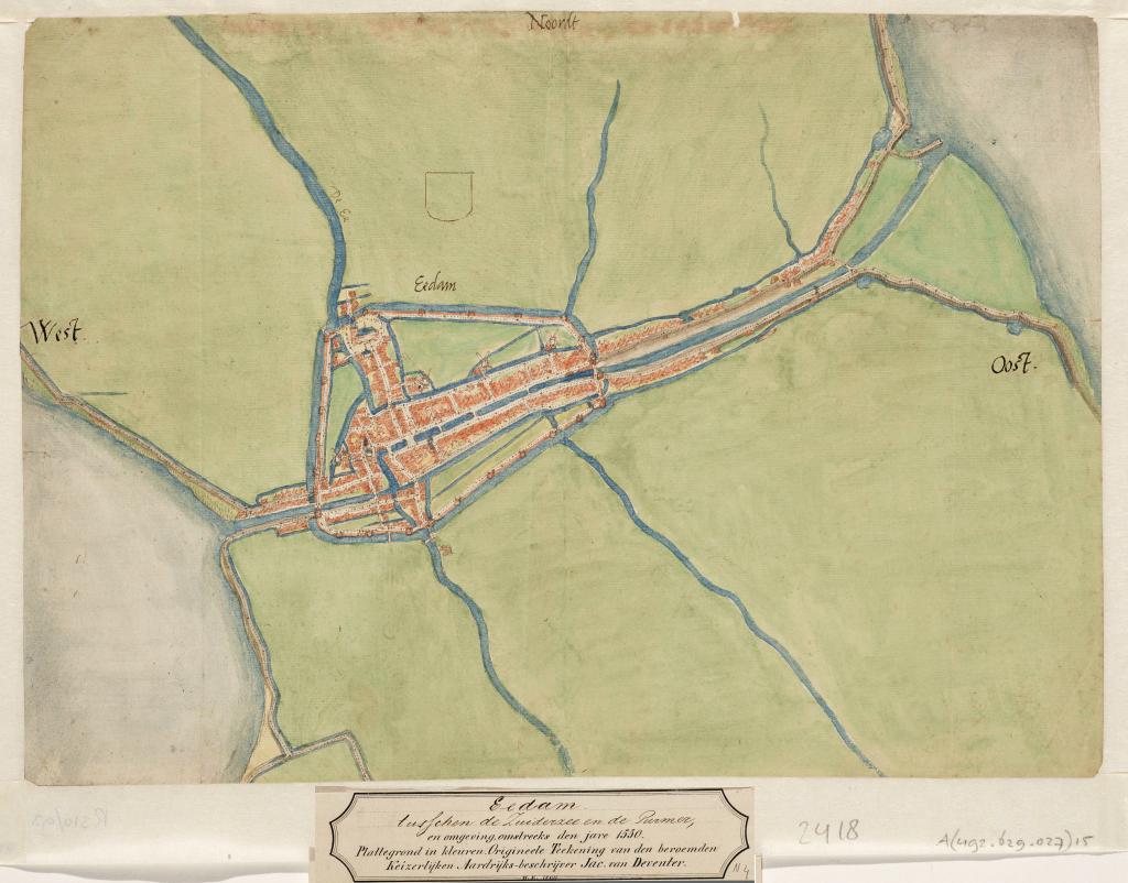
Edam was granted city rights in 1357 and was also allowed to dig a canal through the city between the Zuiderzee and the Purmermeer. This connection led to a flourishing of shipping and trade. The abrasive effect of the ebb and flow of the tide kept the port of Edam at a good depth. However, elsewhere, the inflow of salty seawater caused a great deal of nuisance and land loss. To counteract this, Emperor Charles V decided in 1544 to close off the sea inlet in Edam with locks. Due to resistance from Edam, Charles V's measure was not implemented immediately. The construction of a lock meant that the abrasive tidal currents in the harbor would disappear. This would certainly cause it to silt up. This was very detrimental to shipping and the many shipyards in the city.
Keeping the harbor at depth
In 1565, King Philip II sent a commissioner to Edam to finally enforce the decision of 1544. He commissioned the construction of the lock and immediately established a new water board to manage and finance the works. Philip ratified this in January 1566. The new water board became known as the Hoogheemraadschap van de Uitwaterende Sluizen in Kennemerland en West-Friesland (Water Board of the Drainage Sluices in Kennemerland and West Friesland). However, the people of Edam continued to resist and subsequently destroyed the gates in 1570 and 1572 in order to reopen the harbor. It was not until 1592 that the current stone Damsluis lock was finally completed.
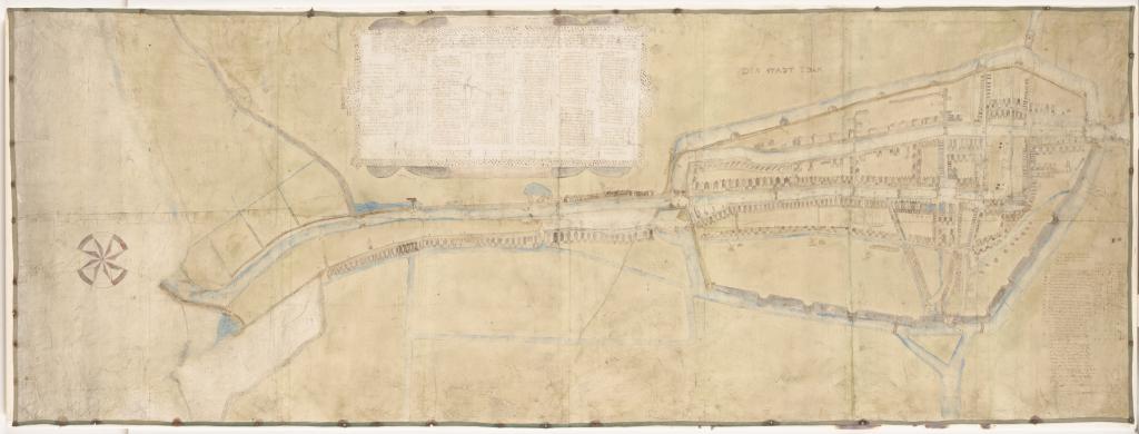
The city of Edam remained responsible for maintaining the depth of the harbor. No garbage was allowed to be thrown into the water. The Supreme Court authorisation sluices to be opened for a few days each month so that mud could be flushed out of the harbor. To check the depth of the harbor, the High Council commissioned surveyor Gerrit Dircksz Langedijck (1561-1623) to make a map showing the depths of the harbor. This map was restored in 2016 by the Hollands Noorderkwartier Water Board and then transferred to the Waterlands Archive in Purmerend.
Throughout the centuries
When the reclamation of the Purmer got underway in 1617, the Water Board of the Uitwaterende Sluizen (Drainage Locks) stipulated that, in exchange for its cooperation, the Purmer Water Board would take over the Damsluis. After three quarters of a century under the management of the Purmer Water Board, the Uitwaterende Sluizen took it back in 1701. They wanted to install ebb gates. The lock was built entirely for drainage. At low tide, the inland water pushed the lock gates open and flowed naturally into the sea. In the summer, however, that fresh water was desperately needed for the farmlands and livestock. The ebb gates allowed it to be retained.
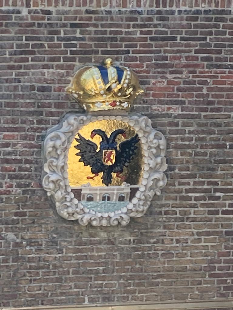
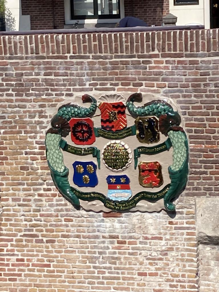
The two large coat of arms stones in the eastern lock chamber commemorate the takeover of the lock by the Purmer Water Board in 1701. One coat of arms stone shows the coat of arms of Uitwaterende Sluizen (Drainage Locks) and the other shows the family coats of arms of the dike reeve, the water board members, and the secretary.
To prevent cars from driving over the lock, two rows of stone posts were placed on both sides of the bridge in 1767. Today, stone posts still stand on both sides of the bridge.
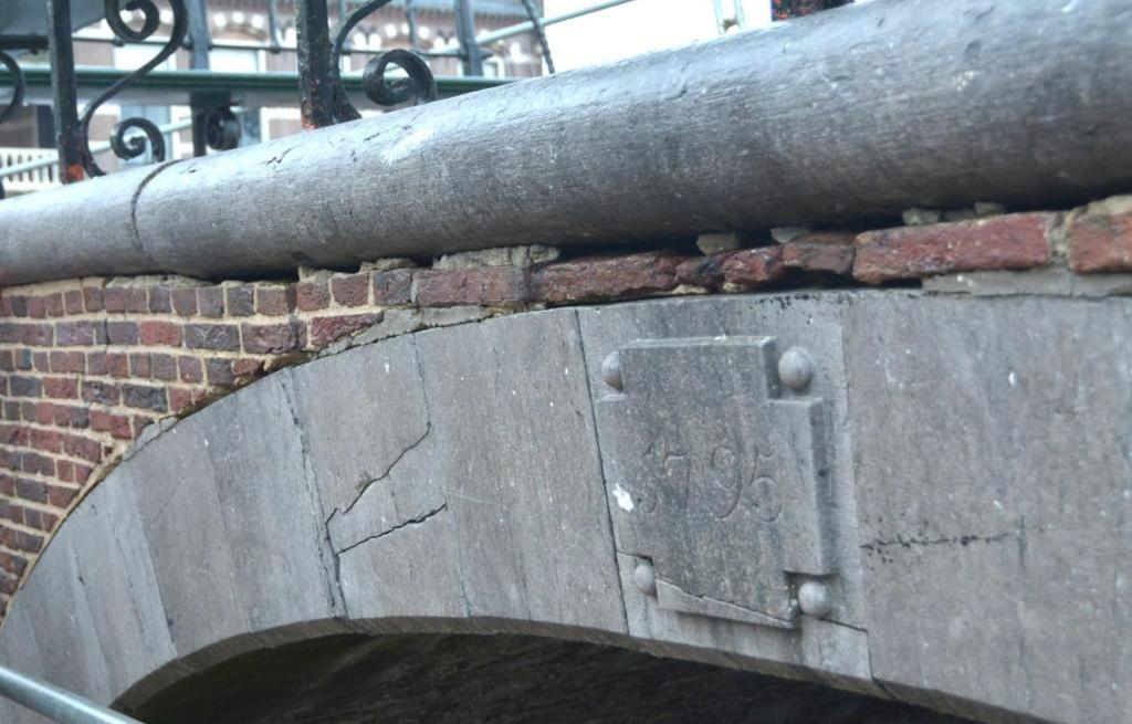
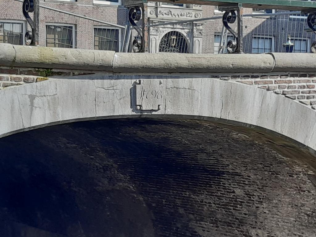
The lock was repaired on the east side in 1795, and in 1798 it was drained for major repairs to the chamber walls and floor. To mark this occasion, two commemorative stones were placed at the head of the lock, bearing the dates "1795" (east side) and "1798" (west side).
After the construction of the Grote Zeesluis (Great Sea Lock) at the end of the Oorgat in 1829, the Damsluis was taken out of service. The lock gates were probably removed at that time, but the mounting points are still visible in the walls.
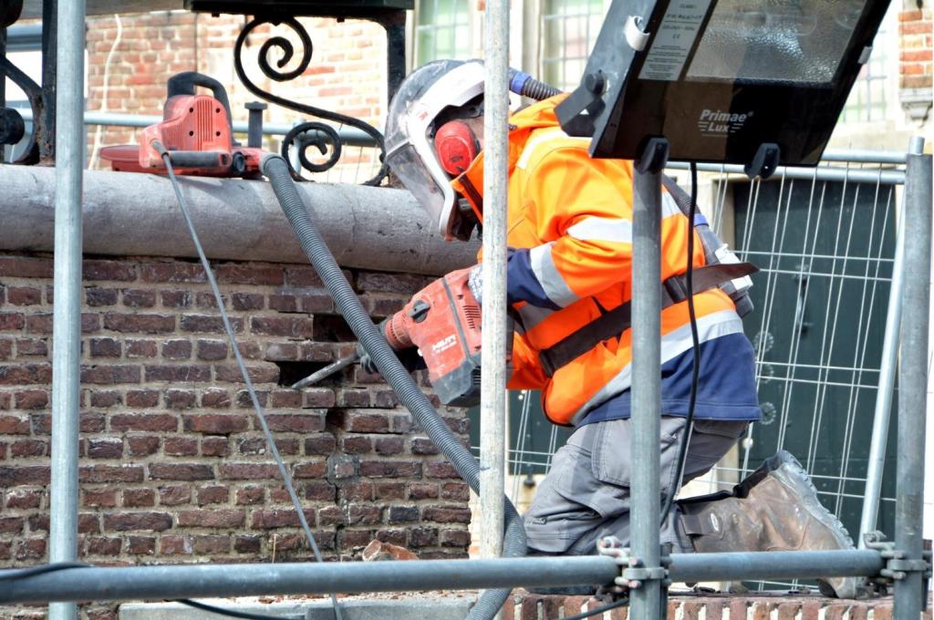
Renovation
Due to severe wear and tear, the Damsluis was restored in 2021 and 2022. Broken stones were replaced and the jointing repaired. The coat of arms stones were also refurbished and given a fresh coat of paint. Finally, the paving on and around the Damsluis and a crack in the vault were repaired.
Extra
- Video of coat of arms renovation
- Next to the lock is the Steenen Koopmanshuys. This house was built in 1550 and was the first stone merchant's house in Edam. The building has a wooden cellar that floats on the groundwater. It houses the Edams Museum.
- A wooden model of a watermark hangs in the permanent exhibition'Waterschat' in the office of the current Hollands Noorderkwartier Water Board in Heerhugowaard. 'Waterschat' is open to the public free of charge during office hours.
- Waterline Path Stage 01
- Southern Sea Trail