The Beemster
In May 1612, the great Beemstermeer lake was drained. The layout of the new land was planned in detail on a map in advance. This was based on aesthetic principles from classical antiquity that had been rediscovered during the Renaissance. The result was an unparalleled monumental landscape. This gained international acknowledgement in 1999 acknowledgement the Beemster was added to the UNESCO World Heritage List.
Difficult drainage
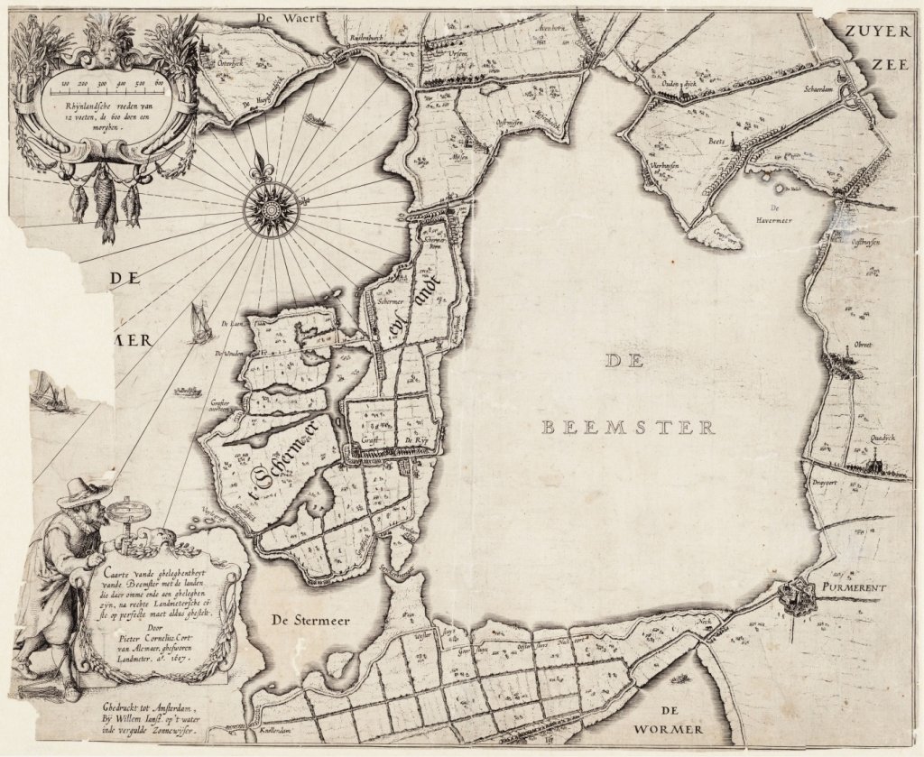
In May 1607, a group of wealthy Amsterdam merchants and senior civil servants in The Hague obtained a patent or concession for the reclamation of the Beemster. This was the largest lake in the Noorderkwartier region. In the spring of the following year, construction of the ring dike and canal began, and the first water mills were erected to drain the lake. The work progressed smoothly, and by the end of 1609, the bottom of the Beemster was visible in places. Unfortunately, a severe storm in January 1610 caused enormous damage. The Beemster flooded again and most of the work had to be redone. Fortunately, new capital was raised and two years later, the Beemster was completely dry. Residents from the surrounding villages ventured into the muddy new polder to catch one last meal of fish in the remaining pools. The costs had meanwhile risen to 1.6 million guilders, comparable to approximately 30 million euros in 2023.
The ideal square
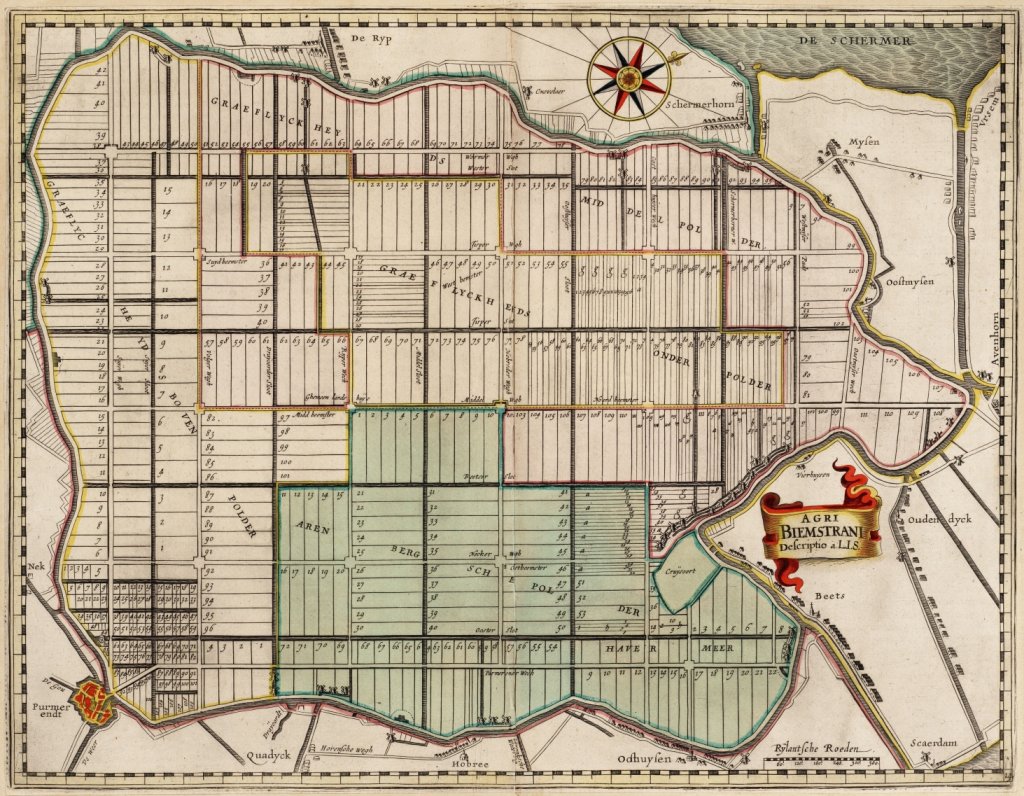
As early as January 1611, investors began to consider the layout of the new polder. As a first step, Amsterdam surveyor Lucas Jansz. At the end of March, the decision was made to divide the Beemster into large squares measuring 1,800 by 1,800 metre, with each road square divided into four smaller square blocks by ditches. Surveyor Sinck marked out five elongated plots in these blocks, each with an area of 20 acres (18 hectares).
In 1611, decisions were made not only about the layout of the new polder, but also about the villages. Space was reserved for five settlements at road intersections. The centrally located village of Middenbeemster marked the centre the polder. The lords of the polder administration immediately had a church built there. Elsewhere, people wanted to wait and see whether villages would actually 'grow'. At a series of other intersections, land was kept free for market squares. This entire planning process resulted in the very first architecturally designed landscape in Holland.
Practical, durable, and attractive
The Beemster's tightly organized and highly efficient design did not come out of nowhere. It was clearly inspired by the aesthetic principles of classical antiquity, which had been rediscovered during the Renaissance. During the sixteenth century, the legacy of the Roman architect Vitruvius († 20 BC) became widely known in the Low Countries. Central concepts in his theory were utilitas, firmitas, and venustas: utility, solidity, and beauty. These principles had to be harmoniously combined according to the universal laws of geometry and symmetry. The landscape architect, master builder, and painter Hans Vredeman de Vries († 1609) in particular popularized this body of thought in the Netherlands. However, the publication of translations of the works of the Italian architect Palladio († 1580) and his pupil Scamozzi († 1616) was also of great significance for the dissemination of Vitruvian principles among surveyors such as Lucas Jansz. Sinck and his clients.
The master plan for the Beemster, based on the ideal square, can be compared to a geometric Renaissance garden, but on the scale of a polder covering an area of 7,200 hectares. In 1999, this unique polder landscape gained international acknowledgement it was added to the UNESCO World Heritage List. In the report of the World Heritage Committee, the Beemster is praised as a masterpiece of creative planning based on the ideals of classical antiquity. Moreover, the innovative Beemster landscape had (and continues to have!) a profound and lasting influence on the design of later land reclamation projects in Europe and far beyond. The Hollands Noorderkwartier Water Board, together with the municipality of Purmerend, is the official 'site holder' of the Beemster polder World Heritage Site.
Unscathed
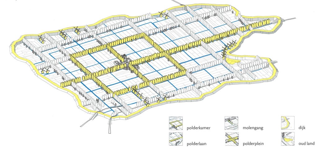
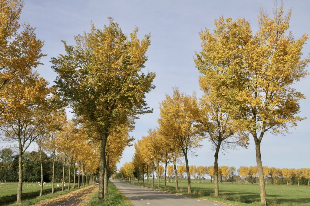
Of course, much has changed, but the expansions at Middenbeemster and Zuidoostbeemster, for example, have been carefully integrated based on the same principles that Lucas Sinck applied in the17th century. The same applies to the design of the new Cono Kaasmakers factory along the Rijperweg near the village of De Rijp, which was opened by Queen Máxima in 2014. Outside the built-up area, the original 'polder grid' is still immediately apparent from the rows of trees lining the roads.
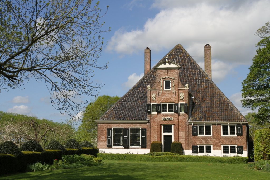
The many farmhouses with square floor plans and pyramid roofs fit perfectly into the landscape, which was designed with mathematical precision. Some had a dual function. They were both farms and summer residences for the landlords from the city. The latter had access to a few stately rooms at the front. The facades, inspired by luxurious canal houses, are a reminder of this. The De Eenhoorn farm at the intersection of Middenweg and Volgerweg is a textbook example of such a stately farmhouse. Finally, the church in Middenbeemster, built in 1618-1625 to a design by Hendrick de Keyser, remains the undisputed center of the polder in 2023, four centuries later.
Extra
The best starting points for visiting the Beemster are the Visit Beemster website and, physically, the Beemster Visitor Center.
Or watch the videoDroogmakerij de Beemster: 25 years on the UNESCO World Heritage List.
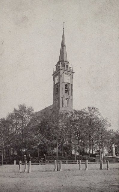
The large-scale architecture of the Beemster is best viewed from a high vantage point. A wonderful opportunity to do so is offered by climbing the church tower of Middenbeemster.
The Beemster is ideal for exploring by bicycle. Various routes have been mapped out through the polder and surrounding area, including:
- Bicycle route through Middenbeemster, Zuidoostbeemster, Westbeemster(Bicycle Network)
- Cycling route through Middenbeemster, Beets, Scharwoude (Cycling network)
- Cycling route through Oosthuizen, Middenbeemster, De Rijp(Cycling Network)
- Leeghwater cycle route (Netherlands Cycling Country)
All the polder mills in the Beemster have disappeared, but there are still a number of mills in the nearby Schermer (drained in 1635). The Leeghwater Route passes through both the Beemster and the Schermer and also visits De Rijp, the birthplace of the famous17th-century mill and polder expert Jan Adriaensz. Leeghwater. He was involved in the reclamation of the Beemster as a supervisor.
- Beemster Fortress Cycle Route(Dutch Water Lines)
The Beemster region is home to three forts belonging to the Defense Line of Amsterdam, with accompanying large floodgates. The Defense Line has been a World Heritage Site since 1996. This route takes in the forts of the Defense Line in and around the Beemster region.
The following museums focus on aspects of Beemster's history:
- Westerhem Agricultural Museum (Beemster Historical Society)
- Betje Wolff Museum (Beemster Historical Society)
- Fort Spijkerboor (Nature Conservation Society)