C. Mantel pumping station and the Schermerboezem
In 2017, the C. Mantel pumping station was commissioned, named after former water board chairman Cees Mantel. It drains the Schermerboezem, an extensive water system stretching from Den Helder to Zaanstad and from Alkmaar to the Markermeer. Dozens of polders depend on this drainage basin for the supply and removal of water.
Until the seventeenth century, the Schermerboezem consisted of large lakes, including the Beemster and the Schermeer. Excess polder water was discharged into these lakes. During the Golden Age, the lakes were drained. Land reclamation was accompanied by an impressive reduction in the size of the boezem. An enormous amount of space for water was lost.
The Schermerboezem thus changed from a large water storage area into a network of canals and ring ditches. Since then, all excess water has been retained and drained there. The capacity is limited. Water has to be released from time to time. For this purpose, sluices were used at the edge of the boezem.
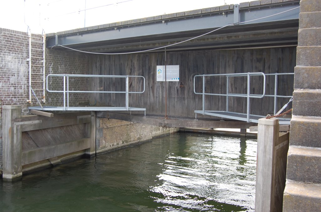
Three of these sluices are located just south of the Omringdijk in the village of Schardam. One is just around the corner from the dike. This sluice, the Hornsluis, was built in 1735 by the Beemster polder board. It drains a canal that connects to the Beemsterringvaart.

Two commemorative stones have been affixed to the lock wall of the Hornsluis. The one pictured here commemorates the laying of the foundation stone beneath the Beemster coat of arms: 'This new stone sluice was laid in accordance with the resolution (decision) of the gentlemen of the Beemster on October 16, 1734, under the direction of the gentlemen of the dike reeve and water board, and the first stones were laid by Jacob Alewyn & Jan Pet Olpherts on July 6, 1735.' Jacob Alewijn was the son of the dike reeve.
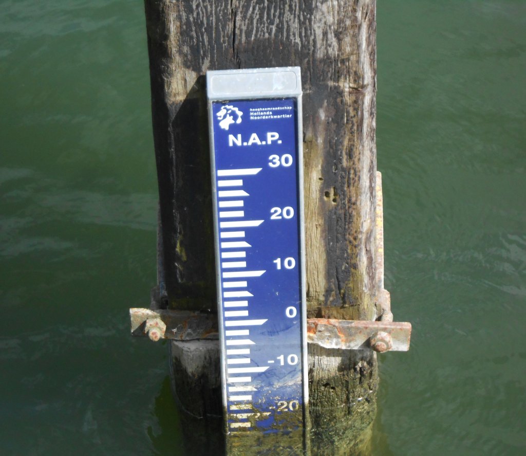
For a long time, the locks were the only way to maintain the water level in the Schermerboezem. It was not until the 1960s and 1970s that two pumping stations were put into operation: in Den Helder and Zaandam. For drainage on the Markermeer, people remained dependent on the locks. Of course, drainage via a lock is only possible if the inland water is higher than the outside water. When the Markermeer was still the Zuiderzee, drainage was easy at low tide. The closure of the sea in 1932 made drainage more difficult. The IJsselmeer and Markermeer have a fixed water level, which is often higher than that of the reservoir.
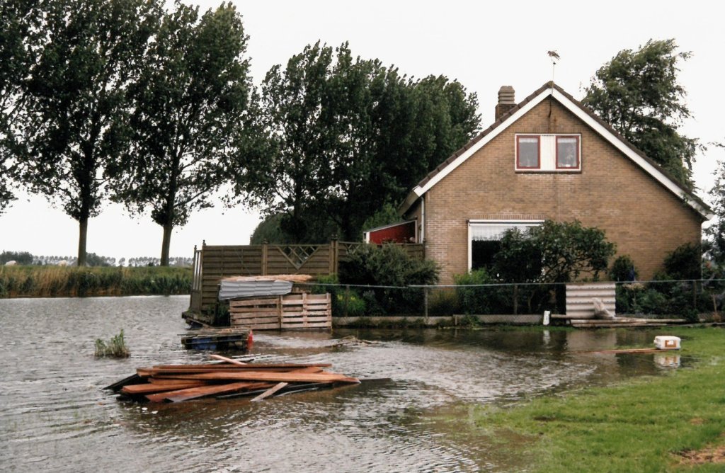
Due to the limited drainage options on the Markermeer, the water level in the reservoir often rose high—too high in September 1994. At that time, there was so much rain that the polders had to drain more water than the reservoir could handle. The water level in the ring ditches and canals rose to dangerous heights. Houses on the banks were flooded (photo) and in some places the water even overflowed the dike. A pumping ban had to be imposed, which meant that no polder pumping station was allowed to pump water into the drainage basin.
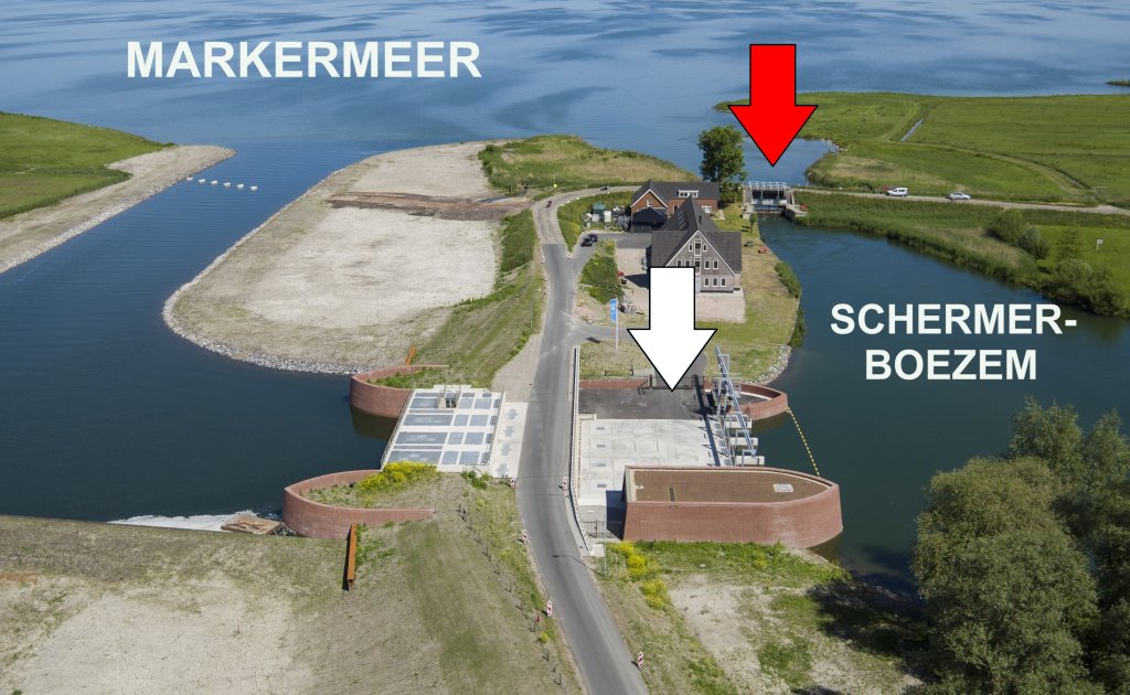
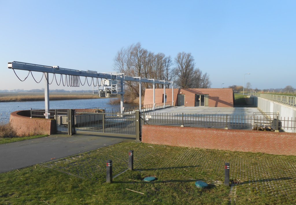
It was clear: to improve water level control, drainage on the Markermeer had to be improved. With the arrival of the C. Mantel pumping station (white arrow), the water board is no longer dependent on the old sluices. The four electrically powered pumps easily pump the water upwards. The pumping station can process no less than 2,000 cubic metre per minute. That is equivalent to the volume of five to six single-family homes. In this aerial photo, we can see the Hornsluis (red arrow) next to the pumping station.
The pumping station not only discharges water from the reservoir, but can also pump extra water from the Markermeer into the reservoir. This is no luxury, because dry springs and summers such as those in 2003 and 2018 will occur more frequently in the future.
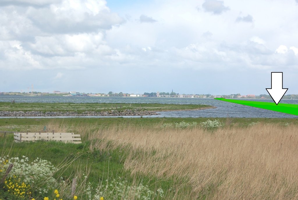
What is striking about this place is that the dike does not run from north to south, but from west to east. Also striking is the grassland outside the dike, through which the pumping station's supply and discharge canal runs. These are indications of the old route of the Omringdijk. Look towards Hoorn and imagine a dike running straight towards the city (see the arrow in the photo). This was the situation until 1375, when a storm surge damaged this dike to such an extent that a new one had to be built inland on the route of the current north-south dike.
C. Mantel pumping station
- Next: Walingsdijk
- Previous: Breakthrough at Scharwoude