Lely pumping station
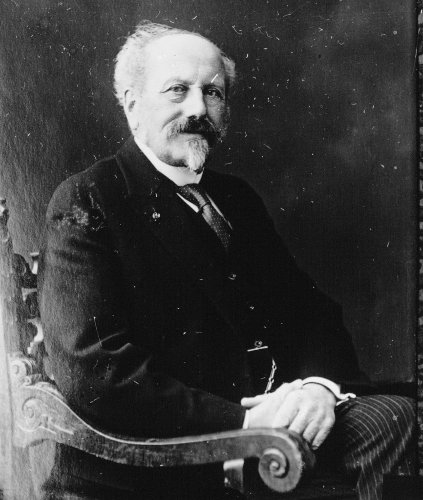
During the night of January 13-14, 1916, the Zuiderzee raged violently. Dikes broke in several provinces. The Westfriese Omringdijk held firm. In response to the disaster, the Zuiderzee Act was passed in 1918. It largely followed the ideas of civil engineer and Minister of Water Management Cornelis Lely (1854-1929, photo): the Zuiderzee was cut off by a sea dike between North Holland and Friesland, the Afsluitdijk. This created the IJsselmeer between North Holland, Friesland, Overijssel, and Utrecht.
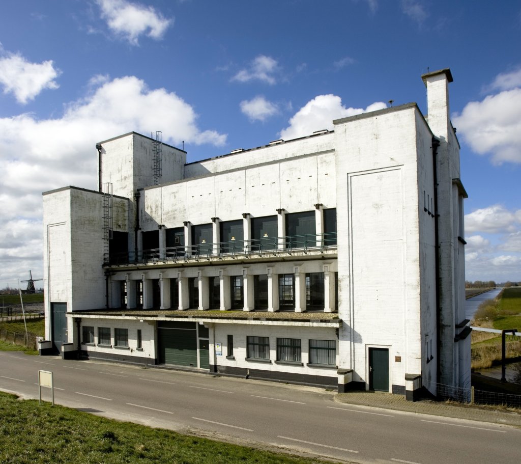
Lely had devised a number of polders that were to be established in the IJsselmeer. The Netherlands could really use new agricultural land. The Wieringermeer was the first large IJsselmeer polder (1927-1930). At the southeastern end of the polder, near Medemblik and the Omringdijk, we find the pumping station named after Lely.
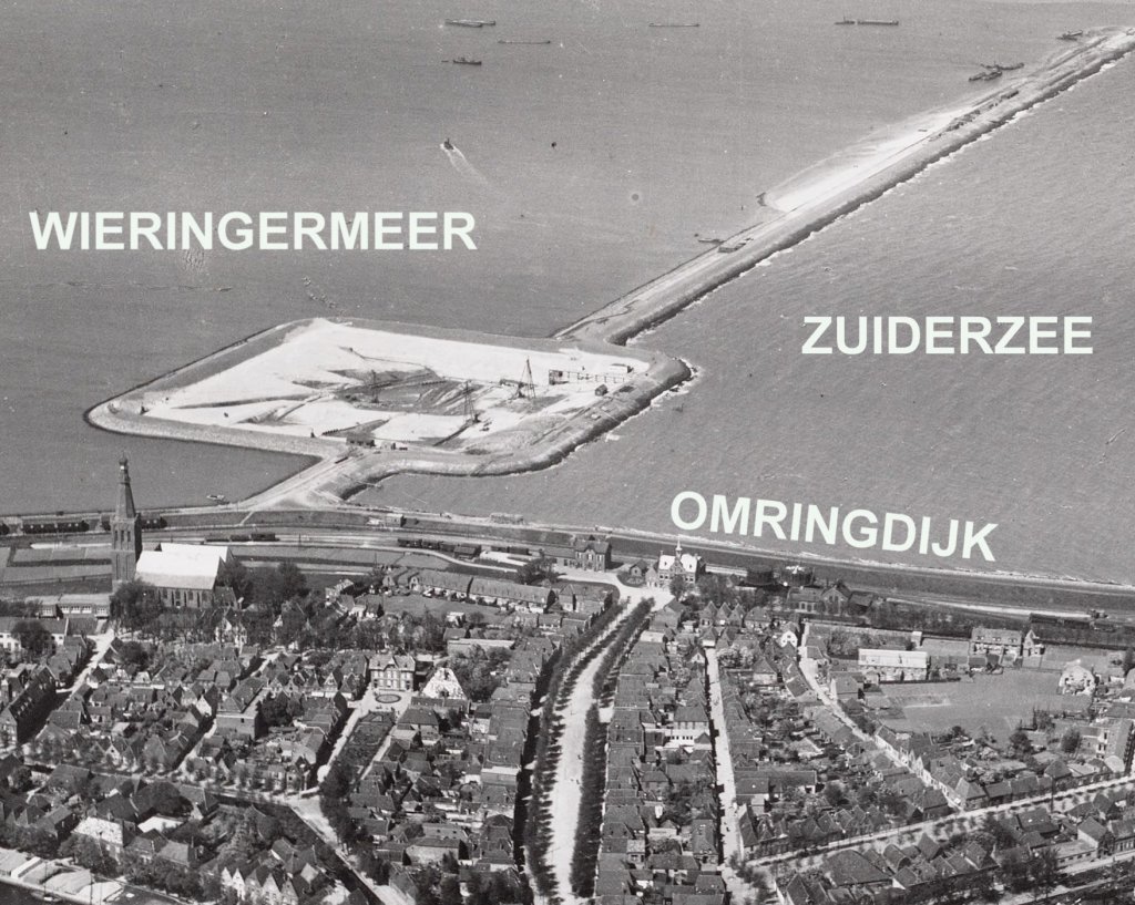
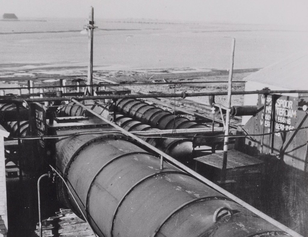
Two pumping stations were built to drain the Wieringermeer: Lely near Medemblik and Leemans near Den Oever. The photo shows the large construction pit that was dug in the still salty water especially for the construction of Lely. The pumping station was ready for use at the end of 1929. Cornelis Lely did not live to see this: he had died in January of that year.
The pumping station is definitely an eye-catcher. Architect Dirk Roosenburg designed a building in modernist style: businesslike white with straight lines and an emphasis on symmetry. The installation was also modern. Whereas many pumping stations still ran on steam or diesel, the pumps at Lely were powered by three powerful electric motors.
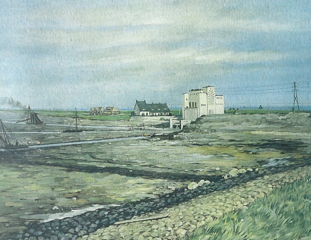
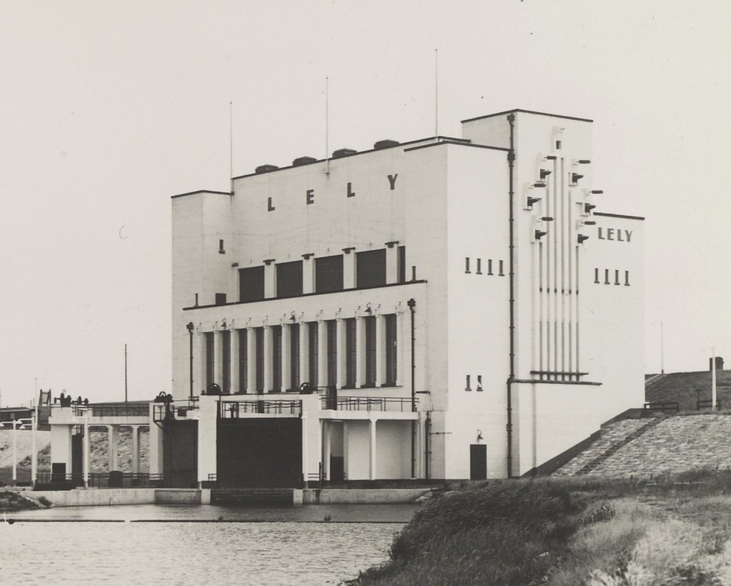
The Lely and Leemans pumping stations were officially commissioned in February 1930. Within six months, they had drained the entire Wieringermeer. This school poster shows the Lely pumping station in the newly drained polder. The engineers lived in the white houses next to the pumping station. The first child of the Wieringermeer was born there. On the right, we see a power pole. A new high-voltage cable was laid especially for the pumping station. Until the 1980s, the transformer room on the upper floor supplied both Lely and Medemblik with electricity.
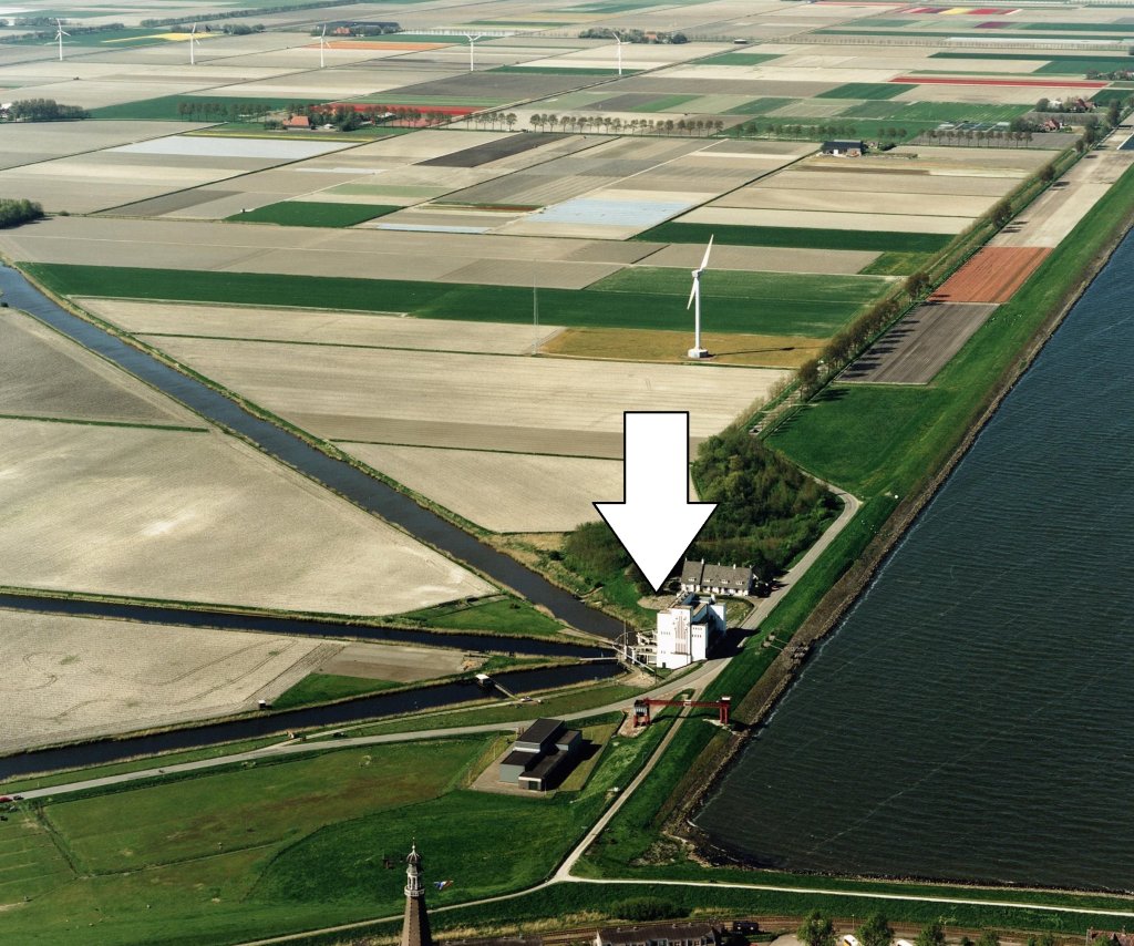
The Wieringermeer lies four to five metre sea level. By comparison, the water level in the IJsselmeer lies between 0.1 and 0.4 metre sea level. The water from the Wieringermeer flows through three canals to the pumping station (arrow in the photo). In the polder, these branch off into smaller waterways.
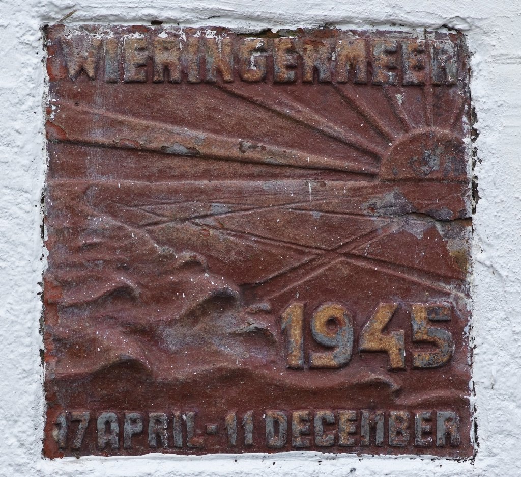
This commemorative plaque is embedded in the facade of the pumping station. On April 17, 1945, the Germans blew up the Wieringermeer dike. As far as is known, there were no casualties, but the damage was enormous. The disaster taught us that it was a good idea to place the electric motors and transformer room of the pumping station on the upper floors. They were spared.
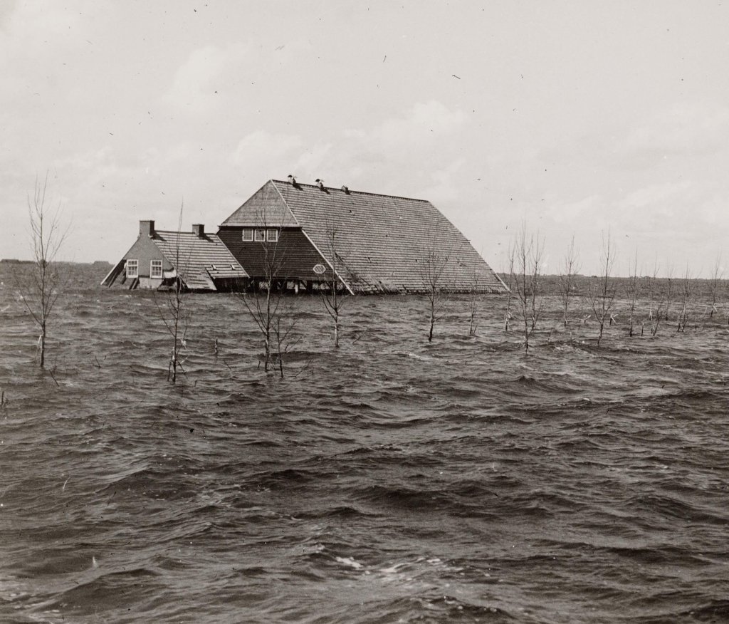
The flooding of the Wieringermeer was planned, and the Germans had deliberately kept the water level of the IJsselmeer high for a year. However, by April 1945, the war was virtually over. It is not entirely clear why the Germans went ahead with the plan anyway.
It was essential to remove the water from the flooded polder before winter. Because Lely and his sister-in-law Leemans near Den Oever did not have sufficient capacity to do this, auxiliary pumps were installed. Lely received help from four such pumps. By December 1945, the polder had been drained again. The following year, the harvest proceeded as usual, because the pumped-out water was fresh, which was a blessing in disguise.
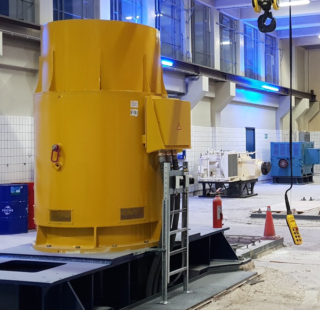
The Lely pumping station has recently been renovated. It now has larger motors and the pumps have been fitted with different impellers, allowing fish to swim safely through them. The photo shows a new motor, much larger than the old white one in the background.