Kolk van Dussen
In 2008, the ecological and hydrological consultancy firm Ten Haaf & Bakker was commissioned by the water board to convert the old Kolk van Dussen polder into a water storage facility. In times of flooding, the water board can choose to divert large amounts of water here and flood the land in a controlled manner. The capacity of the Kolk van Dussen is 60,000 cubic metre.
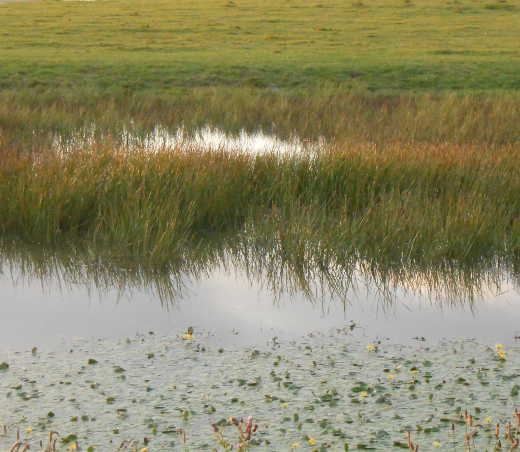
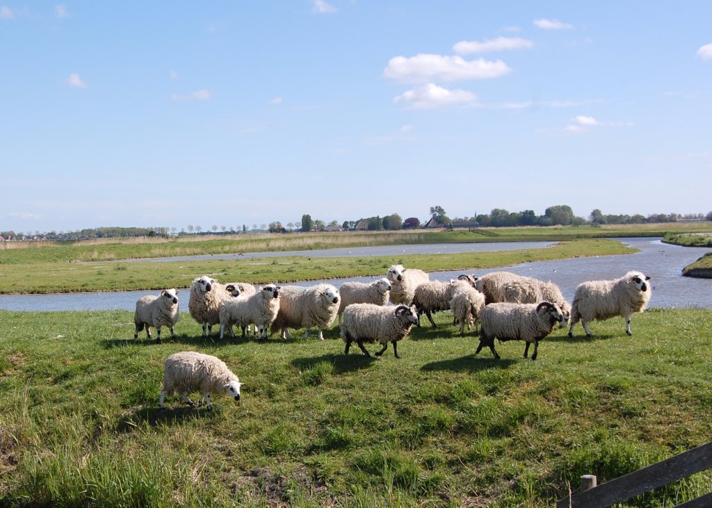
The land has been metre by half a metre to prevent flooding. Channels and wet grasslands alternate. The aim of this design was to recreate the appearance of the West Frisian coastal region in the period before the Omringdijk was built. The water was also intended to give nature a boost, and this has been successful. All kinds of birds, such as the avocet and little ringed plover, have found their way to the whirlpool and breed in the shallow water.
The former Kolk van Dussen polder was founded by Eduard Jacot van Axele, Lord of Dussen (1585-1656), and dates back to 1641. Until that year, the area was, as it is now, a water storage area, rich in reeds. It was used for storage when the sea sluices in the Omringdijk could not be drained. The then water board, the Vier Noorder Koggen, was therefore not very enthusiastic about Van Dussen's plan. However, he was not the least important person: he sat on various polder boards and had been involved in the reclamation of the Schermer (1633-1635).
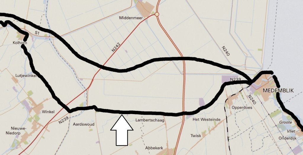
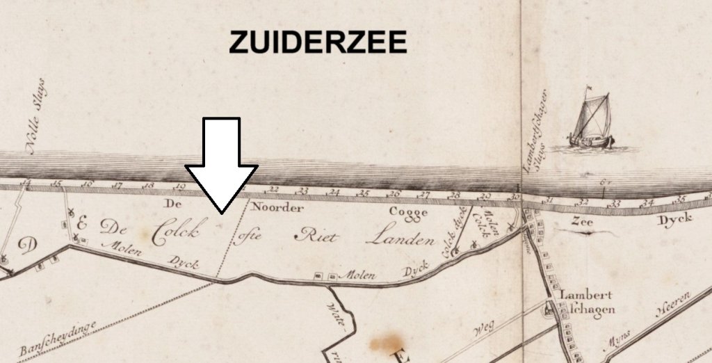
The water storage area that Van Dussen put an end to was probably created by work on the Omringdijk. This originally lay a few kilometre the north in what is now Wieringermeer. In 1334, this dike was so badly damaged by storm surges that a new one was built inland on the current route. At that time, the rule was that the soil for a new dike was preferably taken from the area where it was to be built. This may have created a reed-filled pool that could be used for water storage (arrow on the map). The upper black line shows the route until 1334, the lower line shows the route that has remained intact since then.
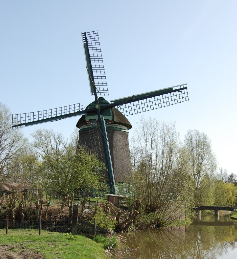
To the west of the Kolk van Dussen, near Aartswoud, a windmill is hidden among the greenery. Until 1907, it and a few others pumped water up to a lock in the Omringdijk.
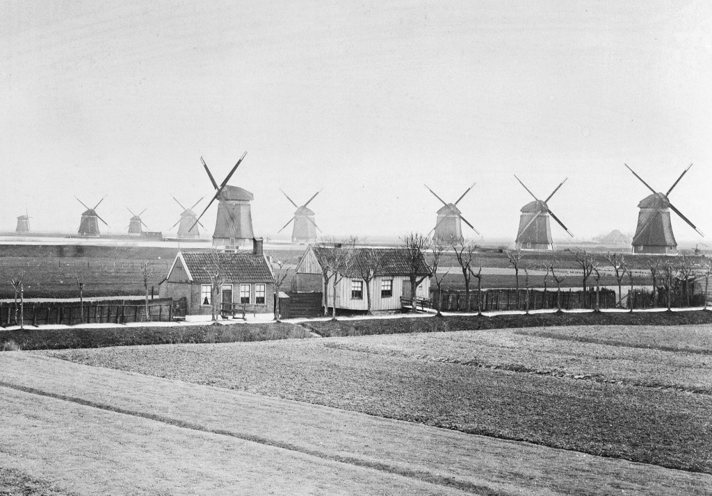
The mill at Aartswoud was one of 24 used by the Vier Noorder Koggen water board to pump water from its polders into the sea. They were arranged in 'teams' along the Omringdijk. There were no fewer than fifteen of them at Medemblik.
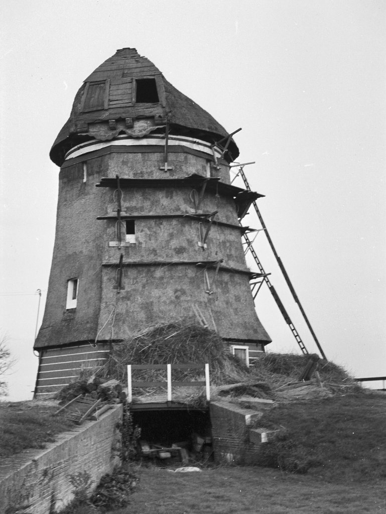
Since 1868, the water board had a steam pumping station near Medemblik. The windmills remained in operation, which was no surprise. A miller and his mill cost less than the coal for a full-time steam engine. In 1907, the pumping station was reinforced. The water board said goodbye to the mills. All 24 were demolished except for the one at Aartswoud, which was dismantled and converted into a residence. Thanks to restoration work, it can now run and grind again.