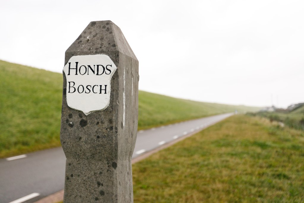
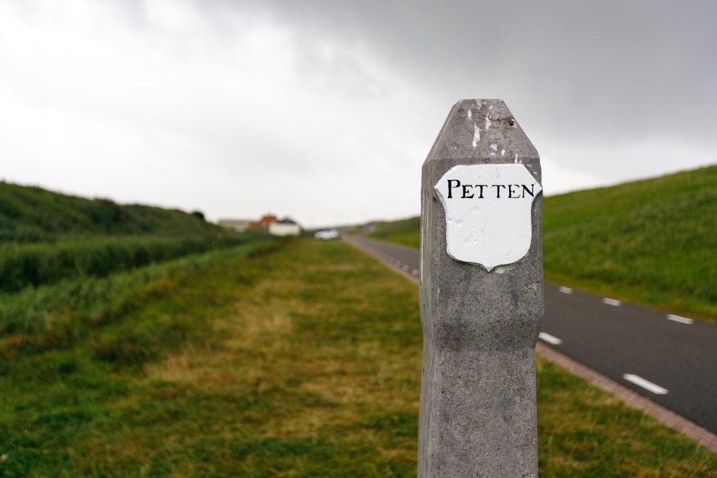
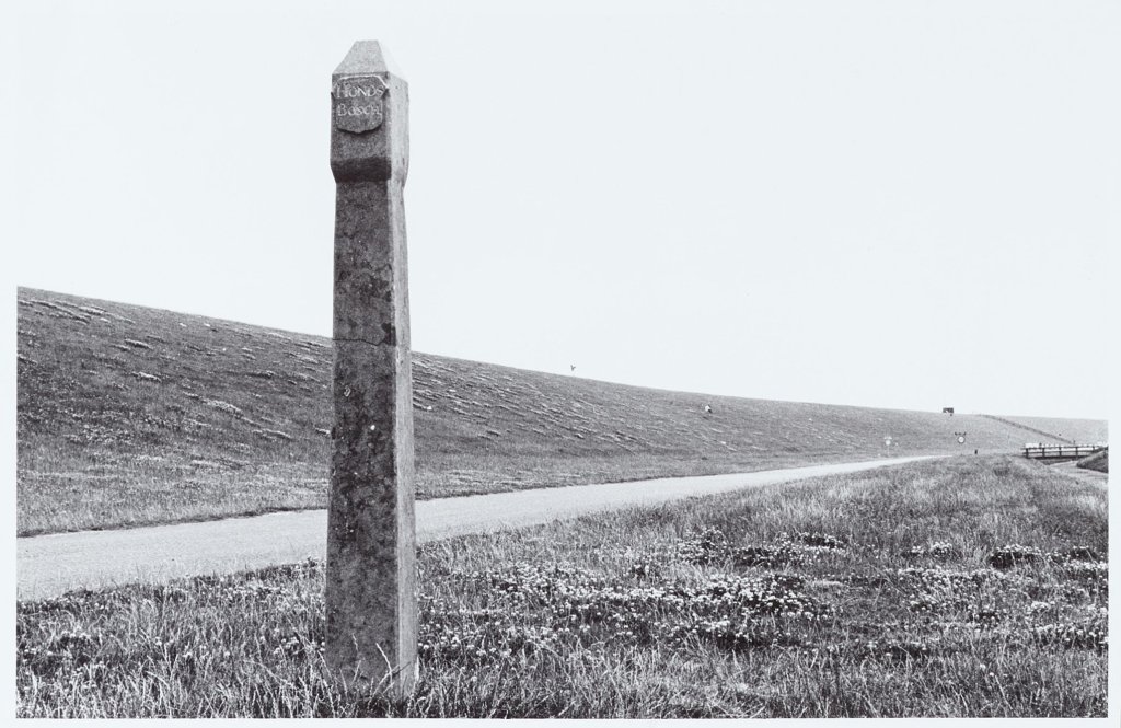
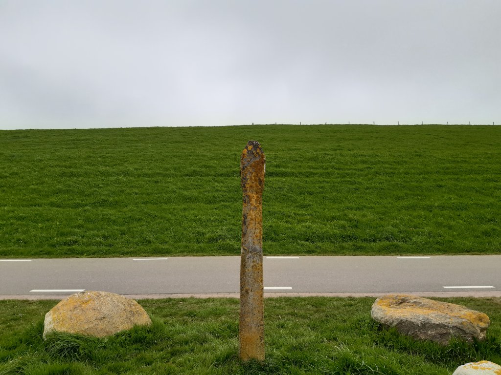
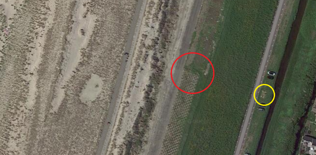
Boundary marker on Spreeuwendijk near Petten
Along the Spreeuwendijk in Petten (near Vliewint 35), there is a bluestone boundary marker in a long green strip. This boundary marker was probably placed around 1800 and marks the boundary between the Hondsbossche and Pettemer Zeewering. The post is a provincial monument and is surrounded in the grass by four large boulders, which were used in the past to reinforce the sea defences.

From dunes to dykes
In the Middle Ages, the coast at Petten consisted of a narrow and vulnerable strip of dunes. This was exposed to constant erosion by coastal currents. During the Saint Elizabeth's flood of 1421, the sea broke through the row of dunes at Petten. The village was washed away and was subsequently rebuilt further inland. At the beginning ofthe 16th century, a series of groynes were constructed at Petten, breakwaters built across the coast from piles and boulders. In this way, it was hoped that further sand loss could be prevented. This is how the Hondsbossche Zeewering took shape.
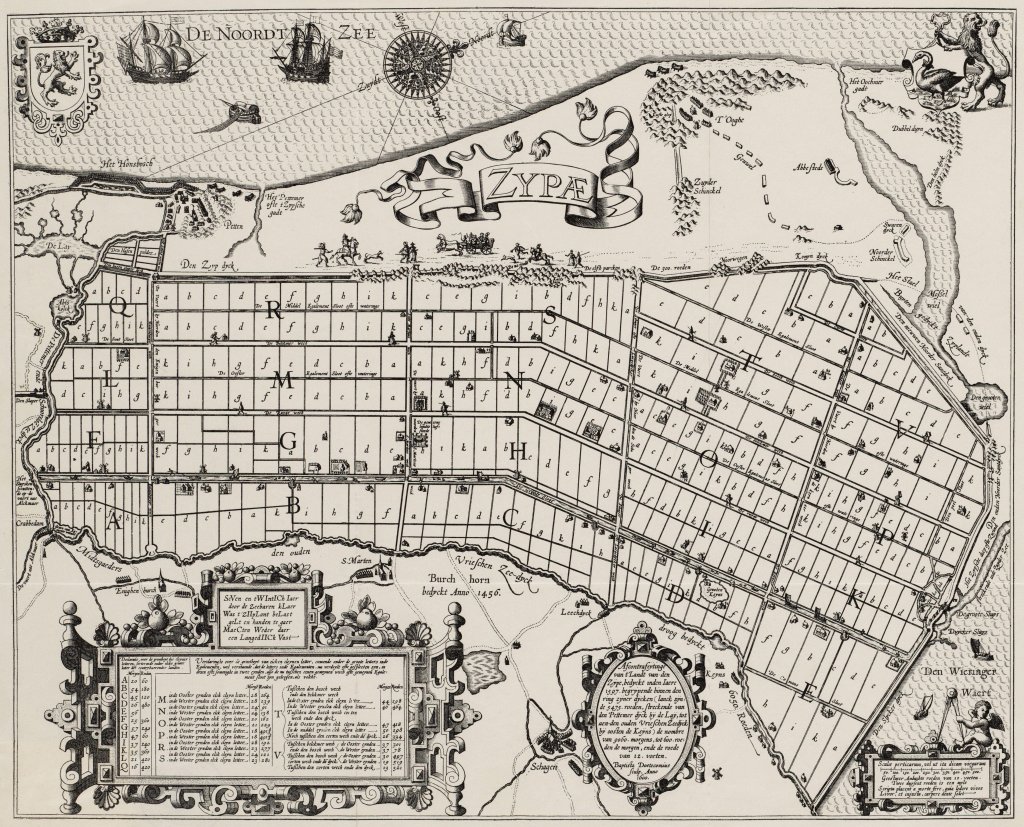
In 1555, Charles V established a new water board, the Hoogheemraadschap van de Hondsbossche en Duinen tot Petten, to manage the sea defenses. However, the beach heads were wiped off the map during a storm surge in 1570. Eventually, at the beginning ofthe 17th century, people returned to a sand dike planted with marram grass and a wide beach where the waves could run out. After a series of severe storms around 1790, the beach had narrowed considerably and the sand dike was in poor condition. After the necessary research and much discussion, the Hondsbossche Water Board therefore began constructing a new series of groynes in 1795 to protect the sea defences against ongoing coastal erosion.
Poor Petten
The village of Petten was responsible for its own sea defenses. Although these connected to the Hondsbossche, the water board was absolutely unwilling to take on Petten's coastal defenses because of the costs involved. However, the poor fishing village was unable to maintain its coastal defenses and the region had to come to its aid on several occasions. This support could not prevent Petten from disappearing into the sea again in the last quarter of the17th century. In 1701, a new church was built inland in the middle of nowhere. The entire village moved to this church, and thus the current Petten was established.
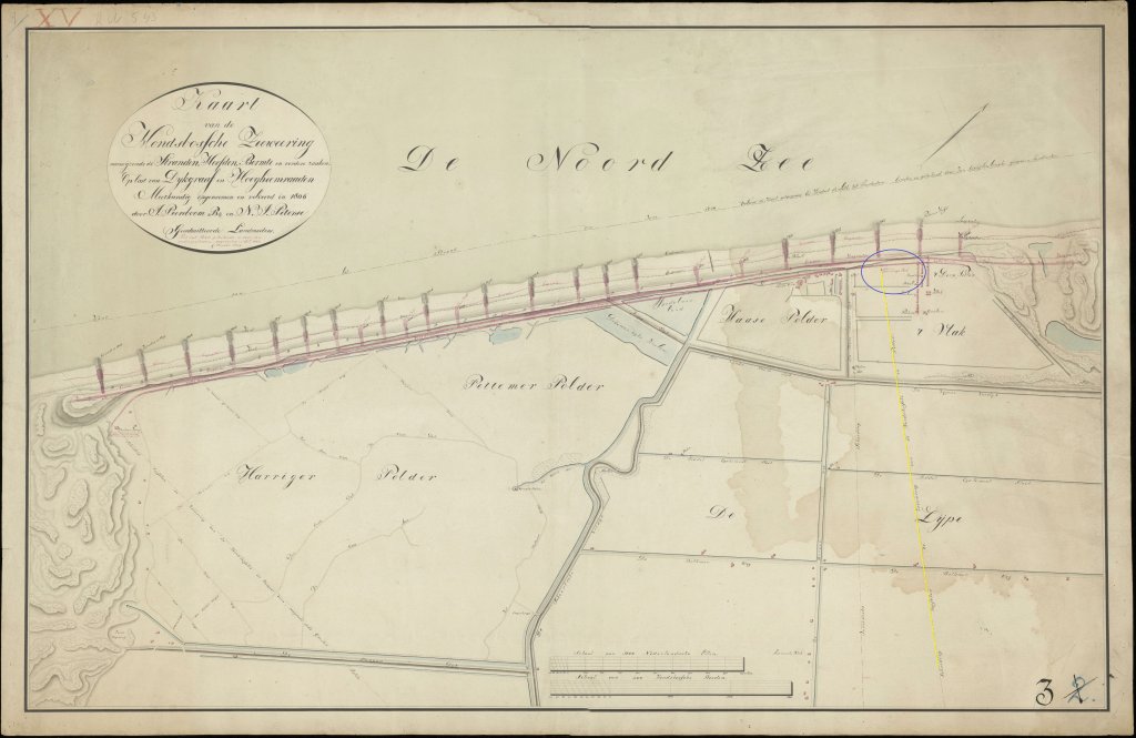
The boundary post
In 1798, the Empire took over the Pettemer Zeewering. This was probably when the pole was erected. We see it for the first time with a boundary line on a map from 1806. The pole is shaped like a square obelisk that widens slightly at the top and features two white coats of arms. The coat of arms on the south side is inscribed with the words 'Honds Bosch' in black letters, and 'Petten' on the north side. Due to mould on the north side, the text is less legible. The post will be refurbished in the autumn of 2023. The boundary post is unique because it marks the boundary between the sea defences and because of its unusual shape.
Water board with the longest staying power
The national government and the Hondsbossche Water Board did not agree on dyke improvements. This resulted in differences between the two dykes. In 1921, the aforementioned water board merged into the new North Holland North Quarter Water Board. When both dikes were raised to Delta height around 1970, Noordhollands Noorderkwartier and Rijkswaterstaat each pursued their own plans, as they had always done. This resulted in a slightly higher and steeper Pettemer Zeewering. It was not until 1990 that both sea defences came under the control of the water board. This transfer was part of a policy initiated in 1978 to place coastal management under the control of sufficiently powerful water boards. In fact, it was only then that the boundary marker really became obsolete.
New dike improvement
In 2004, it became clear that the Hondsbossche and Pettemer Zeewering no longer met safety requirements. They were one of the weakest links in the Dutch coastline. In 2015, the current dike manager, Hoogheemraadschap Hollands Noorderkwartier, decided to combine safety with new opportunities for recreation and tourism. Boskalis Nederland reinforced the coast with 35 million cubic metre that was sucked up from the sea off the coast of the Hondsbossche and Pettemer Zeewering. This created a new beach and new dunes. This led to the renaming of the sea defences packed in sand to the Hondsbossche Duinen.

Extra
Hiking
- Various walking routes from the North Holland Walking Network, starting point Petten
Cycling
- A historical tour of Petten (Historical Society De Zijpe)
- Cycling through the Schoorlse Duinen (route.nl)
- Tour of Petten and Schagen (route.nl)