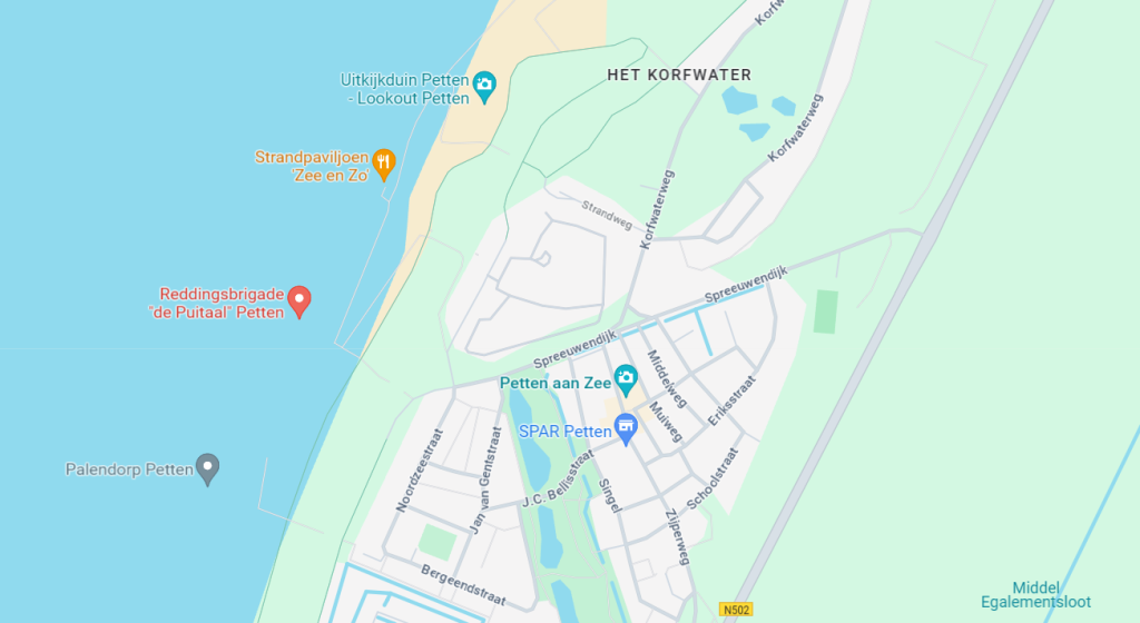
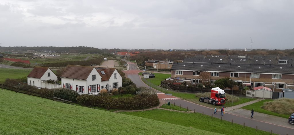
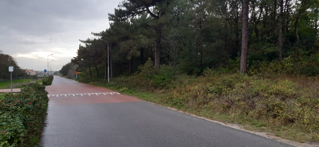
Spreeuwendijk near Petten
Anyone driving along the Spreeuwendijk on the north side of Petten would not say that it was an important sea defense for the village. The dike had to withstand the force of the North Sea. Now it lies in the middle of the landscape with houses on the south side and dunes on the north side. Only the street sign reminds us of its former function.
Pauwendijk
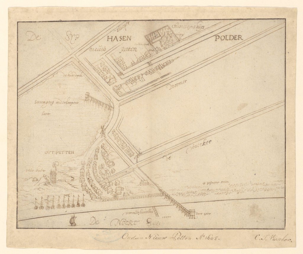
In the 17th century, the North Sea continuously eroded sand from the beach and dunes at Petten. Due to this coastal erosion, the village slowly but surely washed away into the sea. Directly behind the village, on the landward side, an open water area called the Crabbe or Corfwater was created. During storms, seawater washed over the beach and filled this basin. In the mid-17th century, it was decided to reclaim the Krabbewater. This could be done simply by constructing a transverse dike from the dunes at Petten (near the lighthouse) to the Zijperpolder. In 1668, a small dike was built by Count Leonard van der Nath, Lord of Petten. However, the dike failed in the same year. The breach posed a threat to the Zijpe dike due to the scouring action of the water. The chief landowners of Zijpe contacted Van der Nath's son, Johan van der Nath, to repair the dike. Surveyor J. Heijmenbergh was asked to measure the dike. The surveyor named the small dike Pauwendijk. In 1676, a new dike was constructed, but this attempt also failed and the dike was lost.
Alkmaar salt makers
In 1691, Gerrit Schatter, a tax collector from Haarlem, made a new attempt to reclaim the Krabbewater. In that year, Schatter purchased the manor of Petten from the Van der Nath family for 11,400 guilders. This meant, among other things, that he had rights to hunting, fishing, and appointment rights in Petten and could call himself 'lord of Petten and Nolmerban'. This new dike also failed to hold. Schatter wanted to expand his manor, so on May 5, 1692, he commissioned the repair of his destroyed dike. This met with fierce resistance from the salt makers of Alkmaar. They wanted to keep the pump house in the Krabbewater, which had been installed in 1624. This pump was used to pump salt seawater through a gutter into special barges and transport it to Alkmaar. There, the water was used for salt refining. However, Schatter ignored this and had the pump house boarded up with a plank in front of the door. This led to a lawsuit before the Supreme Court, which Schatter ultimately lost in 1693. He ran into financial difficulties and his manor was sold to Gerard van Egmond van de Nijenburg.
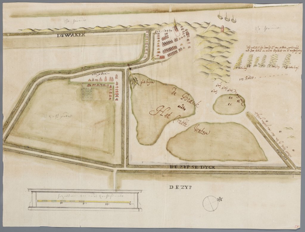
In 1698, Gerard van Egmond resumed his plan to reclaim the Krabbenwater. To prevent the salt makers from resisting again, he moved the old pump house to the beach in front of the Zeewering. This allowed the salt makers to draw water directly from the North Sea. The reclaimed land became known as the Pettemervlak. The new dike was named Spreeuwendijk.
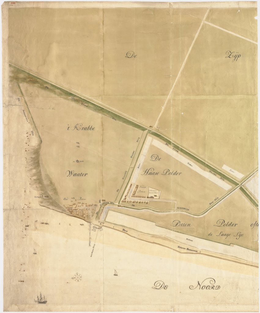
Due to the formation of dunes in front of the Spreeuwendijk, the sea was no longer a threat in 1774 and the small dike lost its function. As mentioned, only the name of the road now reminds us of the function of the small dike.
Name of the dike
The name Spreeuwendijk does not, as one might assume, derive from the bird species. Instead, the name originates from a resident of Oudesluis named Cornelis A(d)ri(aen)sz. (also Aerjensz.) Spreeuw.
In 1688, he submitted a request to be allowed to catch birds with a net on the outer dike grasslands (overgrown outer dike lands that are only flooded during spring tides). In addition, in 1691, he was also supervisor of the dike works, which he co-led. Mr. Gerrit Schatter was apparently very satisfied with Spreeuw's supervision so the dike was named after him.
Extra
Hiking
- Green route from starting point Petten (North Holland Walking Network)
- Blue route from starting point Petten(North Holland Walking Network)
- Starting point Petten(North Holland Walking Network)
- Walking through the Pettemerduinen (route.nl)
Cycling
- A historical tour of Petten (Historical Society De Zijpe)
- Beautiful coastal route near Petten aan Zee (route.nl)