Huigendijk
The Huigendijk runs from Alkmaar to Rustenburg. Today, it is called Slingerdijk and Noordschermerdijk. It is difficult to imagine, but four hundred years ago, the old dike lay between two lakes: the Heerhugowaard and the Schermeer.

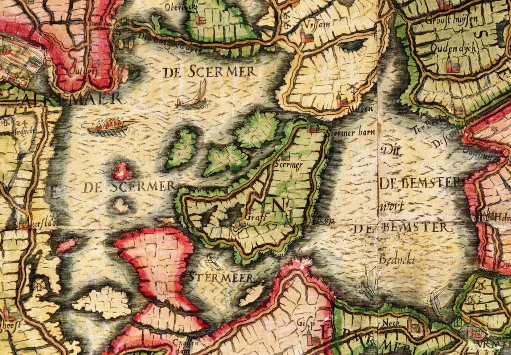
In 1248, the Omringdijk in the far north near Schagen broke through. A lake district formed from north to south, reaching as far as the Huigendijk. At the time, this was low and vulnerable. To the south, the Schermeer had already formed. The dike (black line on the map) was then still protected on both sides by wide strips of land outside the dike (green), but over time these were eroded or washed away by the waves.
Lakes such as the Beemster and the Schermeer were formed between 1000 and 1200 from peat rivers. Because farmers dug ditches to drain the peat soil, the land sank by one centimeter per year. The rivers received more and more water. Due to breaches in the Zuiderzee, they eventually overflowed on a massive scale. Large areas of land were flooded, submerged by meters of water.
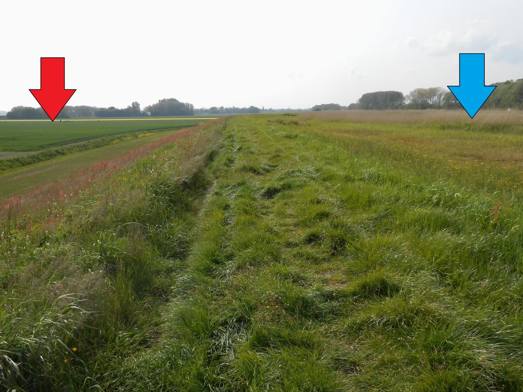
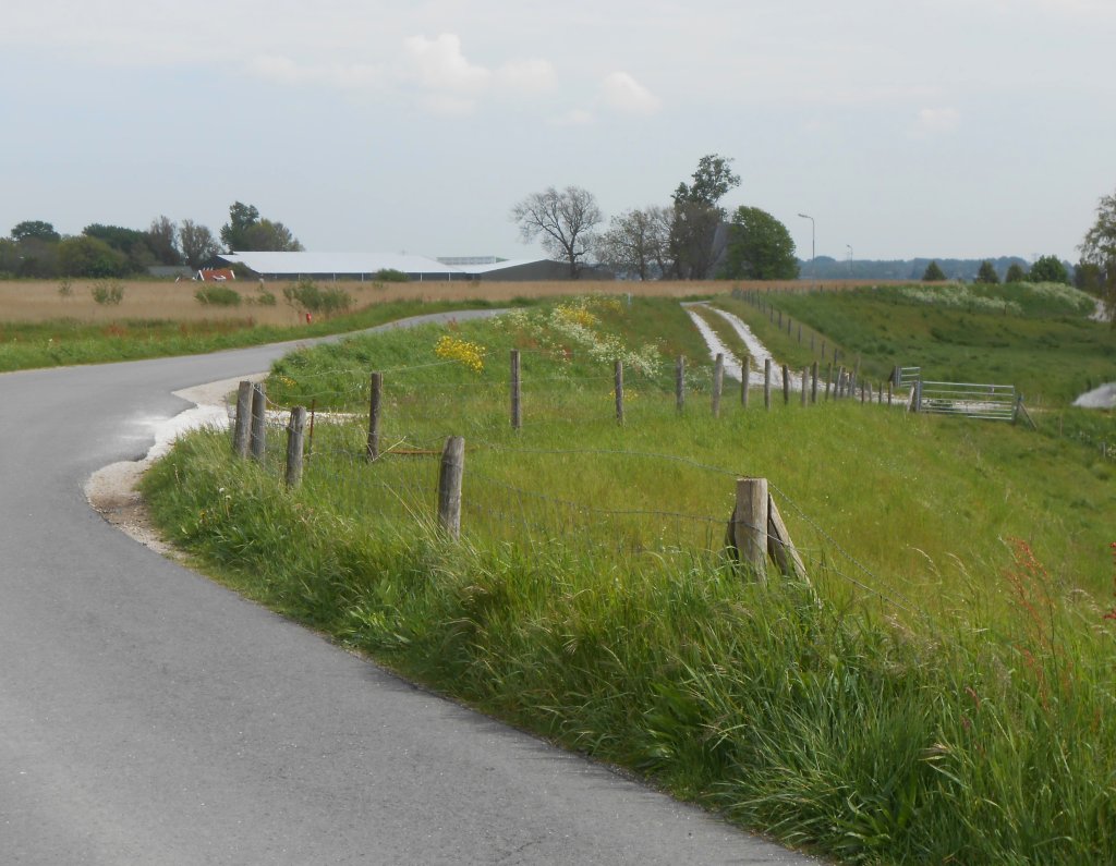
From the Oterleek windmill, the Huigendijk is kilometre accessible on foot for a distance of one and a half kilometre . Four hundred years ago, there was nothing but water on either side. Imagine the Schermeer on the left (red arrow) and the Heerhugowaard lake on the right (blue arrow). By 1600, virtually nothing remained of the land outside the dike. Only the dike prevented the lakes from merging.
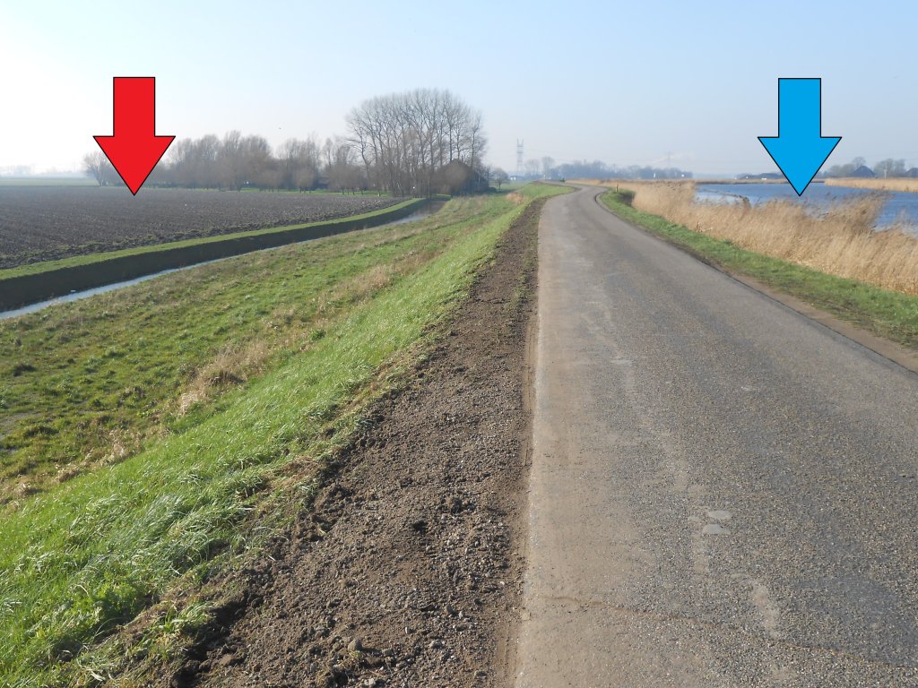
De Schermer and Heerhugowaard were diked and drained between 1629 and 1635. A ring canal was dug between the two (blue arrow). From that moment on, it served to drain the water, which until then had been discharged into the lakes via sluices in the Huigendijk. The Huigendijk was incorporated into the ring dike of the Schermer (red arrow). It made a considerable difference in costs that this section of the Omringdijk was ready to protect the new polder from the water from the ring canal.
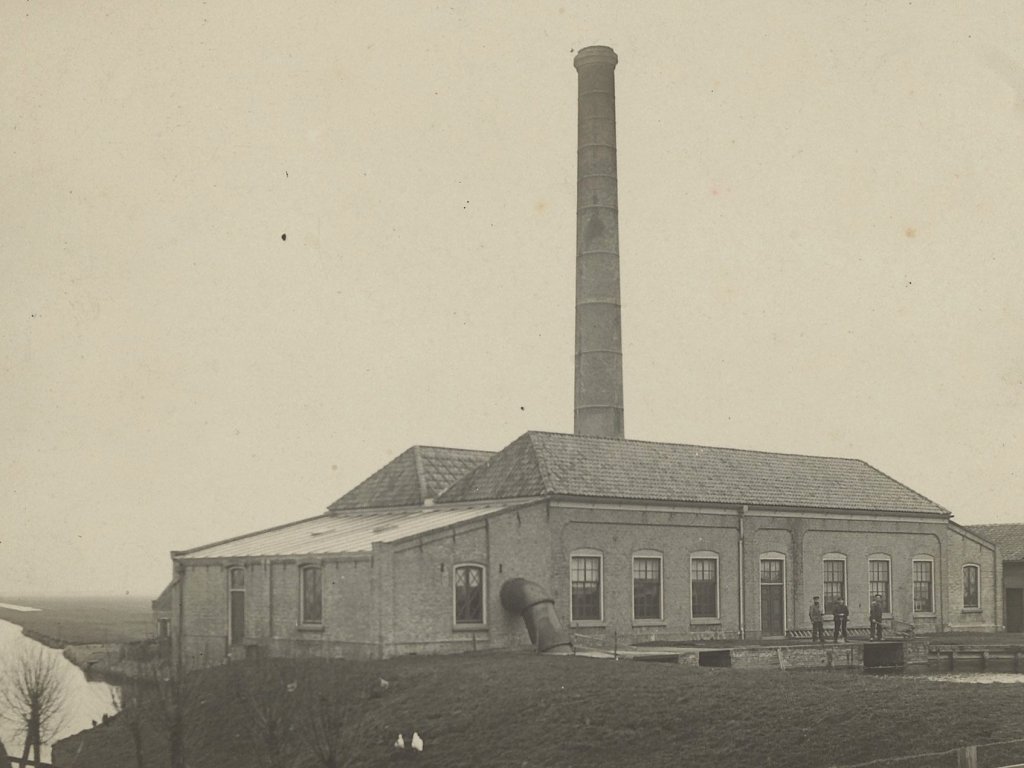
Across the way, we see the former steam pumping station of Heerhugowaard, dating from 1877. The reason for its construction was the wet winter of 1874. There was so little wind at the time that the many windmills were unable to pump away the water. Heerhugowaard was faced with flooding. The farming community pointed the finger at the polder board: never again, it's time for steam! A pumping station was built, but not all the windmills were demolished. It was only after technical innovations to the pumping station in the years 1899-1907 that the remaining windmills were abandoned.
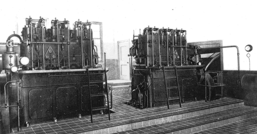
The pumping station was in operation from 1877 to 1994, initially powered by steam, then diesel, and later electricity. The diesel engines pictured here were replaced by electric motors during the war due to strict rationing of diesel fuel. In 1994, a new, automatically operated pumping station took over. It stands next to the old building, which now houses the Polder Museum and cafeteria.