Hoorn Canal
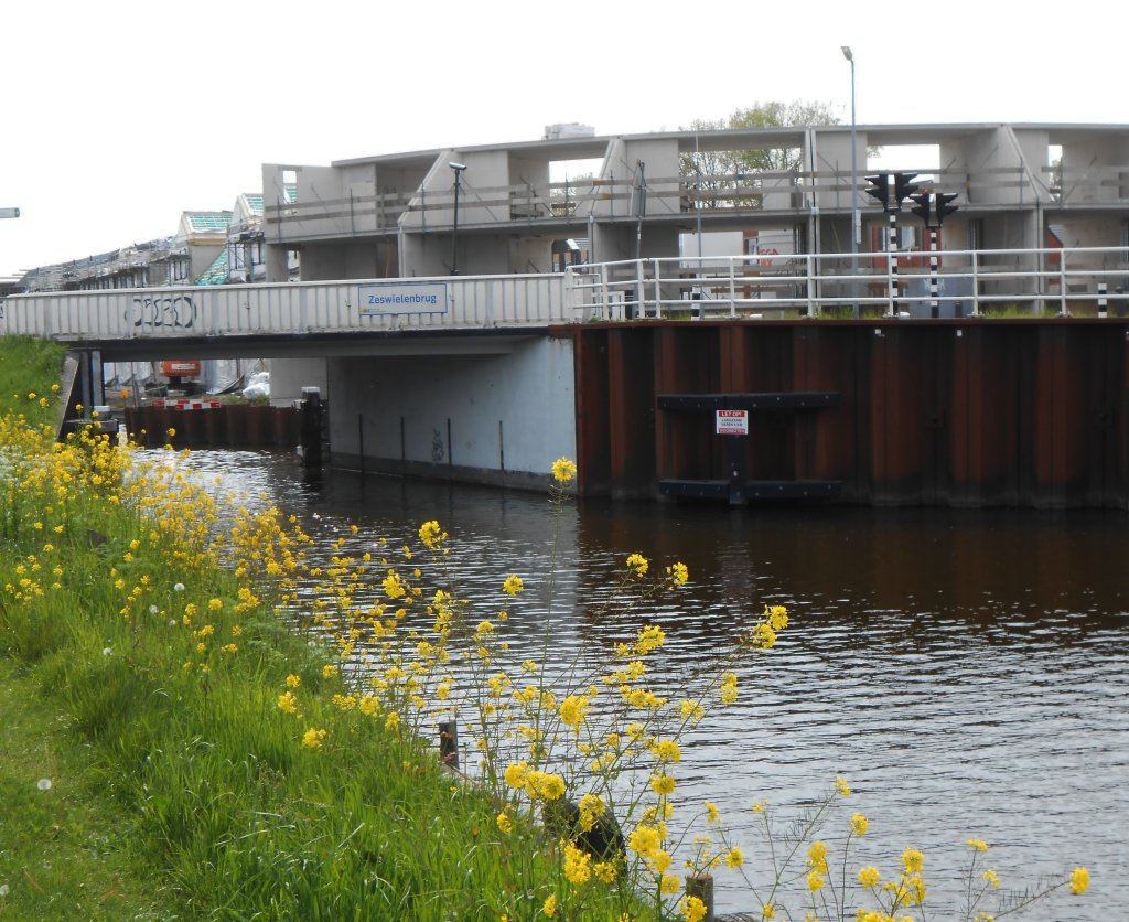
We are standing at the water's edge of the Hoornse Vaart canal. Where the bridge now stands, on the route of the Omringdijk, there used to be a lock. This was because there was a difference in water levels.
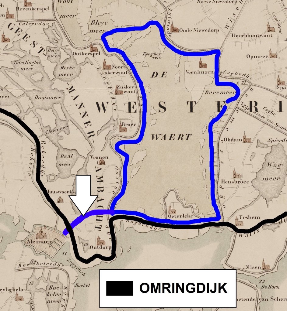
The Hoornse Vaart (arrow on the map) was dug as a result of the reclamation of Lake Heerhugowaard (1629-1631). This was an important drainage point until it was drained during the Golden Age, along with other lakes. From then on, water from the polders was drained via the ring ditch that ran around the drained Heerhugowaard (dark blue).
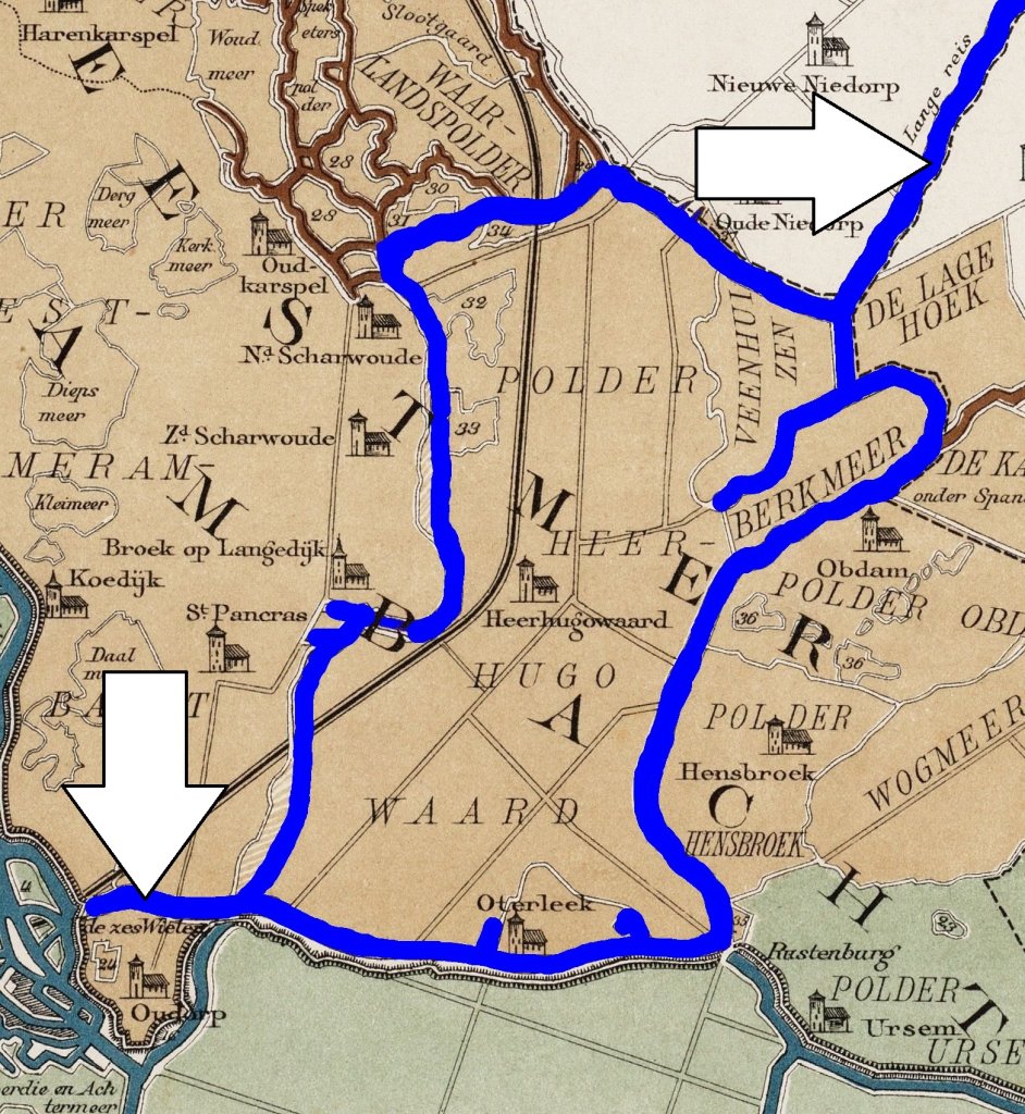
From a large lake to a ring canal: a drastic reduction in drainage capacity. This had to be compensated for with water outlets for the ring canal. In the north, this was achieved by the Langereis canal (arrow top right), and here in the south by the Hoornse Vaart canal (arrow bottom left), among others. The Langereis ran to the Zuiderzee, while the Hoornse Vaart runs to the Noordhollandsch Kanaal (until 1824 still known as the Hondsbossche Vaart), which is part of the Schermerboezem water system.
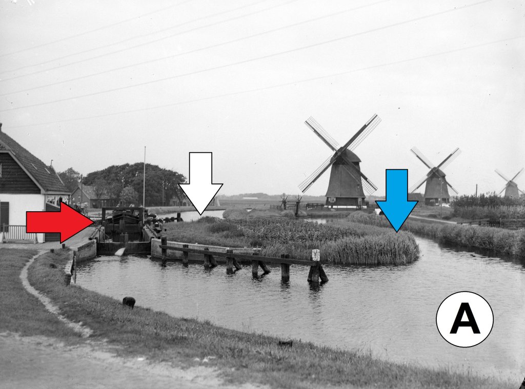
The water could not flow directly into the Noordhollandsch Kanaal, because the Schermerboezem had a higher water level. Hence the lock halfway along the Hoornse Vaart (red arrow in the photo). The water therefore had to be drained via a detour, and to this end, six windmills were built in the Heerhugowaard polder between 1627 and 1630. Four of them are still standing today. They pumped water from the canal (white arrow) into a whirlpool (blue arrow). From there, the water could flow into the Schermerboezem on the other side of the lock (A). You are standing at the location of the blue arrow.
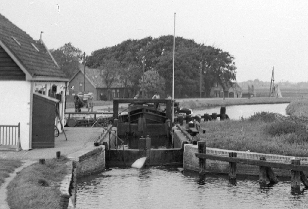
Ships became larger and heavier, but the lock did not grow with them. In the 1930s, part of the Heerhugowaard ring canal was incorporated into a new canal. The canal connected to the North Holland Canal via the Hoornse Vaart. The difference in water levels was eliminated. This was possible because both the ring canal and the canal had been widened. The elimination meant that the lock, the mills, and the sluice had become redundant. The lock was removed and the sluice was filled in.
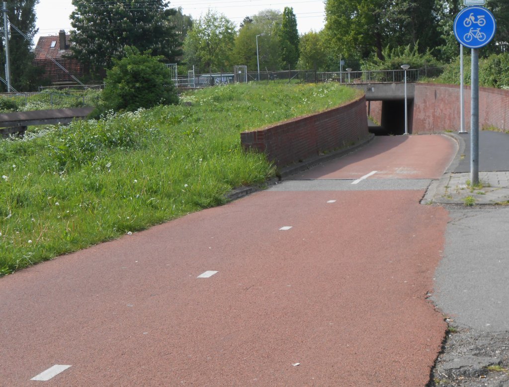
The Omringdijk runs across the bridge. To the north, it continues under the name Rekerdijk. Nowadays, this is nothing more than a cycle path through the residential area of Huiswaard (photo), but between approximately 1200 and 1550, it protected the area from the river Rekere. The river has long since disappeared, but its course outside Alkmaar corresponds closely to that of the Noordhollandsch Kanaal.
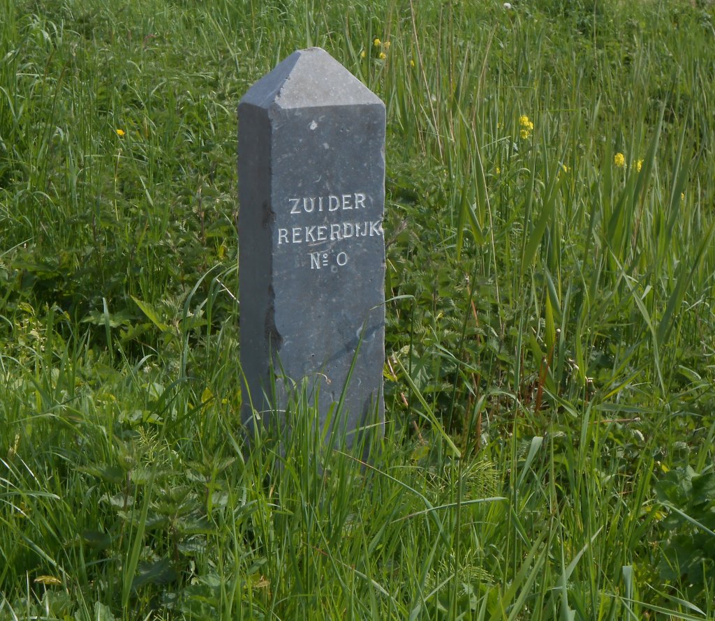
At the start of the Rekerdijk, there is a bluestone dike post from 1871 standing in the grass. Such posts marked the sections into which a water board divided the dike. Due to the former river, the old town of Alkmaar lies outside the Omringdijk – not that it was necessary to include Alkmaar within the dike. The city is located on the remains of a prehistoric beach ridge.