Drainage of the Niedorperkogge
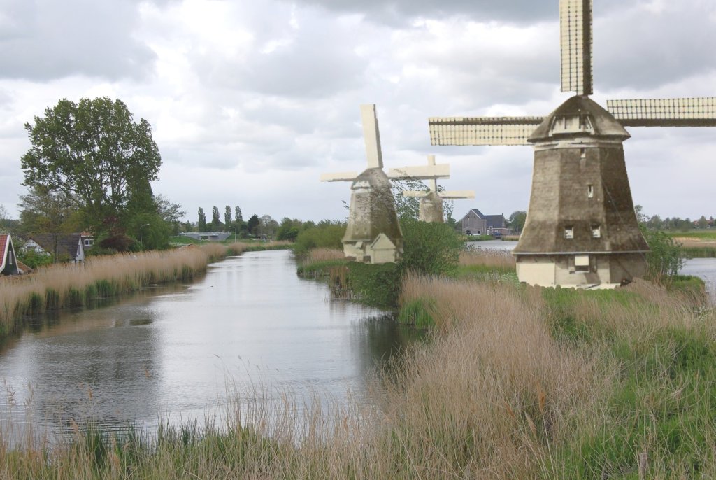
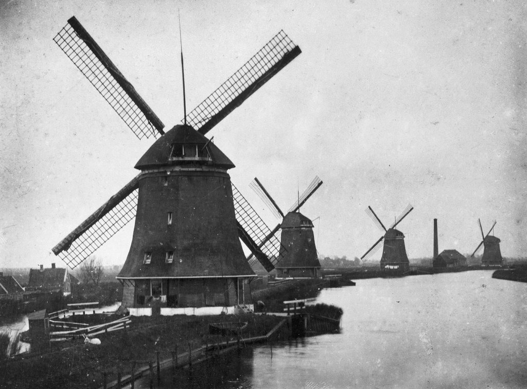
Between 1654 and 1911, there were five mills here belonging to the former Niedorperkogge water board. The main water system (the reservoir) of this water board consisted of a number of large ditches. These were used to drain water from the polders. It is important to monitor the water level in these ditches. Water has to be drained from time to time. The water board used these mills for this purpose.
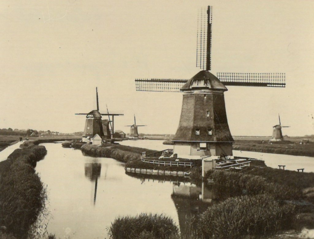
Windmills that pump water from the reservoir are called pumping mills. One of the main sluices led to the left-hand lake, the lower basin. The pumping mills 'pumped' the water up into the right-hand lake, the upper basin. This had a higher water level. From there, the water was discharged into the sea via a sluice in the Omringdijk. Yes, you read that correctly: into the sea. On the other side of the dike lay the Zuiderzee, although it was starting to deposit more and more silt, creating land outside the dike.
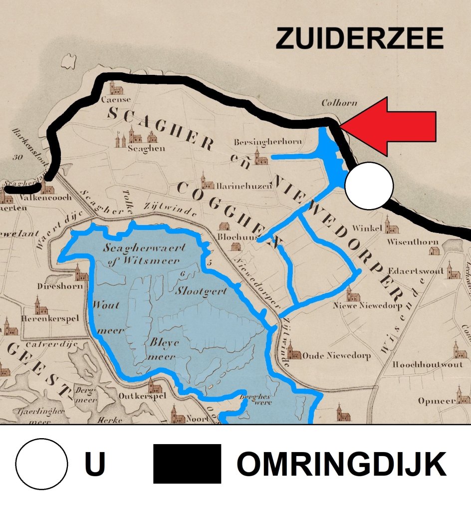
The mills and the lock were measures taken to prevent flooding. For a long time, the Niedorperkogge Water Board had two drainage systems for its large ditches: sea locks in the Omringdijk (red arrow on the map) and a number of lakes inland (blue). However, after 1600, these were drained one by one. As a result, the main ditches remained flooded for longer. The same applied to the many polder ditches that drained into them.
An additional problem was the neglected state of the sea locks. In 1653, Niedorperkogge wanted to improve the drainage of the main water system with iron mills and a new lock, but Schagerkogge did not want to contribute to the costs. Both kogges had formed a water board for centuries, but now they split up. Niedorperkogge continued to build the mills and the lock on its own.
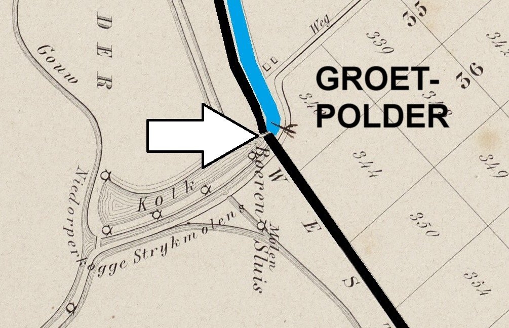
On the other side of the dike (black line on the map), land outside the dike formed as a result of continuous silting. Between 1844 and 1847, it was reclaimed under the name Groetpolder. Not everyone agreed with this. Skippers were concerned about the accessibility of the port of Kolhorn and the water boards were concerned about drainage via the sluices in the dike. At the behest of Niedorperkogge, the dike builders of the Groet dug a canal (blue) that ran from the lock (arrow) to the sea.
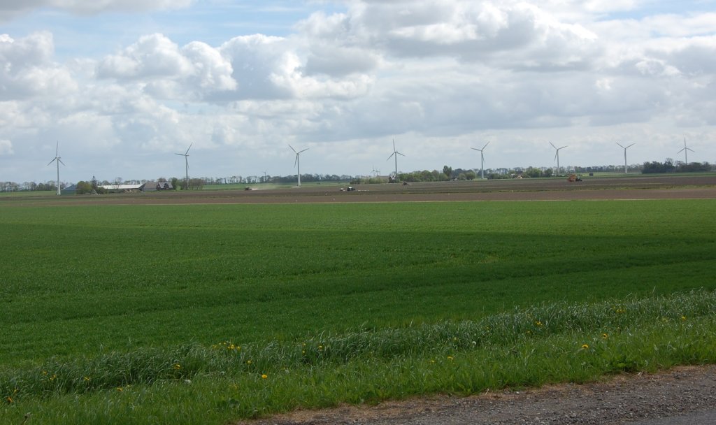
The reclamation of the Groet was problematic. The budget for the work was too tight, the first contractor had to withdraw due to financial problems, and the dikes suffered severe storm damage at the end of 1845. The polder was not an immediate success either. The soil was so salty that no crops could be harvested in the first few years.
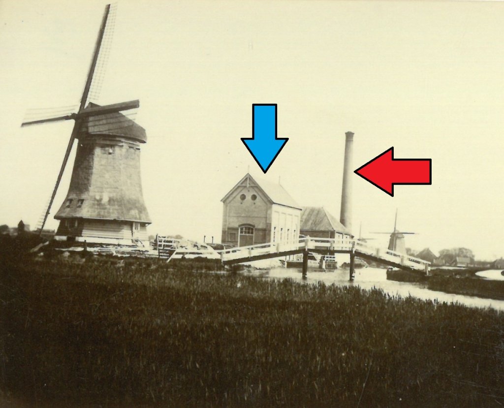
In 1876, the ironing mills were assisted by a steam pumping station (red arrow). This only operated when the mills were unable to cope with the workload. Nothing remains of the building. However, the former diesel pumping station from 1911 (blue arrow) still stands between the upper and lower chambers. It was built because more pumping capacity was needed. The diesel installation spelled the end for the mills, which were demolished that same year.
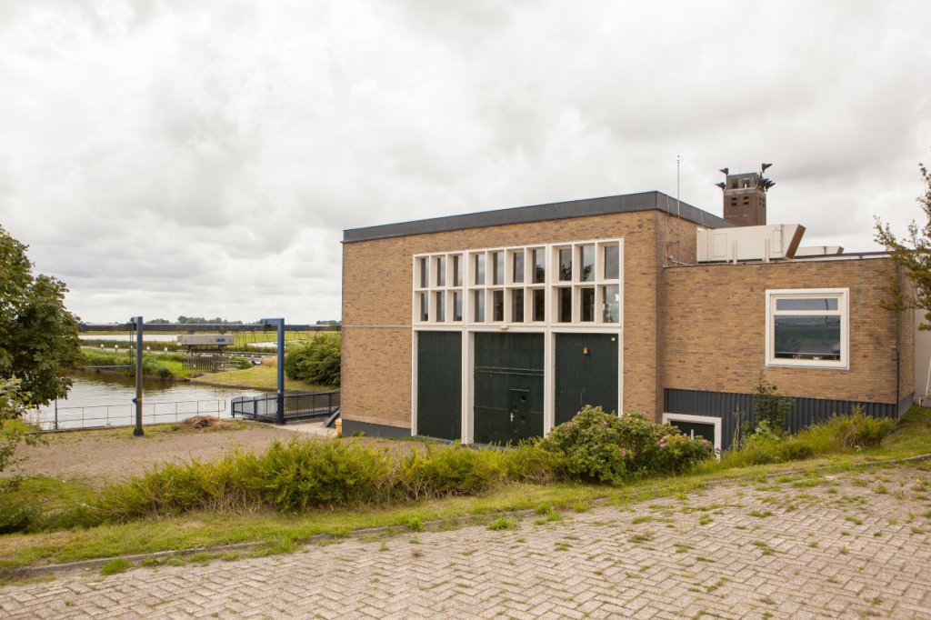
In the 1950s, the De Waakzaamheid diesel pumping station (photo) took neighbourhood the work of all the pumping stations in the neighbourhood . It is located slightly further north on the Omringdijk and has been running on electricity since 2003.