Walingsdike
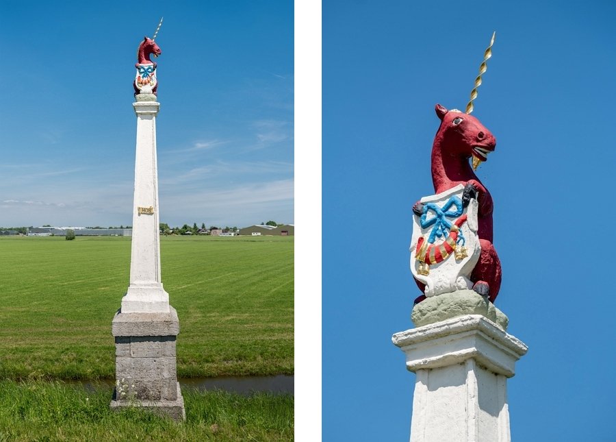
In the past, anyone who was banished by a city court was no longer allowed to enter the jurisdiction of that city. The boundary was marked with ban posts. The jurisdiction of Hoorn began east of this18th-century example. The year 1408 is inscribed in the middle of the post. At that time, a series of villages east of the post came under the jurisdiction of Hoorn.
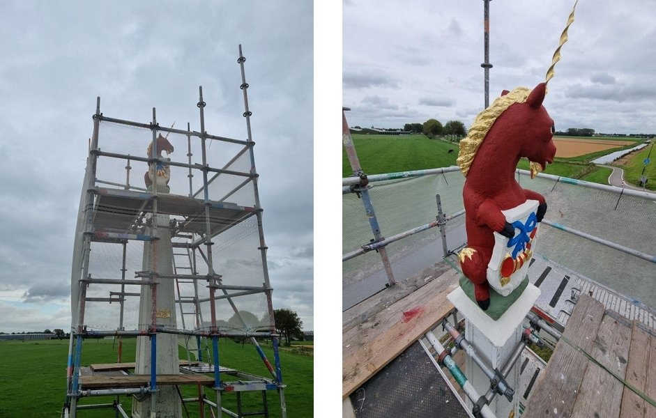
During restoration work in 2024, the unicorn, which had been brown for a long time, regained its red color after thorough color research. The red corresponds to the official coat of arms of Hoorn. There were more ban posts on the Omringdijk, and not just from Hoorn. Most of them disappeared when the Netherlands came into conflict with the French in 1795. Inspired by the ideals of the French Revolution, many villages wanted to break away from urban jurisdiction. In 1810, the city courts were abolished.
The Omringdijk originally ran through the land on the other side: the Mijzen. This situation was not ideal, because the Mijzen was located between two lakes: the Schermeer in the west and the Beemster in the east. These lakes had been created around 1200 from peat rivers.
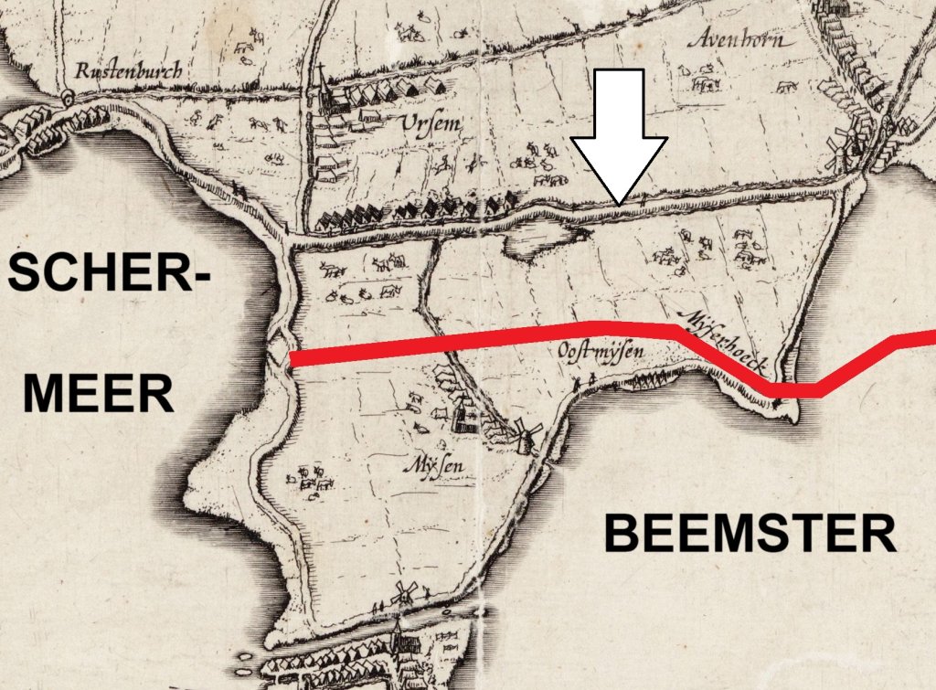
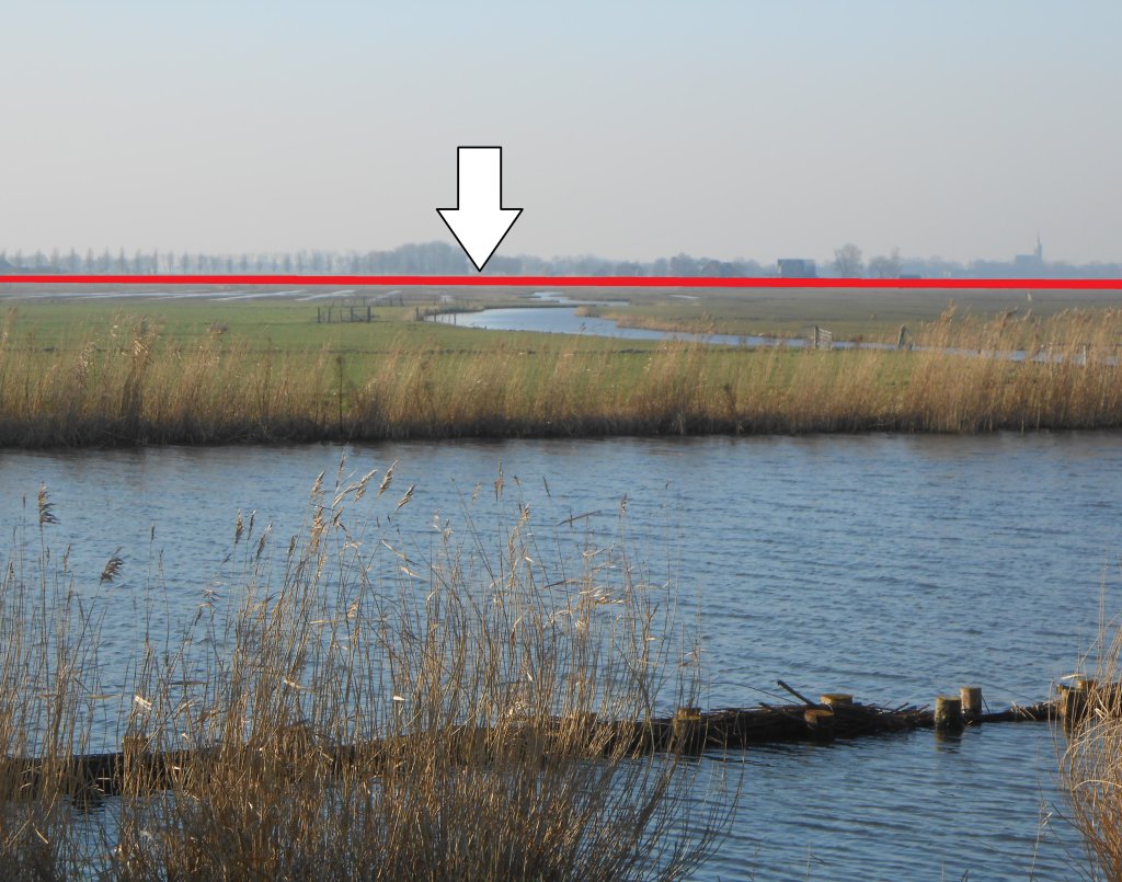
The water in the lakes was often pushed up by the wind. Because the old dike (red line on the map) was low and vulnerable, a new one was built around 1350 on the current route, the Walingsdijk (arrow). The Mijzen now served as a buffer.
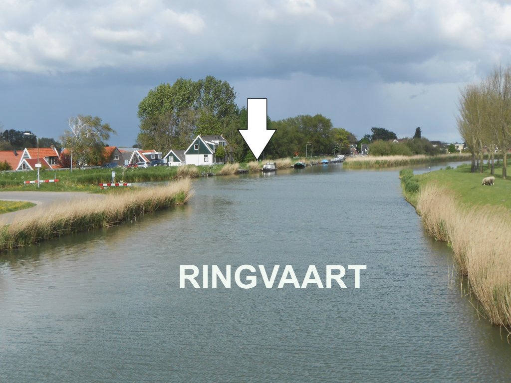
Between 1607 and 1612, the Beemster was drained. This had major consequences, because several polders, including the Mijzen, discharged their water into the lake. The land reclamation engineers therefore had to dig a ring canal between the old polders and the Beemster. This runs north along the Mijzen to the Walingsdijk (arrow in the photo), just before the village of Avenhorn. In the photo, you can see the Mijzen on the left and the Beemster on the right.
Of course, the water level in the ring canal could not be allowed to rise too high. That is why the land reclamation engineers also dug a drainage canal from the Schermeer to the Zuiderzee. It runs from Ursem along the Walingsdijk and then via the ring canal at Avenhorn and Oudendijk to the sea, now known as the Markermeer. The section along the Walingsdijk is called the Ursemmervaart.

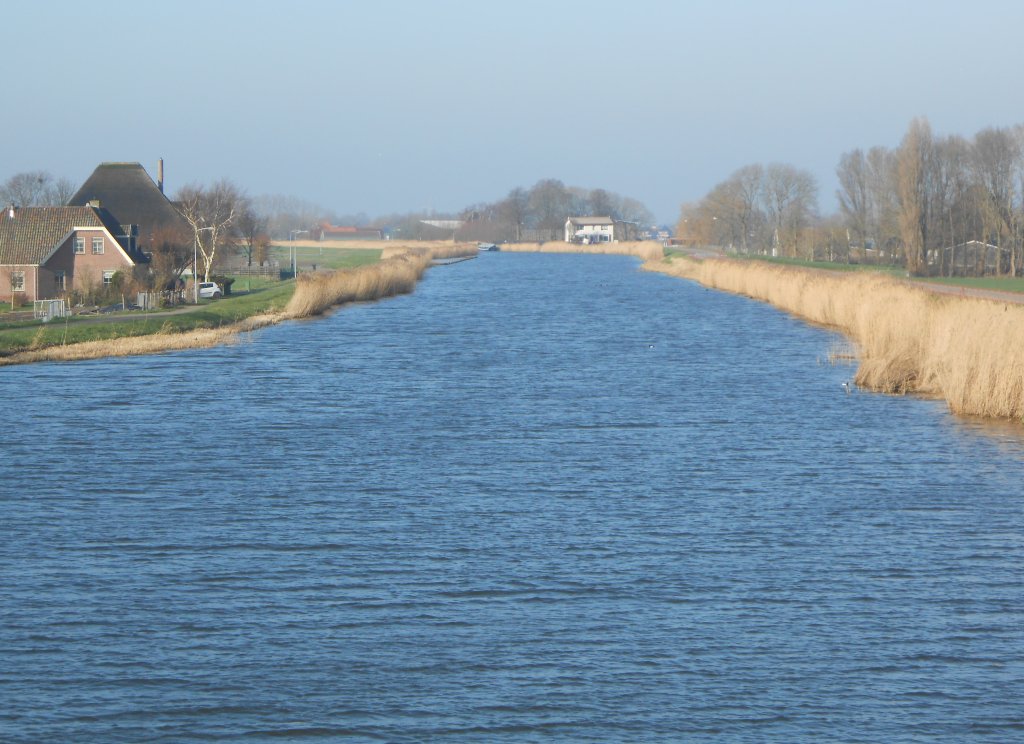
In 1658, the Ursemmervaart was incorporated into the Hoorn-Alkmaar tow canal. For 165 guilders per year, payable to the Beemster, the cities were allowed to use the Mijzerkade opposite the Walingsdijk as a towpath. There, a horse was used to pull the barge. The fact that the cities had this right also meant that they had to maintain the quay. The tow canal has disappeared, but the canal remains important for the storage and drainage of excess water.