Water bosses walks
What is a Waterbazenwandeling?
A walk is a real Water Boss walk when you use our 'do & discover guide' with fun assignments, ideas, and facts. This makes your walks as a water boss a lot more fun. Are you walking (or cycling) in the city, in the countryside, or on the dike? You can take the guide with you digitally on any route. You will find assignments such as: pick up litter along the way, take the best photo of a water route and post it on social media with the hashtag #wateenwaterbaas, or tick off what you spot along the way. And maybe you will learn something about water management along the way. It's also a fun family outing.
Simply download the 'do & discover guide'. Enjoy your walk!
Step outside and experience the landscape
We have been keeping our land dry for centuries. And stories about the battle against water are everywhere. The polder mills immediately catch the eye. They drained the polders. But the dikes that hold back the water are also worth discovering, as are the pumping stations and sluices that maintain the correct water level. They make the story of water visible and tangible. They form the conscience of the landscape.
Spread across our area, we have chosen five starting points for beautiful walks from the North Holland Walking Network.
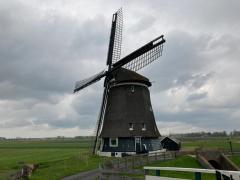
1. Schellinkhout

Schellinkhout windmill and pumping station
The winding village of Schellinkhout is located near the centuries-old West Frisian Omringdijk. In the past, if you walked along the dike between Hoorn and Enkhuizen, you would encounter thirteen windmills. Now there is only one left: the Grote Molen (Great Mill) of the Schellinkhout polder. The small polder pumping station next to it was built in 1900 to help keep the polder dry.
2. Lely pumping station
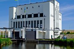
Lely pumping station
The Lely pumping station is named after engineer Cornelis Lely (1854-1929). He devised the plan for the Zuiderzee with the Afsluitdijk and the reclamation of the Wieringermeer. Together with the Leemans pumping station near Den Oever, they pumped the entire Wieringermeer dry in six months. The white building is a landmark visible from afar in the open Wieringermeer.
3. Hondsbossche Sea Defense
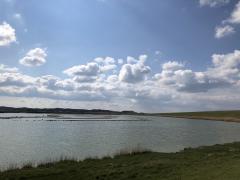
Clay pits near Hondsbossche Sea Wall
North Holland above the North Sea Canal has around 1,500 km of dykes, equivalent to the distance between Alkmaar and Madrid. One very famous dyke is the Hondsbossche Zeewering between Camperduin and Petten. For several years now, it has been completely covered by new dunes and beach, but previously it was a bastion against the North Sea made of basalt, concrete, and asphalt, which was actually unparalleled in our region.
4. Langedijk/Heerhugowaard
Veenhuizer Mill
The Kingdom of a Thousand Islands had countless fields on small islands. The area was created by the farmers themselves. They dug ditches and raised their plots of land with fertile silt. They auctioned their produce by boat at the Broeker Veiling, which can now be visited as a museum. The centuries-old Veenhuizermolen towering high above the islands is an indispensable ingredient of the typical North Holland landscape.
5. Zaandam
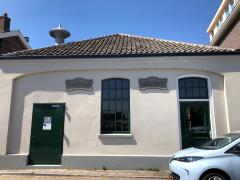
Soeteboom pumping station
The Noorder IJ and Zeedijk run right through Zaandam. These protected the land against the IJ. This was necessary because the IJ was openly connected to the Zuiderzee, with all the dangers that entailed. This changed when the North Sea Canal was constructed in 1876 (and parts of the IJ were reclaimed). Be sure to stop at the Soeteboom pumping station at Hogedijk 100. This oldest pumping station in the Zaan region was built on top of an old lock.