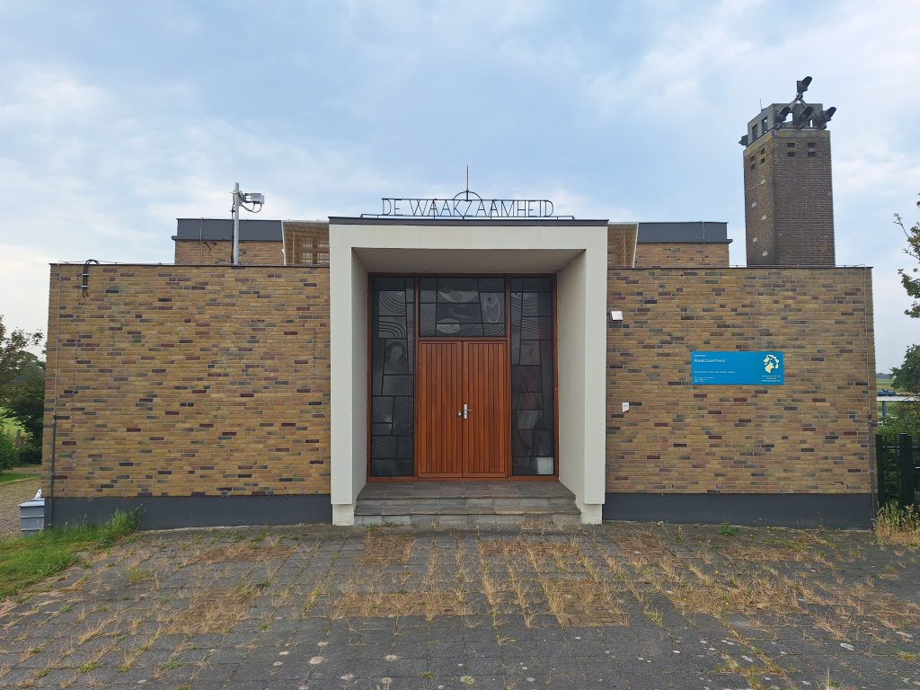
De Waakzaamheid pumping station
South of the village of Kolhorn, in the open countryside, lies the post-war Waakzaamheid pumping station. This municipal monument is located at the foot of the Westfriesedijk and is surrounded by the Groetpolder, Braakpolder, and Weerepolder polders. The pumping station maintains the water level in the Verenigde Raakmaats- en Niedorperkoggeboezem polder.
Former drainage
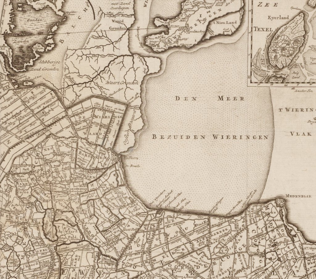
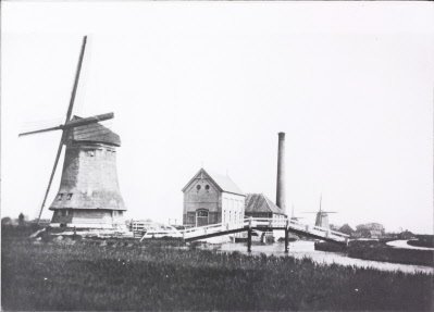
From 1654 to 1911, there were five pumping mills near Lutjewinkel in the vicinity of the current pumping station. They drained the Niedorperkoggeboezem. This type of mill 'pumped' the water up into the upper sump. It was then discharged into the sea at low tide. The other large West Frisian basin, the Raaksmaatsboezem, had 13 water mills in the neighbourhood Oudorp and Rustenburg in 1864. They drained into the adjacent Schermerboezem. In addition, water could be discharged into the Zuiderzee through a large drainage canal to Aartswoud, the Langereis.
In 1875, an auxiliary steam pumping station was built next to the mills of the Niedorperkoggeboezem to assist when it rained heavily and/or there was little wind. In 1911, the mills were demolished in favor of a diesel pumping station. The Raaksmaatsboezem also partially switched to steam in 1894. That year, a large paddle wheel steam pumping station was built at the northern end of the Langereis.
United Raaksmaats and Niedorperkoggeboezem
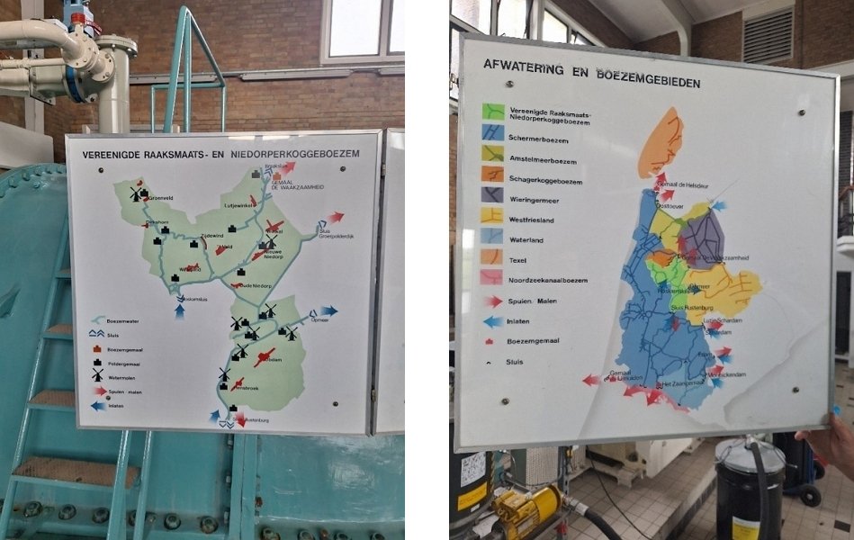
After decades of wrangling, work began in the 1920s to open up West Friesland within the Omringdijk by constructing a series of new shipping channels. The new waterways also had consequences for the old reservoirs. On September 15, 1941, the Niedorper Verlaat was opened without fanfare, merging the Niedorperkoggeboezem and Raaksmaatsboezem into the Vereenigde Raaksmaats- en Niedorperkoggeboezem (VRNK-boezem). The western part of the ring ditch of the Heerhugowaard polder, which was incorporated into the Alkmaar-Kolhorn canal, joined the Schermer reservoir. The new separation between the two reservoirs became the Roskamsluis lock near Noordscharwoude.
The administrator of the Schermerboezem, the Hoogheemraadschap van de Uitwaterende Sluizen (Water Board of the Drainage Locks), was given the VRNK basin. The new VRNK reservoir was drained by the three existing pumping stations: the steam pumping station at Aartswoud (built in 1894), the steam pumping station (from 1875) at Lutjewinkel, and the diesel pumping station (from 1911) at the same location.
New pumping station
In the mid-1950s, the board of Uitwaterende Sluizen began considering modernizing the drainage system of the VRNK reservoir. The existing pumping stations did not have sufficient capacity, were completely outdated, and, finally, the long supply channel to the pumping station in Aartswoud was not functioning properly. As a result, the stop signal had to be activated regularly due to high water levels in the drainage basin. This meant that all the pumping stations in the polders that discharged their water into the VRNK drainage basin had to be shut down. This caused a great deal of damage, especially in the extensive horticultural area of Langedijk.
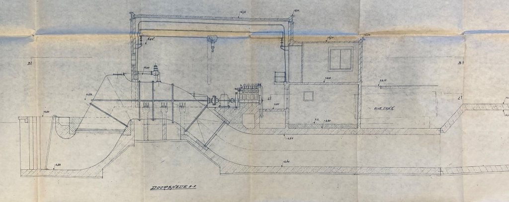
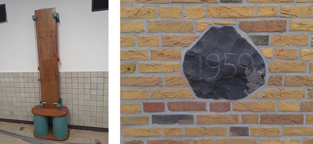
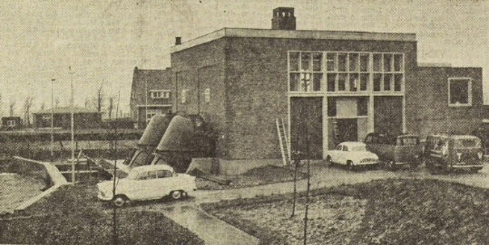
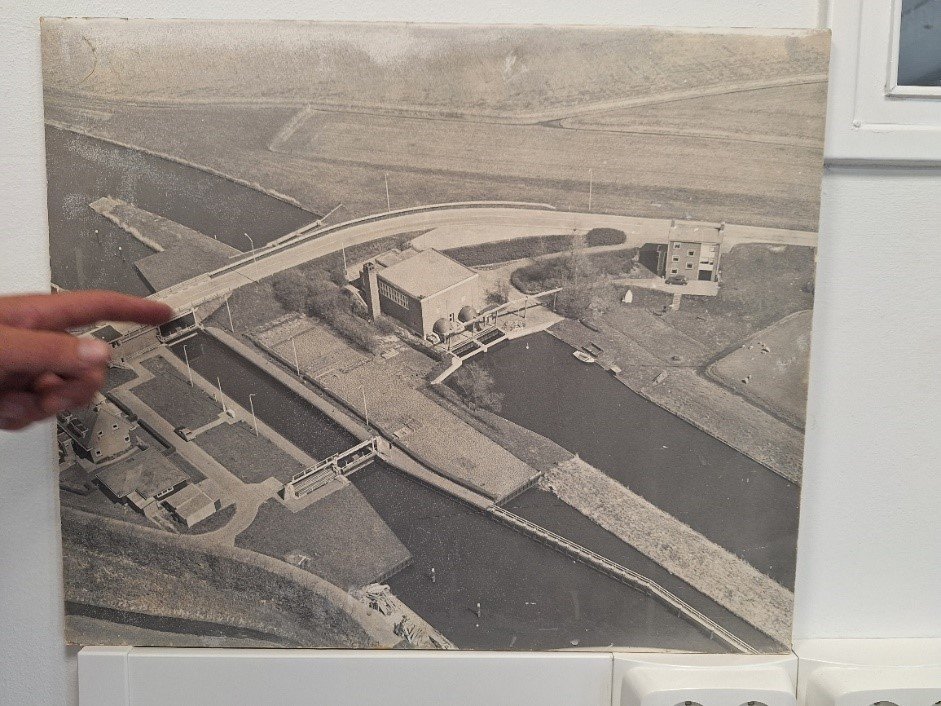
The pumping station, called De Waakzaamheid, was built in 1959 at the end of the Alkmaar (Omval) Oudkarspel-Kolhorn canal next to the Braaksluis lock and discharges into the Kolhornerdiep canal. Designed by K. van der Mast (from the engineering firm A. van der Mast), the pumping station was officially commissioned in March 1960. It was built in the functionalist style, in which the form of the building follows its function. This resulted in a sober architecture with few decorative elements. This is typical of the period of reconstruction with limited building budgets after the Second World War.
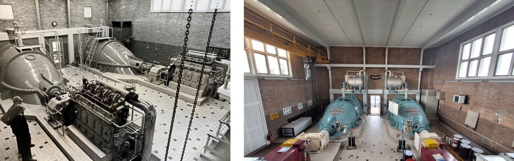
The pumping station houses two screw pumps that were originally powered by Stork-Ricardo diesel engines. Next to the pumping station is the chimney for the exhaust gases. At the time, diesel was cheaper than electric drainage.
The pumping station drains an area of 10,000 hectares. Via the canal south of the pumping station, the water is raised from –0.60 cm NAP to –0.40 cm NAP. The water is then discharged via Kolhorn into the Amstelmeer lake and from there through the Oostoeversluis sluice into the Wadden Sea.
Complex
On the west side of the pumping station are the Braaksluis lock and the Braakbrug bridge with the former lock keeper's house. On the east side is the former engineer's house, also designed by K. van der Mast. The cost of building the pumping station and engineer's house at the time was 1,400,000 guilders.
Modernization
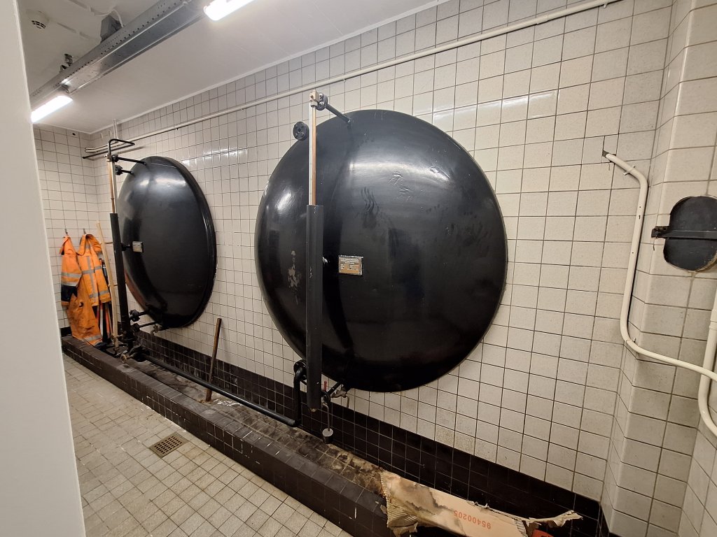
The pumping station was modernized in 2003. The diesel engines were removed and replaced with electric motors. This increased the capacity of the pumping station from 1,000 cubic metre 1,800 cubic metre minute. The two oil tanks are still present, but have since been cleaned up.
Extra
Hiking
- Kromme Gouw Route (North Holland Walking Network)
Cycling
- Westfriese Omringdijk cycle route (Cycle network)
See also:
The old diesel engines were given a museum destination. One was moved to the Motor and Crafts Museum in Nieuwe Niedorp and the other to the De Tuut steam pumping station in Appeltern.