Drone operations for dike inspections
What's going to happen?
As a water authority, we use drones to carry out statutory tasks. For example, for the inspection of dikes, pumping stations, and dunes, and for enforcement and supervision . We use drones equipped with various sensors, including cameras and laser scanners (LiDAR).
On behalf of HHNK, the company Droneview will use a drone to take aerial photographs of the dike. This is being done for the purpose of inspecting the sea dikes (primary flood defenses).
Where is the project taking place?
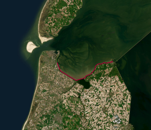
The aerial photographs will be taken on the primary flood defense between Den Helder and Den Oever (see the red line in the figure below).
What do you notice?
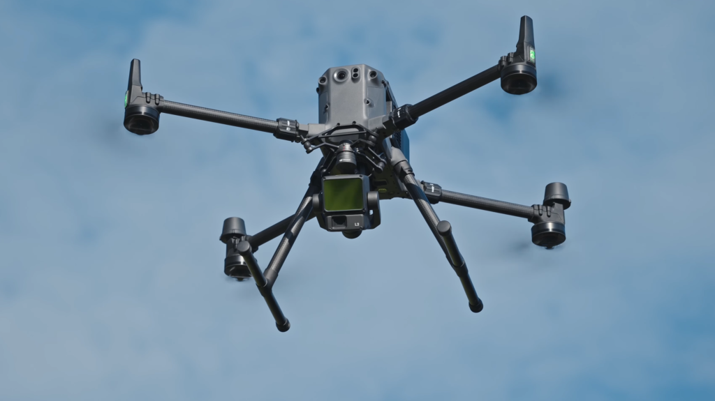
During the work, a drone will be flown from the dike. Below is an example of what such a drone might look like.
The aerial photographs are mainly taken while flying over the dike. The drone may fly over built-up areas for a brief moment.
We are aware that in some cases this may affect privacy, for example when individuals are recognizable in images. To limit this risk, we have a policy in place for the use of drones.
When will the project take place?
The work will be carried out from November 18, 2025. Taking the photographs will take several days to over a week, depending on weather conditions.
Who do we work with?
The work will be carried out by Droneview, a company based in Leeuwarden.
Want to know more?
For more information about this project, please contact Sem Jongejan via our contact formor by calling +31 (0)72 – 582 8282.
See also the page Use of drones.